Hotovlja - Bukov vrh (by road)
Starting point: Hotovlja (400 m)
| Latitude/Longitude: | 46,11840°N 14,19440°E |
| |
Route name: by road
Walking time: 1 h 30 min
Difficulty: easy unmarked way
Elevation gain: 432 m
Elevation difference along the route: 432 m
Map: Škofjeloško in Cerkljansko hribovje 1:50.000
Recommended equipment (summer):
Recommended equipment (winter):
Views: 6.713
 | 1 person like this post |
Access to starting point:
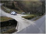
From Škofja Loka we drive towards Gorenja vas. The road then brings us to the traffic-light crossroads in the village Poljane nad Škofjo Loko. Here we turn left towards the village Hotovlja. The road immediately after the crossroads crosses Poljanščica over a bridge and then brings us to the next crossroads, where we continue left. Further, the road brings us among houses in the village, where we also notice the beginning of the footpath to Bukov vrh. Here we drive a few dozen meters further to the parking lot, which we notice on the other side of the stream along which we are driving.
Route description:
From the parking lot, we continue on the road along which we have parked. We follow the road, which leads us past the quarry, to the crossroads, where we turn left in the direction of Bukov vrh. The asphalt road then, after a few more minutes of walking, brings us to the next crossroads, where we again continue left in the direction of Bukov vrh. Further, the asphalt ends and the road, which moderately ascends through the forest, brings us to a smaller hamlet, where we also step out of the forest.
Further, we mostly ascend on grass-covered slopes, which offer nice views. Further, the road brings us to the village Bukov vrh, where we continue left and past the last houses in the village ascend to Bukov vrh, on which we already clearly see the church. From the last houses in the village to the top we have less than five minutes of ascent on a grassy slope.
PS: The path along the road is signposted but not blazed.
Photos:
 1
1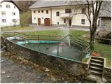 2
2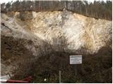 3
3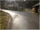 4
4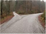 5
5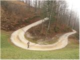 6
6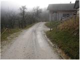 7
7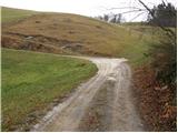 8
8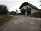 9
9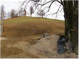 10
10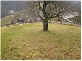 11
11 12
12
Discussion about the trip Hotovlja - Bukov vrh (by road)
To post a comment you must log in:
If you do not yet have a username, you must first
register.