Hrastnik - Kal (Kalski hrib) (via Klobuk)
Starting point: Hrastnik (290 m)
| Latitude/Longitude: | 46,14930°N 15,08520°E |
| |
Route name: via Klobuk
Walking time: 2 h 25 min
Difficulty: easy marked way
Elevation gain: 695 m
Elevation difference along the route: 800 m
Map:
Recommended equipment (summer):
Recommended equipment (winter): ice axe, crampons
Views: 18.814
 | 1 person like this post |
Access to starting point:
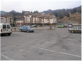
From Trbovlje or Laško we drive to Hrastnik, and then we continue driving in the direction »Hrastnik center and village Čeče«. We follow this road to the spot where we notice signs for ski resort Rajska dolina. Here we turn right and then already after a few meters park on one of the numerous parking lots in Hrastnik.
Route description:
At the end of the parking lot, we will notice on one of the buildings hiking signposts, which point us to the left onto an ascending road in the direction of Kal and Mrzlica. Higher the marked path leaves the road and continues left through the forest. After a few minutes of additional walking, we come to a well-marked junction, where we continue left in the direction of »Kal, Mrzlica over Klobuk« (straight path over Blate).
The path ahead immediately steeply ascends a very steep and, when wet, dangerous for slipping slope. Higher the path flattens a little, crosses a forest road and then brings us to the spot where the path to Jelenca branches off to the left. We continue straight on a relatively steep path, which higher brings us onto a forested ridge. The path higher turns to the left, leaves the ridge and becomes completely flat. After a while, the path returns to the ridge and starts to ascend more steeply again. We follow this path, which for most of the way runs through the forest, all the way to the top of the panoramic Klobuk.
From Klobuk we continue on the marked path, which starts to descend an initially quite steep slope. The path soon flattens, turns a little to the left, where it crosses the slopes of Pleše (956m). The path soon passes to the northern side of the mentioned summit, where we step onto part of the ski runs of the ski resort Rajska dolina. Beside the ski resort we descend to an asphalt road, beside which we notice hiking signposts.
We cross the road and continue the ascent on a marked footpath, which ascends over a panoramic grassy slope. Higher the steepness eases and the path joins a road, which we then follow all the way to the mountain hut on Kal.
From the hut we continue on its left side (direction of arrival) on the path which crosses the fence and goes into the forest. After a few minutes of additional walking we notice signs for the peak of Kal, which direct us left onto a somewhat steeper footpath, on which we ascend to the summit in a few steps.
Hrastnik - Klobuk 1:30, Klobuk - Planinski dom na Kalu 0:45, Planinski dom na Kalu - Kal 0:10.

The trip can be extended to the following destinations: Mrzlica
Photos:
 1
1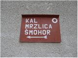 2
2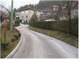 3
3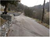 4
4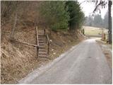 5
5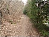 6
6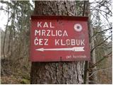 7
7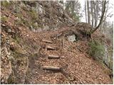 8
8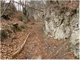 9
9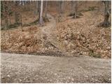 10
10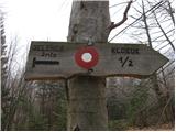 11
11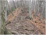 12
12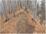 13
13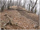 14
14 15
15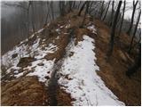 16
16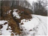 17
17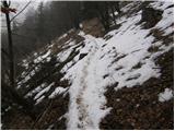 18
18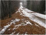 19
19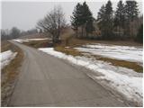 20
20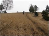 21
21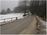 22
22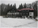 23
23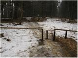 24
24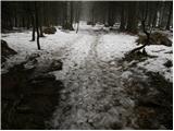 25
25 26
26 27
27
Discussion about the trip Hrastnik - Kal (Kalski hrib) (via Klobuk)
|
| taubi668. 02. 2020 |
We were there today. The path is awesome. Really exceptionally maintained and I recommend it to everyone. We enjoyed it like we haven't in a long time. As for the markings, you can't get lost at all.
|
|
|
|
| Roberto-MMLM7. 01. 2024 12:54:17 |
Hello.
This time on 6.1.2024 I went on a hike to Kal via Klobuk. First, the path is very nice, but I would emphasize that when going from the parking lot towards Klobuk there aren't enough directions, markings. Especially if it's your first time, you wander a bit between parking lots and blocks/houses. The description in the initial phase isn't very helpful either. Then I kept more to the left direction and only after some time I noticed a direction, so then I knew I was on the right path.
From there on everything went smoothly and everything is super marked, I would praise that. But not the very beginning to Klobuk.
And also, on Kal there are often Croatian children, and as a hiker where on top you have nowhere to dry, they rush with the bill and literally chase us away? Saying we need to understand they have children, 75 people and .... OK, they could have taken 3 minutes to take care of me for that little time we stay there and find a spot, as I noticed on departure that below everything was empty with a bench and table. OK, nothing of that, I've never experienced anything like that anywhere, not even on Kum, where this year at the end there were over 1100 hikers, they took care of everyone and no one was chased away.
That was really a bad aftertaste, I had to leave all soaked. Only on departure did the radiators start working, as children were coming into the rooms, I was leaving. I understand that in ideal conditions everything goes OK, but like this it's a total pogrom. No one takes a moment to at least find some radiator for me to dry, so I found one myself only on departure below where they also had plenty of space, but nothing from them. Disaster.
Otherwise it's nice up there, in nice weather I say you have places to sit outside too. Every time I come, all Croats. Fine, let them have a good time, but what are our Slovenian organizers and schools doing? I don't know...
That's it, I had to describe the experience, which doesn't mean it's not worth visiting...
lp
|
|
|
|
| jboc19. 01. 2024 11:13:36 |
Hello.
In a case like yours, I advise continuing the path right past the hut on to Mrzlica, where the picture is completely different. There the mountain hut is top-notch, on Kal they run more of a tavern, unfortunately. I notice that more and more hikers go straight past the hut and don't stop at Kal anymore. I'm one of them too 😁. Best regards.
|
|
|
|
| jprim9. 01. 2024 18:24:58 |
We're just different. When I'm on this path, I never bypass Kal, but in recent years I no longer go to the hut below the summit of Mrzlica. In that hut in winter it's so stuffy and humid that you can hardly breathe. They don't air it out at all.
As for the hut on Kal, it's just like what's happening lately in quite a few of our mountain huts. They run a tavern and live off that. I myself had a similar experience when the whole hut was reserved, tables set, no free table available. Cold outside,...
But if you manage, you have a tongue , a solution is found. , a solution is found.
You too - Roberto - could just tell them directly about some radiator, and it would be done.
LP!
|
|
|
To post a comment you must log in:
If you do not yet have a username, you must first
register.