Hrastnik - Mrzlica (via Klobuk)
Starting point: Hrastnik (290 m)
| Latitude/Longitude: | 46,14930°N 15,08520°E |
| |
Route name: via Klobuk
Walking time: 3 h 5 min
Difficulty: easy marked way
Elevation gain: 832 m
Elevation difference along the route: 1000 m
Map:
Recommended equipment (summer):
Recommended equipment (winter): ice axe, crampons
Views: 27.655
 | 4 people like this post |
Access to starting point:
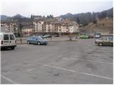
From Trbovlje or Laško we drive to Hrastnik, and then we continue driving in the direction »Hrastnik center and village Čeče«. We follow this road to the spot where we notice signs for ski slope Rajska dolina. Here we turn right and then already after a few meters park on one of the numerous parking lots in Hrastnik.
Route description:
At the end of the parking lot, we will notice on one of the buildings hiking signposts, which point us to the left on an ascending road in the direction of Kal and Mrzlica. Higher the marked path leaves the road and continues left through the forest. After a few minutes of additional walking, we come to a well-marked crossing, where we continue left in the direction of »Kal, Mrzlica over Klobuk« (straight path over Blate).
The path ahead immediately steeply ascends a very steep and, when wet, dangerous for slipping slope. Higher, the path flattens a little, crosses a forest road and then brings us to the spot where a path to Jelenca branches off to the left. We continue straight on a relatively steep path, which higher brings us on a forested ridge. The path higher turns to the left, leaves the ridge and entirely flattens. Eventually, the path returns to the ridge and starts ascending steeper again. This path, which mostly runs through the forest, we follow all the way to the top of the panoramic Klobuk.
From Klobuk we continue on a marked path which starts descending on an at first quite steep slope. The path soon flattens, turns a little to the left, where it crosses slopes of Pleše (956m). The path soon passes on the northern side of the mentioned summit, where we step on part of ski tracks of the ski slope Rajska dolina. By the ski slope we descend to an asphalt road, by which we notice hiking signposts.
We cross the road and continue the ascent on a marked footpath which ascends over a panoramic grassy slope. Higher, the steepness decreases and the path joins the road, which we then follow all the way to the mountain hut on Kal.
From the hut, we continue on its left side (direction of arrival) on the path which crosses the fence and goes into the forest. After a few minutes of additional walking, we notice signs for the peak of Kal, which point us to the left on a somewhat steeper footpath, on which we in a few steps ascend to the summit.
From Kal we descend on the other side on the path which already after a few steps brings us on a wide cart track which we left when we ascended to the summit of Kal. We continue on the mentioned cart track which only a little further starts descending. After a few minutes of descent, the path brings us out of the forest on a smaller saddle between Kal and Mrzlica.
We continue straight, slightly upwards and then ascend by the edge of a larger grassy area. Higher, the path turns a little to the right and ascends diagonally through a thin forest. Higher, the steepness decreases and the path after a few minutes of additional walking brings us to the mountain hut on Mrzlica.
From the mountain hut, we can in less than 5 minutes ascend also to the panoramic peak of Mrzlica.
Hrastnik - Klobuk 1:30, Klobuk - Planinski dom na Kalu 0:45, Planinski dom na Kalu - Kal 0:10, Kal - Mrzlica 0:40.

Photos:
 1
1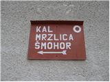 2
2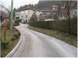 3
3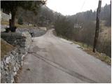 4
4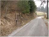 5
5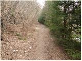 6
6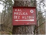 7
7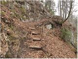 8
8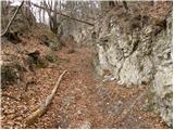 9
9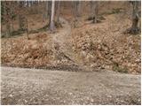 10
10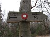 11
11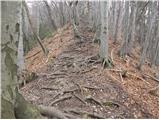 12
12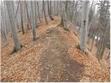 13
13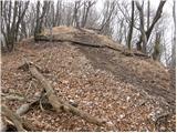 14
14 15
15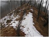 16
16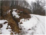 17
17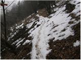 18
18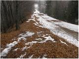 19
19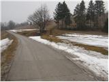 20
20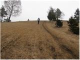 21
21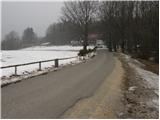 22
22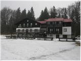 23
23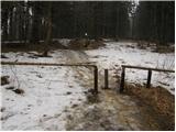 24
24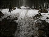 25
25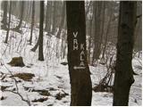 26
26 27
27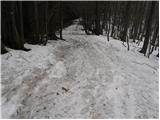 28
28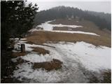 29
29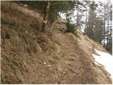 30
30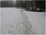 31
31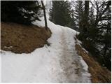 32
32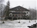 33
33 34
34
Discussion about the trip Hrastnik - Mrzlica (via Klobuk)
|
| zlatan11. 01. 2010 |
Yesterday I walked this trail and I have to say it was great! 
I think Mrzlica should be visited precisely in winter.
|
|
|
|
| Edi227. 12. 2011 |
Today we walked the path from Hrastnik via Klobuk to the hut on Kalu and further to the hut on Mrzlica. Path is nice and trodden, view from Klobuk where there is also a stamp is very nice. But I recommend crampons in the upper part for those not used to walking on frozen snow. Path is very well marked and at all junctions there are direction signs telling where you can go. Staff both on Kal and Mrzlica is very friendly so I recommend this path to others too. Times listed in descriptions hold true.
|
|
|
To post a comment you must log in:
If you do not yet have a username, you must first
register.