Hrastovec v Slovenskih goricah - Črni križ at Hrastovec
Starting point: Hrastovec v Slovenskih goricah (238 m)
| Latitude/Longitude: | 46,56790°N 15,78641°E |
| |
Walking time: 40 min
Difficulty: easy unmarked way
Elevation gain: 42 m
Elevation difference along the route: 50 m
Map:
Recommended equipment (summer):
Recommended equipment (winter):
Views: 148
 | 1 person like this post |
Access to starting point:
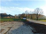
a) Leave the Pomurska motorway at the Pernica exit, first follow signs for Pernica and Malečnik, from the roundabout follow signs for Lenart v Slovenskih goricah and Gornja Radgona. Continue driving through the Močna settlement, on the flat section of the road turn right towards the Hrastovec v Slovenskih goricah settlement. Drive approx. 100 m further and park on the left side of the road at the parking lot by the Agatina poti information board.
b) Leave the Pomurska motorway at the exit for Lenart v Slovenskih goricah, then follow signs for Pernica. A few kilometres further at the Marko shop turn left towards the Hrastovec v Slovenskih goricah settlement. Drive approx. 100 m further and park on the left side of the road at the parking lot by the Agatina poti information board.
Route description:
From the parking lot continue south, before the Pesnica river turn left onto the anti-flood embankment, along it continue eastwards. Later the path, embankment and river turn right southwards, then the path forks.
Continue left and after a few minutes of further walking arrive at the shore of Komarnik lake, where Agatina pot continues left, we go right and continue along the path first along the southern then eastern shore of the lake. The path leads further through forest, passing an observation point from which a nice view opens onto Komarnik lake.
A few minutes past the observation point leave the lakeside path right onto a trodden trail, along which in under ten minutes with moderate ascent climb to Črni križ.
Return can be by the same path or a few minutes longer path along the northern and western shores of the lake.
Start - observation point at Komarnik lake 0:27, observation point at Komarnik lake - Črni križ 0:13.
Description and photos refer to the status in December 2025.

Photos:
 1
1 2
2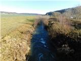 3
3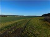 4
4 5
5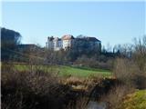 6
6 7
7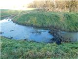 8
8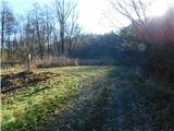 9
9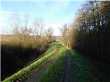 10
10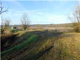 11
11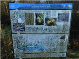 12
12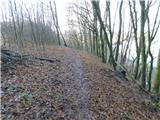 13
13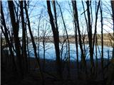 14
14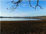 15
15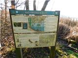 16
16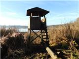 17
17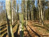 18
18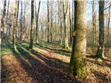 19
19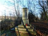 20
20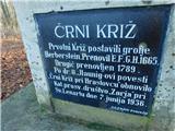 21
21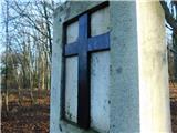 22
22
Discussion about the trip Hrastovec v Slovenskih goricah - Črni križ at Hrastovec
To post a comment you must log in:
If you do not yet have a username, you must first
register.