Hudi Graben - Šentanski vrh (via Koča na Dobrči)
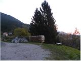
Starting point: Hudi Graben (670 m)
| Latitude/Longitude: | 46,35990°N 14,26000°E |
| |
Route name: via Koča na Dobrči
Walking time: 3 h 5 min
Difficulty: easy marked way
Elevation gain: 965 m
Elevation difference along the route: 980 m
Map: Karavanke - osrednji del 1:50.000
Recommended equipment (summer):
Recommended equipment (winter): ice axe, crampons
Views: 3.129
 | 1 person like this post |
Access to starting point:
From the Ljubljana-Jesenice highway, at the Podtabor junction we continue in the direction of Ljubelj and Tržič. We continue driving on the fast road towards Ljubelj, and then just before the gas station we turn right in the direction of Tržič and Begunje. The road then starts descending, and at the first crossroad we continue left (direction Begunje) through the underpass, through which we come to Bistrica pri Tržiču. A little further, a sign for Begunje points us right onto a narrower and ascending road, which we then follow through Brezje pri Tržiču to the village Hudi Graben, where at the end of the village we park at an appropriate place by the hiking signposts.
Access from Begunje is also possible.
Route description:
From the starting point we continue along the main road to the sign for the end of the settlement Hudi Graben; a few meters after the sign a cart track branches off to the right upward, beside which we will also notice the sign with the caption »Dobrča 2h«. Along the cart track we continue to the first house, then blazes direct us left onto a footpath that leads us through the forest. Soon the path brings us to another cart track, along which we ascend for a short time, then we continue left along the footpath. Later we come again to a cart track along which we then ascend for quite some time. The cart track also has some forks, at which we keep slightly to the right. The path then becomes a little steeper and brings us to a fork where the path from Zadnja vas joins us from the left side.
We continue straight on a relatively steep path that still runs through the forest. Higher we step onto a poor forest road along which we walk a few dozen steps to a wider macadam road. We merely cross the aforementioned road, as blazes direct us onto a footpath that higher crosses the aforementioned road a few more times. We follow this footpath, which occasionally ascends quite steeply, all the way to the Koča na Dobrči hut.
Near the Koča na Dobrči hut, signs for Dobrča peak direct us onto a forest road along which we begin to descend slightly towards the north. After a short descent we notice signposts that direct us right to Podgorska planina, whose huts we bypass on the right side. Further we ascend over a scenic grassy slope, then the path enters first sparse forest, higher increasingly dense forest. When the slope eases, two paths join us from the right, but in both cases we continue straight ahead. The path ahead rises steeply again and after a few minutes of further walking brings us to the summit of Dobrča.
From Dobrča we continue towards Šentanski vrh along the path that first descends into a small valley between the two peaks, then rises moderately and after a few dozen steps of further walking brings us to Šentanski vrh.

Photos:
 1
1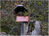 2
2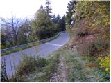 3
3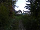 4
4 5
5 6
6 7
7 8
8 9
9 10
10 11
11 12
12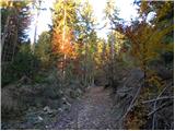 13
13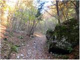 14
14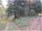 15
15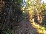 16
16 17
17 18
18 19
19 20
20 21
21 22
22 23
23 24
24 25
25 26
26 27
27 28
28 29
29 30
30 31
31 32
32 33
33 34
34 35
35 36
36 37
37 38
38 39
39 40
40 41
41 42
42 43
43 44
44 45
45 46
46 47
47 48
48 49
49 50
50 51
51 52
52 53
53 54
54 55
55 56
56 57
57 58
58 59
59 60
60 61
61 62
62 63
63 64
64 65
65 66
66
Discussion about the trip Hudi Graben - Šentanski vrh (via Koča na Dobrči)
To post a comment you must log in:
If you do not yet have a username, you must first
register.