Javorje - Rodica (marked way)
Starting point: Javorje (1050 m)
| Latitude/Longitude: | 46,24960°N 13,86750°E |
| |
Route name: marked way
Walking time: 2 h 45 min
Difficulty: easy marked way
Elevation gain: 916 m
Elevation difference along the route: 916 m
Map: TNP 1:50.000
Recommended equipment (summer):
Recommended equipment (winter): ice axe, crampons
Views: 97.055
 | 3 people like this post |
Access to starting point:
From the Ljubljana–Jesenice motorway, take the Lesce exit and follow the road towards Bled and further towards Bohinjska Bistrica and Lake Bohinj. After the settlement of Laški Rovt, we arrive at a smaller junction, where the road branching to the left leads to the starting points of the paths to Rodica, mountain pasture Suha, Šija, Vogel... and the scout camp Laški Rovt. The macadam road immediately enters the forest and first ascends past the mentioned scout camp, then ascends relatively steeply for a few more kilometres. After a little less than 6.5 km of driving on macadam, we arrive at a somewhat larger junction, where the road to mountain pasture Storeča raven (starting point of the path to Vogel) branches off to the right. Here we continue straight and after approximately 50 m of further driving arrive at the left bend, where the starting point of the path to mountain pasture Suha is. We park at a suitable place beside the road.
Route description:
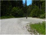
Near the parking lot, on the west side of the torrent we notice a marked footpath which leads towards mountain pasture Suha. The path first ascends on the right side of the torrent, then joins it. After a few steps walking on the torrential gravel, the marked path turns right and flattens completely. The gentle walking is quickly interrupted by a steep ascent over a relatively steep slope. The steepness then eases somewhat and the well-marked path leads us through dense forest along and beside the torrent upwards. A little higher, the marked path moves away from the torrent to the left and rejoins it after a few minutes. The path, which then runs on the right side of the torrent, soon brings us out of the forest onto the spacious mountain pasture Suha.
From the mountain pasture we continue past the shepherd's hut beside the deposit of torrential gravel. In places a very poorly visible little path in the upper part of the mountain pasture turns slightly left. Further on, the path, which starts turning slightly right, is much easier to follow. After a short ascent we bypass the hunting hut, which we notice on the right side.
The path then starts to ascend more steeply up the slope, which is partly overgrown with brushwood. This increasingly panoramic path brings us higher to a somewhat larger cairn, where there is a junction (straight: marked path to saddle Čez Suho, left: unmarked path over Lepo Suho).
We continue straight on the marked path, which ascends between brushwood and sparse trees. Higher up, the trees run out and the path reaches a sinkhole below saddle Čez Suho. The path bypasses it on the left side and soon brings us to the junction at saddle Čez Suho. An old military bunker stands here with signposts on it.
We head left onto the wide panoramic grassy ridge. The path from here is not steep but has a few short descents. Soon the panoramic path brings us to the summit pyramid of scenic Rodica.
Javorje - Suha 1:00, Suha - Čez Suho 1:00, Čez Suho - Rodica 45 minutes.

Photos:
 1
1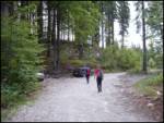 2
2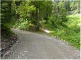 3
3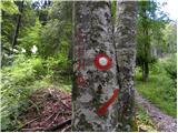 4
4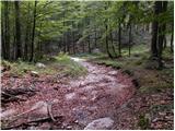 5
5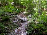 6
6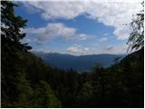 7
7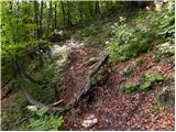 8
8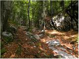 9
9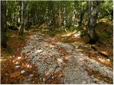 10
10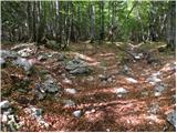 11
11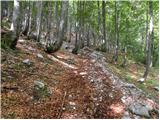 12
12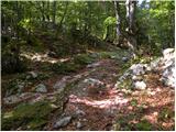 13
13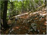 14
14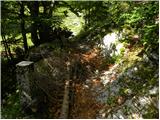 15
15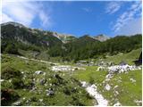 16
16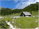 17
17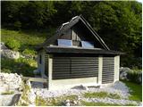 18
18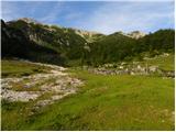 19
19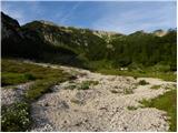 20
20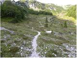 21
21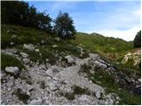 22
22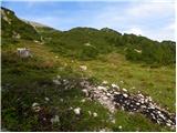 23
23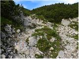 24
24 25
25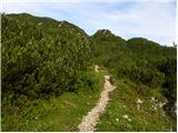 26
26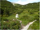 27
27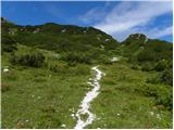 28
28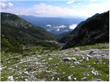 29
29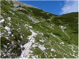 30
30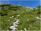 31
31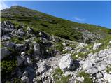 32
32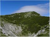 33
33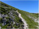 34
34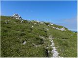 35
35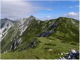 36
36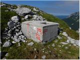 37
37 38
38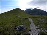 39
39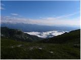 40
40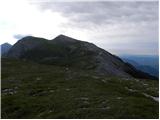 41
41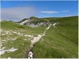 42
42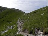 43
43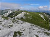 44
44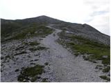 45
45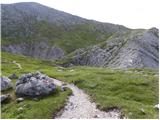 46
46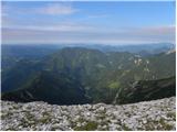 47
47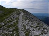 48
48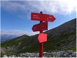 49
49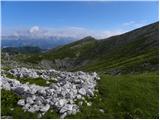 50
50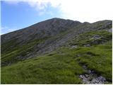 51
51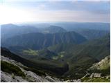 52
52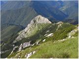 53
53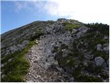 54
54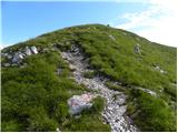 55
55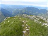 56
56 57
57 58
58
Discussion about the trip Javorje - Rodica (marked way)
|
| Parkeljc29. 09. 2009 |
Yesterday I was up there. The ascent is suitable also for inexperienced, but it's good to have at least some fitness. The path to Suha through the forest, it becomes interesting there, beautiful only at the saddle. The view towards the Alps was poor, although the weather was almost clear, towards the east visibility was practically zero. Too bad, maybe we were up too late. Descended towards Suha via shortcut, unmarked path. First you descend along the ridge in the direction of Vogel, then the path gets lost, but continue into the gully towards the scree, where the well-trodden path reappears. For those with some fitness I recommend continuing along nearby peaks to Črna prst.
|
|
|
|
| Rokoko24. 11. 2010 |
By car you can get high up, no problem to the end of the nice macadam (which is worth it, as the forest path is nothing special). To Suha mostly dry. Then snow starts, about 30cm. From Suha upwards the snow is crusted, but just enough to sink through. Chose the left path (unmarked, at the rocky cairn, which in snow is hard to see the left turn instead of straight, at least 30 minutes shorter than along the ridge but less scenic), but only reached the saddle. Walking became strenuous towards the saddle, as it sank over the knees. Surely easier if the sun had shone.
|
|
|
|
| ZOJA27. 04. 2011 |
At the weekend we would head to Rodica via the mentioned path. What is the path like, is there any snow, is the hut at Suha open from May 1st? Thanks in advance for the information.....best regards
|
|
|
|
| ZOJA30. 04. 2011 |
Has really no one hiked Rodica these days?
|
|
|
|
| Klin30. 04. 2011 |
There is still quite a bit of snow on the northern side of Rodica.
|
|
|
|
| ZOJA30. 04. 2011 |
Thanks Klin, so you don't recommend the ascent without winter gear?
|
|
|
|
| vavtora10. 05. 2011 |
I'd also like to go to Rodica, which path do you recommend without winter gear?
|
|
|
|
| dore11. 05. 2011 |
I think the path from Grantarski gozd is snow-free. But it's a bit far to the starting point.
|
|
|
|
| sunshine21. 06. 2011 |
Has anyone walked this path recently, what are the conditions?
|
|
|
|
| main29. 06. 2011 |
How long does the path from "over Suha" to Vogel take?
|
|
|
|
| Janiel7429. 05. 2012 |
Does anyone know if there's any snow on this trail? Maybe I'll head up tomorrow afternoon. Thanks
|
|
|
|
| Lunatic29. 05. 2012 |
As far as could be seen from Bohinj over the weekend, it's clear...
|
|
|
|
| rozka31. 05. 2012 |
Hey,
from Stržišče-Kal (Baška grapa) it's clear, from the Bohinj side too, only a couple of snow patches remain under Matajur peak, they're not bothersome, can be bypassed along the ridge... very nice hike and the hut was already open over the weekend
|
|
|
|
| Janiel7431. 05. 2012 |
Thanks I haven't made it up there yet, but I have to just because of the SPP stamp Which path to Rodica is the most beautiful for you?
|
|
|
|
| rozka1. 06. 2012 |
Uhh, tough choice... of all that I've walked, the nicest was to start the ascent in the village of Kal, which is interesting and that little church between Stržišče and Kal, well, and also from koča on pl. Razor, over Vogel to Rodica, and the gondola to Merjasec has its charm too, hehe, bad answer, right ... take a cushion with you if you want some trace of the stamp to remain ... take a cushion with you if you want some trace of the stamp to remain
best regards
|
|
|
|
| Janiel741. 06. 2012 |
I was planning to combine Koča na Planini Razor and Vogel (2 stamps) and that from planina Kuk. But how long is the distance Vogel-Rodica?
|
|
|
|
| rozka1. 06. 2012 |
Depends on the walking pace... between 2.30h-3.00h, but could be longer too
best regards
|
|
|
|
| dharma8422. 07. 2013 |
Wonderful tour, suitable for everyone. Less visited from the Bohinj side, so walking was really a pleasure.
|
|
|
|
| Pohodnica5615. 08. 2013 |
I agree, really flat path.
I might just add that a sign for Laški Rovti marking the branch-off would perhaps be welcome.
|
|
|
|
| smukc18. 01. 2014 |
Has anyone been to Rodica recently? I'm interested in the conditions
Thanks and best regards.
|
|
|
|
| ločanka3. 08. 2014 |
The description fully matches the trail. Also the walking time. Most critical is the timely junction from the road in Bohinj, namely at the sign "Andrejev stan".
|
|
|
|
| alenka4s19. 10. 2014 |
Yesterday conquered Rodica. To the summit mostly foggy. Only at the saddle over Suho did views open here and there and some sun peek out. At the summit it cleared considerably and really beautiful views - for the soul. On the return path the fog lifted and we enjoyed wonderful views.
Regarding the junction, really a shame no sign. As written, turn after Laški rovti, where right by the road larger gravel area. On the right wooden hut, after some meters another unfinished house on right (for orientation). Drive past the mentioned scout site and road forks - go left. I first went straight. It's wider than the wrong one. Road to start is fine, even for lower cars. Climbs gently, nice gravel, water ditches across road. Gently and with speed you cross them nicely.
Great mountain trip.
Nirvana! Enjoy the mountains.
|
|
|
|
| malimiha4. 05. 2015 |
I'm wondering if the trail is dry. Thanks and best regards,
|
|
|
|
| valerija11221. 07. 2016 |
Hello! Has anyone driven by car to Javorje this year? I'm interested in the road condition for a regular car (punto, clio). Thank you kindly for the answer.
|
|
|
|
| maregol5. 08. 2016 |
valerija112
21.7.2016 Hello! Has anyone been to Javorje by car this year? I'm interested in the road condition for a regular car (punto, clio). Thank you for the answer.
What's the road condition like?
|
|
|
|
| fravnik19. 08. 2016 |
Yes, was there Saturday 13.8.2016. Road is drivable without issues. On the lower part might need to wait due to timber extraction. Path to Rodica also OK. Good luck and safe steps!
|
|
|
|
| valerija11219. 08. 2016 |
Oh, how friendly. Fravnik, thanks for the reply.
|
|
|
|
| Ficla9. 05. 2020 |
On 7.5. we set off to Rodica. There are still some snow patches along the path. We didn't go to the top. There were individuals with children who went over them. Maybe we're just scaredy-cats.
|
|
|
|
| nordkapp7. 07. 2020 |
lp,
can someone tell me how far it is from the top of Rodica to Zorka Jelinčič's hut at Črna Prst.
Thanks
|
|
|
|
| Shorty22. 06. 2021 08:45:54 |
Hello
Does anyone know what the snow situation is like on the trail?
Thank you
Regards
|
|
|
|
| tango22. 06. 2021 16:29:33 |
Yesterday I went via pl. Suho to Rodica and Mali Raskovec. Snow on the trail just a trace, but no problems at all.
|
|
|
|
| lepenatka12. 09. 2021 15:44:03 |
What is the condition of the road to Javorje, the starting point for Rodica?
Regina
|
|
|
|
| madeira14. 09. 2021 17:03:27 |
Today I went to Rodica via this path. The path itself is super, on the ridge and then on Rodica super views. Too bad the visibility wasn't the best. Towards Primorska hardly anything was visible.
The road to the starting point is something else. Especially the first part of the road from the first junction onwards is very rough. I felt sorry for the car and don't believe I'll drive up there again. If you do go, I recommend parking higher than the mentioned starting point. At the place where the path crosses the road for the second time and there's a fork (the road turns sharply right, one branch goes straight) there's more than enough space, and it's nicely flat.
|
|
|
|
| lepenatka14. 09. 2021 19:21:31 |
Thanks for the info.
Good luck.
|
|
|
|
| lepenatka29. 09. 2021 12:01:17 |
Is the road from the former J. Mencinger Lodge perhaps in better condition than this one from Laški Rovt?
|
|
|
|
| lepenatka29. 09. 2021 12:02:35 |
...to Javorje?
|
|
|
|
| ucakakla19. 02. 2023 18:36:39 |
Has anyone hiked in the last few days? Is the road to the starting point normally drivable or still icy?
|
|
|
|
| tango19. 06. 2023 15:08:29 |
Today classic, but we were obviously a bit late, as above planina Suha the blankets of common gentians have already wilted. Higher towards sedlo Čez Suho everything still blooms, so the slopes are a real feast for the eyes. Well, towards the summit of Rodica also for cows that are already on the terrain and likewise along the path over Lepa Suha, which we took for the return. Incredibly many visitors, mostly foreigners, most surprising were two who started in Trst, planning to finish in the principality of Monaco. Hard to believe, but true.
|
|
|
|
| Tomaž0027. 07. 2024 17:52:00 |
Has anyone been here recently, what's the road to the parking lot like, thanks for info
|
|
|
|
| Hribolazec814. 08. 2025 11:01:44 |
How is parking, is there a parking fee here?
Thanks
|
|
|
|
| julika4. 08. 2025 17:23:22 |
For now there is still no parking fee
|
|
|
|
| Barentoter12. 12. 2025 17:57:47 |
Does anyone have info if the road is normally drivable? Is it icy? Thanks!
|
|
|
|
| Rajmond12. 12. 2025 22:49:44 |
The road was normally drivable to the parking lot on Sunday.
|
|
|
To post a comment you must log in:
If you do not yet have a username, you must first
register.