Jeršiče - Sveta Trojica (pot je trajno ZAPRTA!)
Starting point: Jeršiče (650 m)
| Latitude/Longitude: | 45,77480°N 14,23050°E |
| |
Route name: pot je trajno ZAPRTA!
Walking time: 2 h 40 min
Difficulty: easy marked way
Elevation gain: 456 m
Elevation difference along the route: 525 m
Map: Snežnik 1:50.000
Recommended equipment (summer):
Recommended equipment (winter): crampons
Views: 7.801
 | 2 people like this post |
Access to starting point:
a) From the Koper - Ljubljana motorway, take the Postojna exit, then drive towards the center of Postojna. In the mentioned place we will see signs for Pečna reber and the railway station, which direct us to the right, then about 200 m before the railway station turn left (the intersection is not marked) onto the road that soon takes us over the motorway. On the other side of the motorway we come to an intersection where the road to Stara vas branches off to the right, but we continue in the direction of Javornik and Sveta Trojica. A little further on, at the NOB monument, the road to Pečna reber branches off to the left, and we park here in a suitable place.
b) From the Ljubljana - Koper motorway, take the Unec exit, then continue driving towards Unec and Cerknica. In the settlement of Unec we leave the main road towards Cerknica and continue driving right in the direction of Postojna. We then drive on a somewhat narrower road, which continues parallel to the motorway. After a few kilometers, through an underpass we reach the other side of the motorway, then at the first intersection we continue straight. When we return again to the original side of the motorway, at the intersections we continue left or in the direction of Pečna reber and Sveta Trojica. When we soon reach the intersection where the road to Pečna reber branches off to the left and the road to Sveta Trojica continues to the right, we will notice the NOB monument between the two roads. We park in a suitable place near the intersection.
Route description:
The described path is officially closed until further notice for safety reasons as it leads across a military training area (10 April 2018).
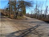
From the intersection at the NOB monument we continue on the lower right road in the direction of Javornik and Sveta Trojica (left Pečna reber). A few steps further along the road we notice a sign that we will continue the path on a forest road, but we walk on it for only a minute or two, then we reach the next intersection where a somewhat ambiguous sign for Sveta Trojica directs us to the lower right road. That we are on the right road is quickly confirmed by fairly frequent markings along the path. The path ahead leads us slightly downhill, while we first pass a smaller abandoned object, then after a larger clearing where we continue straight, also a somewhat larger abandoned military object. Beyond the mentioned object the path turns into a denser forest, which was heavily affected by ice glaze at the beginning of 2014. The marked path, along which we also notice some signs for Sveta Trojica, gradually begins to ascend gently and takes us into the military area where passage is forbidden during exercises and also life-threatening. The road, which has in the meantime turned into a cart track, then leads us past a maintained wooden hut, a little further it begins to ascend transversely on a moderately steep slope. On a smaller clearing the first views of Nanos open up, a little further when we step out of the forest onto a larger grassy slope also towards the surrounding hills, among others also Sveta Trojica whose summit we could already see during the ascent.
On the part where we step onto the mentioned grassy slope we also notice markings that we have entered the target area (life-threatening), which is not difficult to notice when looking at the heavily damaged ground from shells or other munitions.
On this part where a solitary birch stood at the time of the description we encounter a larger orientation loop, as on a stone under tall grass we notice markings that from a nicely traceable path direct us right downhill onto an initially not very visible path that begins to descend towards the foot of the hill Poček (826 m). After a few tens of meters of descent we catch a grassy cart track on which we descend to another, somewhat more stony cart track which we follow left downhill. There follows some more descent across extensive meadows adorned with numerous birches. When lower, at the indistinct saddle Vratca the path levels completely, then at the intersection where we reach a wider gravel road we continue left, which is also indicated by an arrow or marking on a tree. On the gentle road in a few minutes we reach the next intersection where we continue on the right road in the direction of Sveta Trojica. The road which again begins to ascend moderately quickly takes us to the Lovska koča Trešnja ravan which is located a few steps from the road to the left.
We continue on the road to the next intersection where we go right, a few minutes further at the next intersection straight onto a marked cart track which ascends somewhat more steeply. Higher up at the turning area we cross another forest road, then on the still marked path we begin to ascend relatively steeply on a stony cart track. After about 15 minutes the steepness eases and the path takes us to the saddle between Lonica on the left and Sveta Trojica on the right.
Here we reach a poorer forest road which we follow to the right, and on it with increasingly beautiful views in a few minutes we ascend to the scenic summit with a church and a viewing plaque.
The description and photos refer to the situation in 2014 (December).

Photos:
 1
1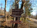 2
2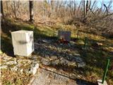 3
3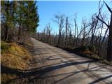 4
4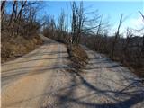 5
5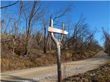 6
6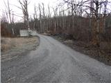 7
7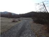 8
8 9
9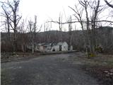 10
10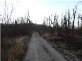 11
11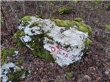 12
12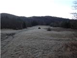 13
13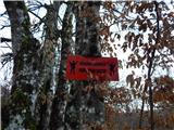 14
14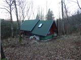 15
15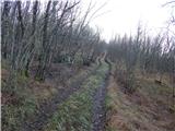 16
16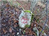 17
17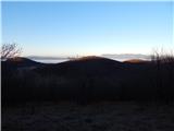 18
18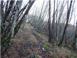 19
19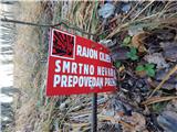 20
20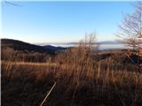 21
21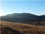 22
22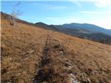 23
23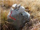 24
24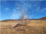 25
25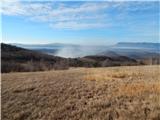 26
26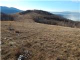 27
27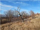 28
28 29
29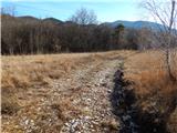 30
30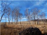 31
31 32
32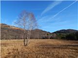 33
33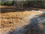 34
34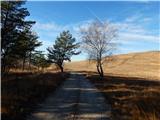 35
35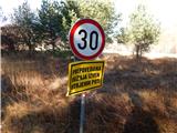 36
36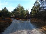 37
37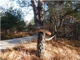 38
38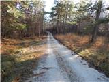 39
39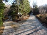 40
40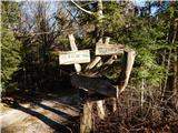 41
41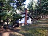 42
42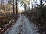 43
43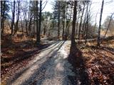 44
44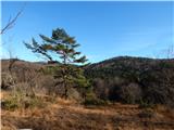 45
45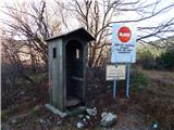 46
46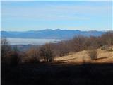 47
47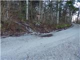 48
48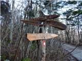 49
49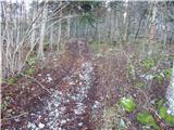 50
50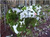 51
51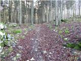 52
52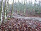 53
53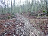 54
54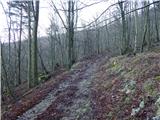 55
55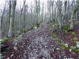 56
56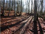 57
57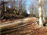 58
58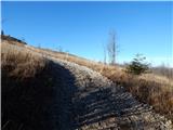 59
59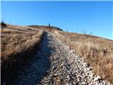 60
60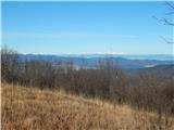 61
61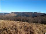 62
62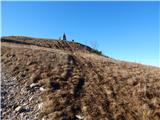 63
63 64
64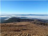 65
65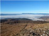 66
66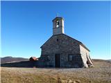 67
67 68
68
Discussion about the trip Jeršiče - Sveta Trojica (pot je trajno ZAPRTA!)
|
| nusa4. 01. 2015 |
Today I walked the described path, which is very nicely marked. Most of the path was snowy, making it nice to walk, as at the beginning there is quite a bit of forest gravel road. I recommend it to hikers who like solitary paths, as I didn't meet anyone. At the top beautiful views and a light breeze.
|
|
|
|
| tavzentroza23. 10. 2016 |
Walked the path today, the path is solitary, I met only one runner, really for those who want to walk in silence. The path currently matches the above description. I recommend walking on weekends when there are no military activities.
|
|
|
|
| sikvatro1. 06. 2017 |
Today I walked this path. Markings need renewal. Thanks to the above path description I walked it without issues. I didn't meet a single hiker either. I enjoyed the spring flowers and the beautiful view from the top.
|
|
|
|
| PDPostojna10. 04. 2018 |
The path is officially closed for safety reasons as it passes through a military polygon.
PD Postojna
|
|
|
|
| Lapuh20711. 08. 2021 08:46:32 |
Yesterday we headed to this summit, but completely from a different direction than described here. And we didn't regret it. From Cerkniško jezero (Otok village) we first drove near Debeleg kamen, already deep in Javorniki, from there we marched along forest roads towards Sveta Trojica. Nice, smooth path under the shady canopy of broad-leaved trees, a bit up and down. And checking the map, because there are many junctions and quite a few are no longer marked. When through gaps in the crowns in the valley below us the military training ground could already be sensed, which we completely avoided from this direction, a marked trail crossed our road from the right upwards. We took it left upwards, finally a bit steeper, and soon we were at the panoramic summit. Pleasant path for these hot days, and we ate our fill of raspberries. But we didn't meet a bear.
|
|
|
|
| Hribolazec817. 03. 2026 18:06:25 |
Which path is best to take to Sv. Trojica, so that the path is visible and you don't walk most of the way on macadam?
So it's not like last time, when I went from Jeršiče to Javornik, 90% of the path on macadam 
|
|
|
|
| rokeg7. 03. 2026 21:31:52 |
In my opinion, from Petelinjsko jezero or Slovenska vas there is the least road driving, or from Vlačno. Both paths are described on this portal.
The one described here is quite poorly marked and also closed, and during activities on Poč it is generally not safe to walk.
|
|
|
To post a comment you must log in:
If you do not yet have a username, you must first
register.