Jesenice (Straža) - Španov vrh (via Jelenkamen)
Starting point: Jesenice (Straža) (560 m)
| Latitude/Longitude: | 46,42900°N 14,08250°E |
| |
Route name: via Jelenkamen
Walking time: 2 h 30 min
Difficulty: easy unmarked way
Elevation gain: 774 m
Elevation difference along the route: 774 m
Map: Karavanke - osrednji del 1 : 50.000
Recommended equipment (summer):
Recommended equipment (winter): ice axe, crampons
Views: 6.415
 | 2 people like this post |
Access to starting point:
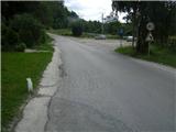
From the highway Ljubljana - Jesenice, we take the exit Lipce, where we turn right towards Jesenice. In the settlement Slovenski Javornik, at the intersection with traffic lights, we turn left towards the town center. At the second traffic-light intersection (at the high school), we turn right, back towards Tomšičeva cesta past the primary school on the left. We drive a further 2.5 km to the end of Tomšičeva ulica, or to the spot where, along the railway tracks, there is the last bus stop below the hill. Here there is a large parking lot, our starting point.
Route description:
From the parking lot, we head up the asphalt road, where just below the top on the left we notice a footpath, onto which we step and turn along it in the direction past the gardens on our left. We immediately come near residential buildings on the left, where we cross a short cart track (leading to the nearby water reservoir on the right). The footpath now rises slightly towards the power line, which we quickly reach. Here we turn right uphill to the east along a gravel path.
We soon reach the second power line, where the path turns left into a short woodland (in season we encounter a wire fence), after which we step onto the (hunting) east-west footpath. We turn left (westwards) across a pasture, at the end of which we notice a small bench, but here we continue right, more steeply uphill. Soon the gradient eases, and the path turns left towards the exposed rocky "baba", where we can enjoy the view.
We continue into the deciduous forest (west direction), where the path crossing the slope first descends slightly, then brings us to a forest clearing. Here among the ferns we reach its edge, where there is a minor junction. We continue right along the edge, and after approx. 40 m we encounter another junction (left branch), where we go straight uphill. Initially a wider forest path, it soon turns right and narrows. It then ascends the forest slope in switchbacks. After some time, at the top of the eastern ridge of Jelenkamen, the path levels out slightly and continues straight uphill to the north. Soon (at the fallen tree) the path turns sharply left, first crossing a somewhat steeper slope, then bringing us to a partly open spot, where we get a view of the Julian Alps and the main viewpoint of Jelenkamen, which lies over 100 vertical metres below its summit. Here the path turns right, steeply uphill (careful on descent when wet!), which does not last long. When the path levels out and directs us slightly to the left, we notice various markers on the trees. Soon, along the eastern slope on a northwest traverse, the path makes its final ascent towards the summit of Jelenkamen. After a few minutes when we reach the summit, we turn right (left to Jelenkamen) towards the northwest. There follows a few-minute walk along the marked path on the forest ridge, after which, as it descends slightly, we reach a junction: right Pristava, left Rovt Dole, straight hunting path to Lenčkov Špik. We choose the last one and ascend it in the same direction from which we came. When after a short time the path descends slightly, we reach a right branch, onto which we turn and leave the marked hunting path. The path, which crosses the fairly steep slope of Lenčkov Špik, soon brings us to Lenčkov rovt. Here we step onto a cart track, along which we first descend slightly and then at the junction choose the left one, and along it moderately ascend across and along pastures to its end on the forest road Prihodi - Križovec. We turn right and walk along the said road for another 10 min, after which we encounter a cart track from the left, which leads into the forest towards the northwest (small parking lot on the right side of the road). We take it and step onto the marked path Pristava - Črni vrh. A little further on, the path reaches a small indistinct saddle, after which it begins to descend gradually. At the point where the path turns left and then rises slightly, we cross a stream (left Ukova). After a short moderate ascent, just before leaving the forest, at the junction we choose right, i.e. the path going straight. When we reach the grassy slope, we head onto the ascending cart track on our right and thus (before re-entering the forest) leave the marked path. The cart track, which fades away towards the top of the increasingly panoramic slope, brings us to a large saddle right below Španov vrh on our right (here a view opens towards Golica). Only a short ascent remains along the edge of the ski slope to the upper station of the Španov vrh chairlift.

Photos:
 1
1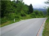 2
2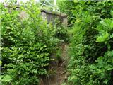 3
3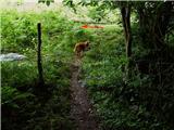 4
4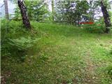 5
5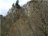 6
6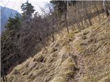 7
7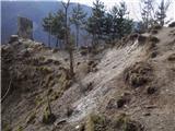 8
8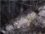 9
9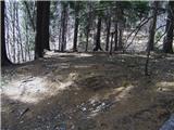 10
10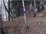 11
11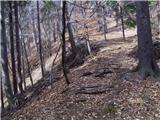 12
12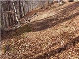 13
13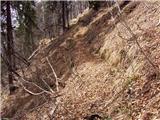 14
14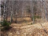 15
15 16
16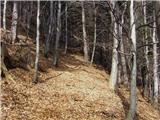 17
17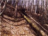 18
18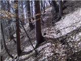 19
19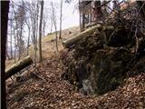 20
20 21
21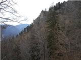 22
22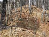 23
23 24
24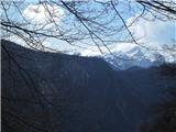 25
25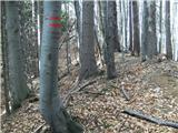 26
26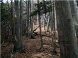 27
27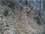 28
28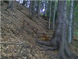 29
29 30
30 31
31 32
32 33
33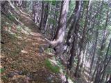 34
34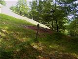 35
35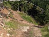 36
36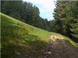 37
37 38
38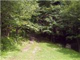 39
39 40
40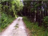 41
41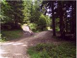 42
42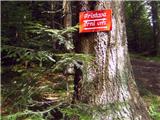 43
43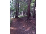 44
44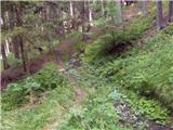 45
45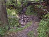 46
46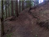 47
47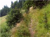 48
48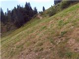 49
49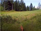 50
50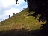 51
51 52
52
Discussion about the trip Jesenice (Straža) - Španov vrh (via Jelenkamen)
|
| Majdag10. 04. 2011 |
...Hi, today Ira and I went via Jelenkamen to Španov vrh. But we didn't go via L. rovt, but via L. Špik. Back we returned via sedem grabnov. There finally something is happening. New little bridge, a bit before the nails, sawn logs and made steps. Even the end of the path is somewhat changed, but the path is poorly visible. So today I was lucky, nice day, good path, and the views from Španov vrh were wonderful. Oh, one more thing, Heinz have you maybe already gone from L. Špik to the left along the ridge, I'm curious where you come down. Best regards Majda 
|
|
|
|
| heinz10. 04. 2011 |
Hello Majda!
So you're bringing good news regarding sedem grabnov.. I'm also glad that finally something is happening here!
Which ridge do you have in mind -left of L.Špik-, or from which side viewed, unfortunately I don't know. If maybe you mean the gully or valley, it could be -through Dole-...that one goes from Dol under L.Špik towards Kalvarija. That path isn't exactly nice to me.
But there is one ridge (wide forest) viewed from L.Špik towards Šp.vrh. This one is nameless, over it runs a marked (probably hunting) trail. It leads to the marked path Pristava - Črni vrh. Better and faster is, if instead you choose 10 min walk on the forest road on its right (as described above) etc..
Good luck! heinz
|
|
|
|
| Majdag11. 04. 2011 |
Heinz, yes, viewed from the direction L. Špik - Š. vrh. Last year I saw someone who fell in that direction. And he told me, if I don't know the path, it's better not to go, but it tempts me. Otherwise, I know the path through Dole. Thanks, and have a nice day, Best, Majda
|
|
|
|
| heinz12. 04. 2011 |
Given that, Majda, you're asking -where you come down- I assume you're asking about the ravine, not the ridge..
When you descend from Lenčkov Špik to the forest road Prihodi - Križovec, on the left behind the bend you notice the valley (ravine), on the other side the part of Sušje hill -1105, which from there looks like some ridge. You can descend into the mentioned ravine or valley through the forest, where you first come across the upper part of Jesniški rovt -1050, lower jz,floods through the thicket and then the lower one. On its western edge you come across a stream (left arm of Ukova), along which the path to the valley runs (you can find my description here: http://www.hribi.net/izlet/jesenice_ukova_spanov_vrh_/11/1231/2472
An easier and more reliable variant is along the road: you walk about 15-20 min, then after a smaller steep rovt with a weekend house on the right you come across a sharp junction of the f. road, to the left (back).This brings you to the lower part of Jeseniški rovt. On the right side of the stream you descend into the forest and continue along a fairly interesting path past a water intake over 100 years old, past a waterfall and along a fairly steep path towards the end to bridges over both Ukova in the lower part. The path ends on the cart track between both bridges.
Once I also tried a bit below the top of L.Š. to the left in the direction as you indicate, along some path towards the valley, but it ended quite quickly, so I turned back up.
If by chance none of this is what you had in mind, you can of course ask again.. I know this end quite well.
Best regards! h
|
|
|
|
| Majdag12. 04. 2011 |
Hello, thanks for the descriptions. I know the path past the old well, I've been there many times. Good that you know all these places so well, it comes in handy on my wanderings. Thanks Heinz, and good luck Majda
|
|
|
|
| Jusk22. 10. 2019 |
I didn't go exactly on this described trail, but from Ukova to Jelenkamen, then past the weekend settlement in Javorniški rovt along the marked trail towards Črni vrh, before Črni vrh directly to Španov vrh. The trail is OK, except from there on when crossing the Prihodi-Križovec road it's quite muddy. Weather nice and (too) warm for this time return along the road towards Prihodi and past Zg. Pejc to Jesenice
|
|
|
To post a comment you must log in:
If you do not yet have a username, you must first
register.