Jevšček - Monte Mataiur/Matajur
Starting point: Jevšček (805 m)
| Latitude/Longitude: | 46,19150°N 13,57990°E |
| |
Walking time: 2 h 30 min
Difficulty: easy unmarked way
Elevation gain: 837 m
Elevation difference along the route: 850 m
Map: Julijske Alpe - zahodni del 1:50.000
Recommended equipment (summer):
Recommended equipment (winter): ice axe, crampons
Views: 3.860
 | 1 person like this post |
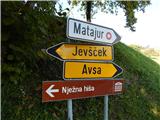
Access to starting point:
A) We drive to Tolmin, then continue driving towards Kobarid. When we arrive at the settlement Idrsko, we turn left towards the settlement Livek, from Livek we follow the signs for Avso and Matajur. A little higher we leave the road towards Avso and continue left towards Jevšček and Nježne hiše. Further on, we drive through the hamlet Piki, then we arrive at the pastures which are still before the settlement Jevšček. Here at the recycling spot the described path begins, we park a little earlier, at an appropriate place by the road.
B) From Kobarid we drive towards Tolmin, but only to the settlement Idrsko, where we turn right towards the settlement Livek, from Livek we follow the signs for Avso and Matajur. A little higher we leave the road towards Avso and continue left towards Jevšček and Nježne hiše. Further on, we drive through the hamlet Piki, then we arrive at the pastures which are still before the settlement Jevšček. Here at the recycling spot the described path begins, we park a little earlier, at an appropriate place by the road.
Route description:
At the recycling spot we leave the road and continue sharply right onto a cart track, which for some time runs parallel to the road and for some time passes under the power line. The cart track soon leads along the edge of the forest and brings us to a smaller valley, where it turns right. At that spot we leave the cart track and continue straight uphill on a faint path, which continues ascending along the edge of the forest. Higher up, when we finally leave the pastures and hayfields and the path enters the forest, blue "markers" appear along the path, which accompany us in a traverse ascent to the right, i.e., all the way to the forest road. We follow to the left the road that arrives from the village Avso, from it we quickly go right onto a footpath, which after a few minutes of ascent returns to the road. We continue the ascent along the macadam road, which after a few minutes turns right and leads us along the edge of the abandoned mountain pasture Sleme, which we notice to the left below us. There follows quite some walking along the fairly gentle macadam road, then an old path from the village Avso joins from the right.
Along the road, which is marked further on, we soon arrive at a marked junction located in a small valley between Mrzli vrh and Srednji vrh.
At the junction a marked but unmarked path branches off to the right to Mrzli vrh, Srednji vrh and Idrska planina, while we continue along the road, which splits on the western side of Mrzli vrh.
We continue along the left road (right to Idrska planina), to which a "new" path from Avso or Livek joins a little further on.
From the poorly visible junction we walk along the road for a few more minutes, then leave it at the next marked junction and continue right in the direction of Matajur (straight to Dom na Matajure).
Further on, the path begins to ascend again over a partly grassy slope, from which increasingly beautiful views open onto the surrounding mountains. Higher up, as the path gradually moves onto the northern slopes, a path from the village Svino also joins from the right, and we continue towards Matajur. A few minutes of traverse ascent follow, and we arrive at the junction below Glava, where the "Slovenian route" to Matajur and the path to Visoka glava continue straight ahead, while we go left uphill and quickly climb to the panoramic eastern ridge of Matajur, where the path from Italy (starting point Mašera / Masseris) joins.
We continue along the mentioned ridge, along which we ascend gently to moderately along the state border between Slovenia and Italy. A few more minutes of increasingly scenic walking follow, and we reach the summit of Matajur, from where a beautiful view opens to the west.
The description and photos refer to the conditions in 2018 (October).

Photos:
 1
1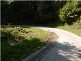 2
2 3
3 4
4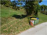 5
5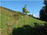 6
6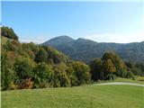 7
7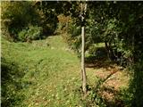 8
8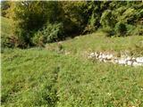 9
9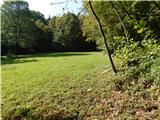 10
10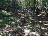 11
11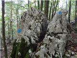 12
12 13
13 14
14 15
15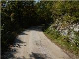 16
16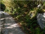 17
17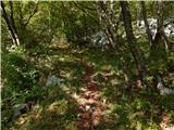 18
18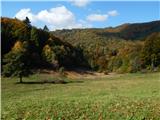 19
19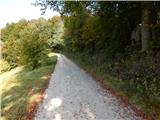 20
20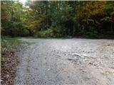 21
21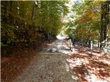 22
22 23
23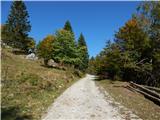 24
24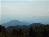 25
25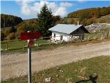 26
26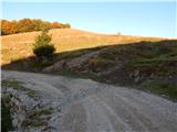 27
27 28
28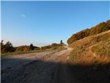 29
29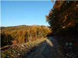 30
30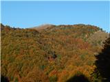 31
31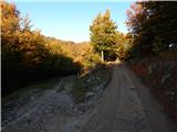 32
32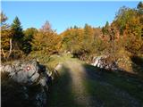 33
33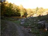 34
34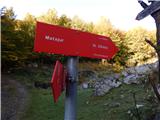 35
35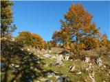 36
36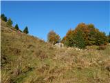 37
37 38
38 39
39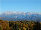 40
40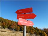 41
41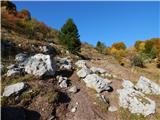 42
42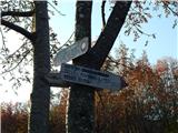 43
43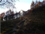 44
44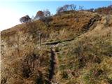 45
45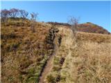 46
46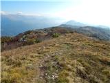 47
47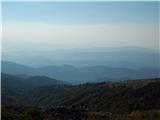 48
48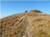 49
49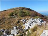 50
50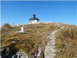 51
51 52
52 53
53
Discussion about the trip Jevšček - Monte Mataiur/Matajur
To post a comment you must log in:
If you do not yet have a username, you must first
register.