Kamnik - Castle Stari grad Kamnik (by road)
Starting point: Kamnik (375 m)
| Latitude/Longitude: | 46,22090°N 14,61240°E |
| |
Route name: by road
Walking time: 1 h
Difficulty: easy unmarked way
Elevation gain: 202 m
Elevation difference along the route: 235 m
Map:
Recommended equipment (summer):
Recommended equipment (winter):
Views: 7.839
 | 1 person like this post |
Access to starting point:
A) From Komenda, Trzin or Domžale we drive towards Kamnik, and then we continue driving on the Kamnik bypass towards Gornji Grad and Kamniška Bistrica. When we get to Kamnik, at the first traffic light intersection we turn right in the direction of the Kamnik health center near which we also park on a large well-maintained parking lot.
B) From Gornji Grad over the Črnivec mountain pass we drive to Kamnik, where we continue driving on the Kamnik bypass. At the last traffic light in Kamnik we turn left in the direction of the Kamnik health center near which we also park on a large well-maintained parking lot.
C) From the Maribor - Ljubljana highway we take the Vransko exit, and then we continue driving towards Tuhinj and Kamnik. When we get to Kamnik we need to pay attention, because at the last traffic light we turn left in the direction of the Kamnik health center near which we also park on a large well-maintained parking lot.
Route description:
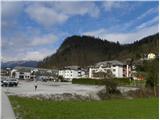
From the health center we continue on the road towards the south, which gradually starts first gently, then moderately ascending. When Kamnik ends, the road passes into the forest and starts ascending even a little steeper. Higher, the path leads us through a short panoramic slope, then behind the nearby farm it returns into the forest and starts turning more and more to the left. For a few minutes we still walk on the main road towards Palovče, then we continue left in the direction towards Stari grad.
From the crossroad onwards we still ascend moderately for a few minutes, then the road flattens and for a few minutes passes out of the forest. When the path returns into the forest, it starts descending and brings us to the saddle between Visoka špica and Krniška gora. From here only a short ascent follows and the path brings us to the ruins of the former castle and inn Grof Andeš.
Photos:
 1
1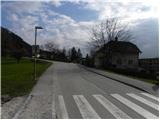 2
2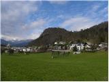 3
3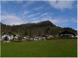 4
4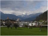 5
5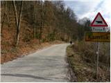 6
6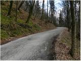 7
7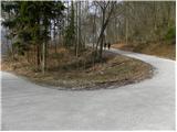 8
8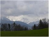 9
9 10
10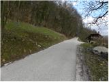 11
11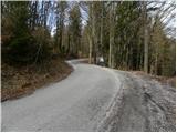 12
12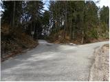 13
13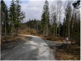 14
14 15
15 16
16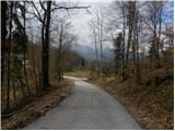 17
17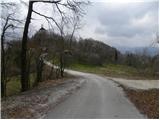 18
18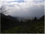 19
19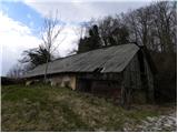 20
20 21
21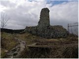 22
22 23
23
Discussion about the trip Kamnik - Castle Stari grad Kamnik (by road)
|
| grajskaterasa20. 07. 2017 |
The path along the road is also interesting, but recommended especially for those who want to avoid the relatively steep forest path. The Old Castle above Kamnik is again becoming a popular excursion spot for hikers from near and far, as a renovated restaurant opened at the end of April  You certainly won't leave disappointed - wonderful view and castle service You certainly won't leave disappointed - wonderful view and castle service
|
|
|
To post a comment you must log in:
If you do not yet have a username, you must first
register.