Kamnolom Ljubelj - Vranilac (Kalnik) (path 2)
Starting point: Kamnolom Ljubelj (220 m)
Route name: path 2
Walking time: 1 h 10 min
Difficulty: partly demanding marked way
Elevation gain: 423 m
Elevation difference along the route: 423 m
Map:
Recommended equipment (summer):
Recommended equipment (winter): crampons
Views: 6.976
 | 2 people like this post |
Access to starting point:
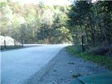
a) Leave the Varaždin - Zagreb motorway at the exit for the town of Novi Marof, then continue left towards Ljubeščica. After one kilometre of driving, continue right towards the village of Ljubelj and the Ljubeščica quarry, which is already visible from the motorway. Continue past the quarry and a few farms along Križevačka Street. Further on, the road enters a gorge and shortly after reaches the second quarry, from which the road continues towards the villages of Kalnik and Borje. Park at a suitable spot at the beginning of the quarry.
b) From the old Varaždin - Zagreb road, at the town of Novi Marof, at the roundabout take the exit towards Varaždinske Toplice. A little further on, arrive at a junction from which motorway access is possible. Continue towards Ljubelščica, then follow the above description.
Route description:
From the starting point continue through the quarry along the unpaved road Ljubelj - Borje. Behind the quarry there are still a few parking spots. Upon reaching the shrine of Our Lady of Hrušov, the first gentle ascent begins. Leave the road after about 15 minutes, then continue left into the forest. Continue along the track that steeply ascends through the forest following the markers. Along the path notice also a jump for mountain bikers. A little further, path No. 2b branches left from our path, made a few years ago to bypass three streams that are harder to cross in rain, but we continue right slightly downhill and soon reach the crossing of the first stream, where there is still quite some mud a few days after rain. On the other side of the stream the path starts to ascend steeply, but levels out at the second stream (also quite muddy after rain here). Here the path leaves the track for a while and switches to a narrower forest path. Upon returning to the track, the third stream crossing awaits. The path then leaves the track again, but only for 2 minutes, then returns to another wider track, where path 2b joins us almost imperceptibly from the left. Here the path levels, then leads us in a gentle ascent to a larger junction.
At the junction, the path from Varaždinske Toplice via Pece, the educational trail and the unofficial path along the forest road to the mountain hut join. Continue ahead following the signs to the summit. Later from the path three consecutive paths to the mountain hut branch left, from the right the path from Novi Marof and the Zagorje mountain path join us. A little higher, precisely at some old willows, continue right towards the summit (branch marked).
Here the path becomes somewhat more demanding and continues along steep partly rocky slopes that are somewhat exposed in places. Several short ascents and descents follow and the path leads to a nice viewpoint. Before reaching the ridge two demanding paths branch left towards the Sedmi zob rock. Upon reaching the ridge a nice view opens to the southeast, we continue right towards the west and quickly arrive below the summit. Here a bracket helps to climb more easily over the steep rock to the summit.
On the summit there is a geodetic point, the logbook is somewhat below the summit, reached with the aid of a fixed cable.

Photos:
 1
1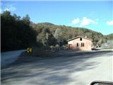 2
2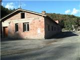 3
3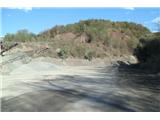 4
4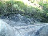 5
5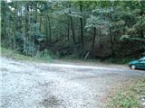 6
6 7
7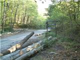 8
8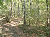 9
9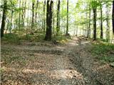 10
10 11
11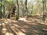 12
12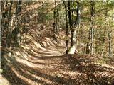 13
13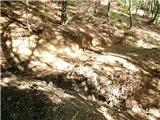 14
14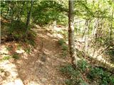 15
15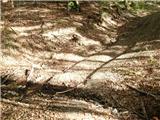 16
16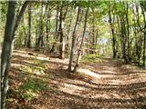 17
17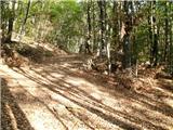 18
18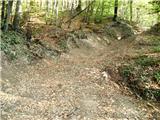 19
19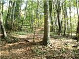 20
20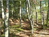 21
21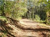 22
22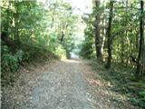 23
23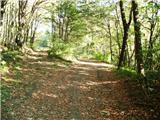 24
24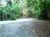 25
25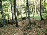 26
26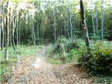 27
27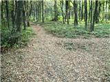 28
28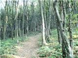 29
29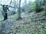 30
30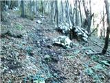 31
31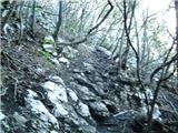 32
32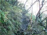 33
33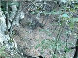 34
34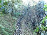 35
35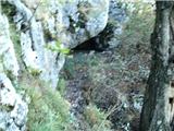 36
36 37
37 38
38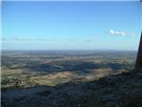 39
39 40
40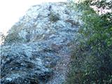 41
41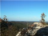 42
42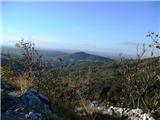 43
43
Discussion about the trip Kamnolom Ljubelj - Vranilac (Kalnik) (path 2)
|
| Marx2. 10. 2012 |
Now I noticed an error in the description - when we reach the ridge we continue right to the west, not left to the east. I apologize for the error, but at this point on the path it's impossible to miss because the summit is visible there.
On the summit there is also a cadastral tower visible from the surroundings (it's a bit more than one meter high).
|
|
|
|
| Marx26. 12. 2012 |
Directly at the junction where variant 2b branches off (picture 12) there is another junction where the path to the spring branches off to the left, where we can refresh ourselves.
|
|
|
|
| Marx4. 08. 2013 |
Variant 2c is also under construction. It will branch off from path 2 somewhere between pictures 7 and 8 and go steeply uphill to the summit of Pec which is in the forest and has no view, but around it there is a very interesting forest world. For now, more than half of the path is marked, at the top of Pec this variant will join the path that goes from Varaždinske Toplice through the pass Kapelski Ljubelj. This path joins path 2 at the junction in picture 25.
|
|
|
|
| zdomec12. 09. 2013 |
Three weeks ago I visited Kalnik. I parked the vehicle at that shrine (Majka bozja hrusovska). From when does it exist and who made it
What does that shrine mean. It's quite nicely arranged, and as seen from the thank you items it's quite visited. Does the shrine have any meaning. If someone knows more about it, I would ask for explanation.
Maybe Marx would know something more to say.
|
|
|
|
| Marx5. 12. 2014 |
When I last went along the path I saw that the path has slightly changed.
Now on picture 24 we no longer go right, but slightly left slightly uphill on the overgrown track. This brings us again to the junction on picture 25. No problem if on picture 24 we just continue on the old path, we'll reach the junction again, but that path is now extremely muddy.
|
|
|
|
| zdomec6. 12. 2014 |
This August when I visited Kalnik, I chose a slightly longer approach variant. I parked the car at the shrine of Our Lady of Hrušov and set off on path no. 4. From the shrine the path descends slightly and then climbs through the forest up to the first crossroads where the path from Varaždin spas joins. Then the path continues moderately to the second crossroads-saddle where the pedestrian path from Novi Marof and PZP joins.
From the saddle the path descends to the saddle and to the gravel road Ljubelj-Burje.
Along the road about 50 meters uphill to the first markers where "Poučna staza" begins.
Here we can decide whether immediately to the main ridge and along it to the top, or along the path to the hut. This path is longer, about 2 h to the hut, but very nice. On the return to the car along path no. 2 I met a friendly man-marker who explained all variants in detail and said that path 2b is being marked which should also lead to the top of Pece (smaller peak in the Kalnik mountain range). The man was a real lexicon of information. He told me that he mostly takes care of the markings and signs himself and knows the entire Kalnik mountain range. It was really pleasant to talk to him. I recommend this path to all those who want a slightly longer walk through the forests of Kalnik. 
|
|
|
|
| Marx7. 12. 2014 |
Zdomec!
The real goal of this path is the peak Mali Kalnik on whose crest are the ruins of the old castle. The peak rises steeply above the village Gornja Rijeka.
You gave me a hint for yet another path description on Kalnik. In the future I will go along that path, and from Mali Kalnik continue all the way to Vranilac. Along the road Kalnik-Borje there are even three variants to choose - Poučna steza, ZPP bypass (Both lead to the hut, the educational path along the south, the bypass along the northern subridge) and the variant that goes over the viewpoint Zmijski vidikovac and the glider take-off Second start leads to the top - this is demanding in one part.
The man you met is the legendary Štefek Jembrek who voluntarily takes care of the paths and markings on Kalnik. My opinion is that Kalnik would be quite neglected without him. Besides the hiking paths he also arranged a trail for mountain bikers B.O.K. (Biciklom oko Kalnika)
|
|
|
To post a comment you must log in:
If you do not yet have a username, you must first
register.