Kisapati - Szent Gyoergy Hegy
Starting point: Kisapati (130 m)
| Latitude/Longitude: | 46,84400°N 17,46600°E |
| |
Walking time: 45 min
Difficulty: partly demanding marked way
Elevation gain: 285 m
Elevation difference along the route: 285 m
Map:
Recommended equipment (summer):
Recommended equipment (winter):
Views: 2.342
 | 1 person like this post |
Access to starting point:
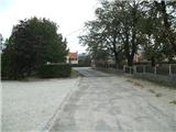
From the Pomurska motorway, we turn off at the Dolga Vas exit, then continue driving towards Hungary. The route takes us through the town of Redics, then we follow the signs for the town of Zalaegerszeg, from there in the direction of Blatno Lake / Balaton, Heviz and Keszthely. When we reach the town of Keszthely, we turn onto the bypass and then follow the signs for Balatonfuered (there are roundabouts along the bypass). When the road to the town of Sopron branches off at the end of Keszthely, we continue east, but only 2 km, then turn right towards the village of Badacsonytoerdemic. We continue through the village (the road in the middle of the village is cobblestoned) and arrive at the village of Nemesgulacs. In the mentioned village, we go left towards the village of Kisapati. In Kisapati, we turn left onto a less noticeable road between the school and the cemetery. We park in the parking lot between the school and the cemetery.
A somewhat shorter route is Lendava - Pince - Tornyszentmiklos - Nagykanizsa - Budapest - Kisapati, but it is much more difficult in terms of orientation.
Route description:
From the parking lot, we continue westwards, where the road splits into three parts. We take the middle road (unfortunately, I couldn't capture a photo of the junction) marked with the green trail. The path ahead begins to climb quite steeply through the vineyards and runs along the eastern slope of the former volcano. After 10 minutes, we reach a junction, from which we continue more northwards along an easier path. Further on, the trail narrows, then takes us past a ditch to an asphalt road. Here the markings disappear, but we go uphill to a junction with a sign in German and Hungarian. At this junction, we continue right and along the road only 30 meters, then continue on a narrow path where we notice the next tourist signs. The path continues from a flower garden towards the nearby forest, through which we walk for just a minute, then arrive at a poorer road where the markings reappear. The road then climbs and brings us in 2 minutes to the Kulcsoshaz inn, which is essentially a mountain hut.
From the hut, we continue uphill and follow the blue trail (until now the trail marking was green, which from here goes to the western slopes, while the blue comes from Tapolca).
From here, the path becomes quite steep and continues over rocks and scree. Further on, we climb what are like steps, occasionally secured with a railing. Higher up, we reach what is for many the most interesting part of the path, namely the 12-meter-high basalt pillars (stalactites). Here the path becomes even more demanding, aided by an iron railing. When the protections end, the path leads us further between smooth walls, where there is a risk of slipping. Above this demanding section, we reach a junction where a path branches off to a viewpoint north (Tapolca and in the distance Somlo), but we continue along the easy path, which in 5 more minutes of walking brings us to a small cabin containing a logbook (so far the only logbook I've seen in Hungarian hills, and I've hiked quite a few).
From here, the blue trail goes downhill, but we continue right along the blue triangle. The path then takes us past a few benches where we can rest a bit, then quickly to a viewpoint from which we have a beautiful view of the former volcanoes and Lake Balaton. From here, we continue right for another 2 minutes to the summit.
At the summit, there is an information board with panorama labels. The view from the top is in all directions except north, where it is blocked by forest. In very good visibility, we can even see Boč and Donačka gora from the top.

Photos:
 1
1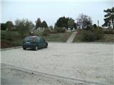 2
2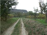 3
3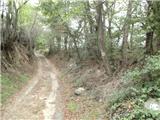 4
4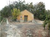 5
5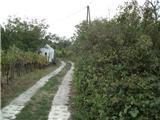 6
6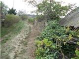 7
7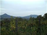 8
8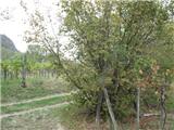 9
9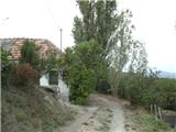 10
10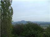 11
11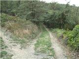 12
12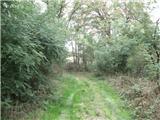 13
13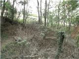 14
14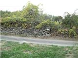 15
15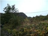 16
16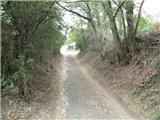 17
17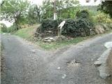 18
18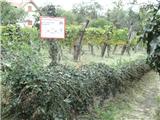 19
19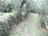 20
20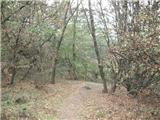 21
21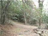 22
22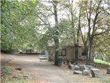 23
23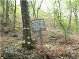 24
24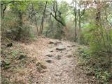 25
25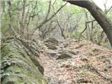 26
26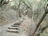 27
27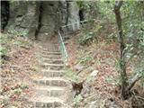 28
28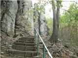 29
29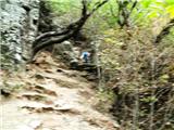 30
30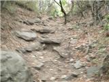 31
31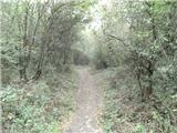 32
32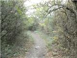 33
33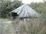 34
34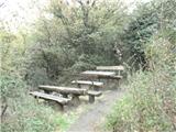 35
35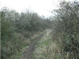 36
36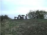 37
37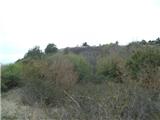 38
38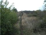 39
39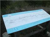 40
40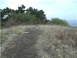 41
41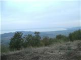 42
42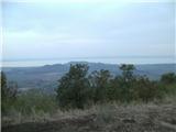 43
43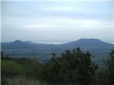 44
44
Discussion about the trip Kisapati - Szent Gyoergy Hegy
To post a comment you must log in:
If you do not yet have a username, you must first
register.