Kneške Ravne (Prošček) - Vogel (via Žabiški Kuk)
Starting point: Kneške Ravne (Prošček) (754 m)
| Latitude/Longitude: | 46,21970°N 13,82560°E |
| |
Route name: via Žabiški Kuk
Walking time: 5 h 20 min
Difficulty: easy unmarked way, partly demanding marked way
Elevation gain: 1168 m
Elevation difference along the route: 1275 m
Map: TNP 1:50.000
Recommended equipment (summer): helmet
Recommended equipment (winter): helmet, ice axe, crampons
Views: 1.280
 | 2 people like this post |
Access to starting point:
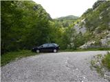
From the road Bača pri Modreju - Podbrdo, in the settlement Kneža we turn onto the road in the direction of Kneške Ravne. Further, we ascend on the road which continues through the valley of the stream Kneža. At first a quite gentle and partly macadam road, higher it starts ascending steeper, on the steep part the road is mostly asphalt. Higher, the road splits, and we choose the slightly right road which leads towards the mountain pasture in Prodih and becomes macadam (left Kneške Ravne). Next follows a few hundred meters of ascent on the macadam road, and then we park at an appropriate spot before the gate.
Route description:
From the starting point, we continue on a macadam road over which there is a gate, and we follow it in a few hairpin turns and after approximately 35 minutes we arrive at the forestry cottage.
At the cottage, we leave the road and on the right side of the cottage we walk into the forest, where a nicely traceable and still unmarked footpath continues. Next follows an ascent, mostly through the forest, occasionally some views open up in the direction of the pre-alpine hills. Next follows crossing of a torrent bed, and then we reach the edge of the mountain pasture in Prodih, where we also step onto the marked path.
We continue left (a few 10 steps to the right is the hunting cottage) and continue walking on the Geological Trail, along which the European footpath E7 also runs. The path ahead mostly gently ascends to the left, crossing occasionally steeper slopes of the Lower Bohinj Mountains. When we reach the ridge between the Ljubinske stene and Masovnik, a nice view opens up in the direction of Kojca, and the path stops ascending and gradually starts descending at the foot of the mentioned walls. Below the walls, from the left an once-marked path from Kneške Ravne joins almost unnoticeably.
We continue straight in the direction towards the mountain pasture Razor, and the path leads us directly below the cliffs, where especially in springtime there is an increased risk of falling rocks. Next follows a traversing ascent and the path brings us into the forest, where it leads us past a spring. Behind the spring the path temporarily ascends steeply, after two hairpin turns it flattens again. A little further we cross a pasture fence, and the path brings us from the forest to the upper part of the mountain pasture Kuk, to the area called Močila, where we bypass some cottages along the lower side. Behind the cottages we reach a cart track, which we follow to the right (left to mountain pasture Kuk and parking lot), along it we quickly arrive at a junction, where to the right branches the path to Žabiški Kuk (also Žabijski Kuk) - the path past Gradič (old military path).
We continue on the mentioned path (straight to Koča na planini Razor 30 minutes), which on the grassy slope starts to fade. During the ascent wooden stakes help us, which in the upper part are painted red. When higher we enter the forest, several footpaths appear, and we continue on the one along which there are red marks. For some time in a traversing ascent we cross fairly steep slopes to the right, then we exit the forest and arrive at steep grassy slopes. Next follows traversing in a slight descent, where especially when wet there is a risk of slipping, then the path turns left and enters a steep, mostly grassy gully surrounded by dwarf pines. Along the indistinct gully the path, still marked with red lines, ascends straight upwards, so that the steepness of the path is considerable. Higher the trail turns slightly right, the slope also flattens somewhat, and with nice views we reach the old mule track. For some time we ascend along the old mule track, then the path from the dwarf pines goes along the ridge edge, where we ascend along the edge of steep slopes. Higher the ridge becomes somewhat more pronounced, and we in a few more minutes arrive at the miniature Aljaž Tower, located on Žabiški Kuk (1844 m).
From the summit logbox we continue briefly along the ridge, then the red marks direct us onto a poorer footpath that bypasses point 1881 on the left side, which is the highest point of the Žabiški Kuk ridge. With nice views of the surrounding mountains the path soon returns to the ridge, along which we descend to the saddle between Žabiški Kuk and Vogel. From the saddle follows a short ascent and we reach the marked path that leads from the mountain pasture Razor towards Vogel.
We continue the ascent and after 10 minutes of further walking we arrive at the panoramic summit.
Izhodišče - planina v Prodih 0:55, planina v Prodih - Močila 2:00, Močila - Žabiški Kuk 1:55, Žabiški Kuk - Vogel 0:30.
Description refers to the condition in July 2018, pictures from July 2016 and 2018.

Photos:
 1
1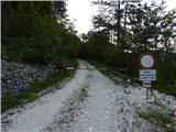 2
2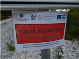 3
3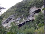 4
4 5
5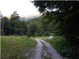 6
6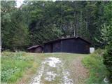 7
7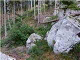 8
8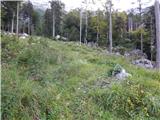 9
9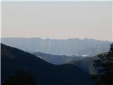 10
10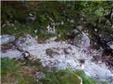 11
11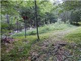 12
12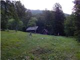 13
13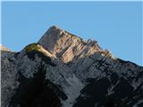 14
14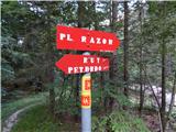 15
15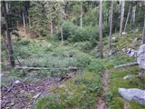 16
16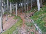 17
17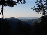 18
18 19
19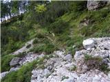 20
20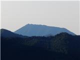 21
21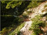 22
22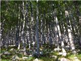 23
23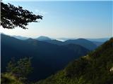 24
24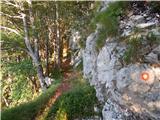 25
25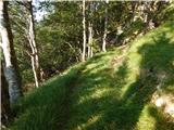 26
26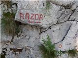 27
27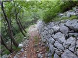 28
28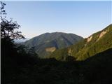 29
29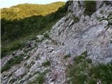 30
30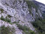 31
31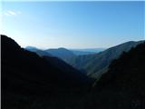 32
32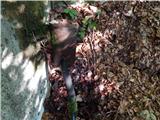 33
33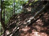 34
34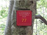 35
35 36
36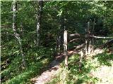 37
37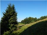 38
38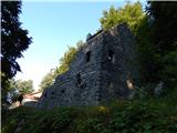 39
39 40
40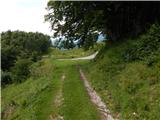 41
41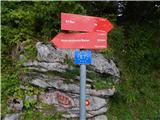 42
42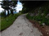 43
43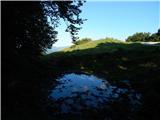 44
44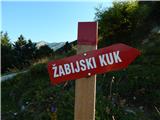 45
45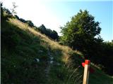 46
46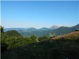 47
47 48
48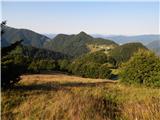 49
49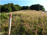 50
50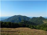 51
51 52
52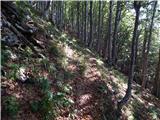 53
53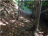 54
54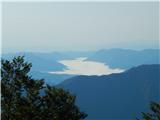 55
55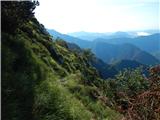 56
56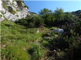 57
57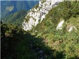 58
58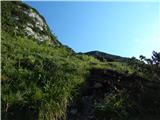 59
59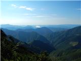 60
60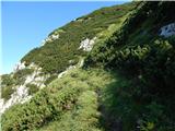 61
61 62
62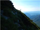 63
63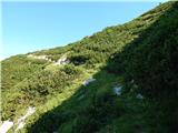 64
64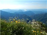 65
65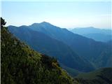 66
66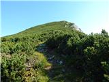 67
67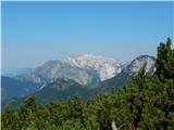 68
68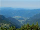 69
69 70
70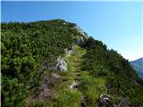 71
71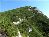 72
72 73
73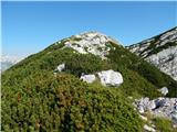 74
74 75
75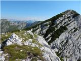 76
76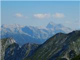 77
77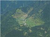 78
78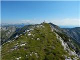 79
79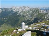 80
80 81
81 82
82 83
83 84
84 85
85 86
86 87
87 88
88 89
89 90
90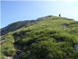 91
91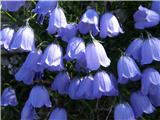 92
92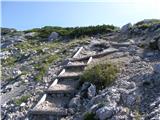 93
93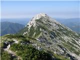 94
94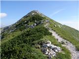 95
95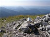 96
96 97
97
Discussion about the trip Kneške Ravne (Prošček) - Vogel (via Žabiški Kuk)
|
| ljubitelj gora2. 05. 2023 12:35:46 |
Lonely sections where you meet no one. Up through pathless terrain, steep grass, but nowhere climbing over rocks.
|
|
|
To post a comment you must log in:
If you do not yet have a username, you must first
register.