Kobarid - Stol (Julian Alps)
Starting point: Kobarid (234 m)
| Latitude/Longitude: | 46,24820°N 13,57740°E |
| |
Walking time: 4 h 15 min
Difficulty: easy marked way
Elevation gain: 1439 m
Elevation difference along the route: 1500 m
Map: Julijske Alpe - zahodni del 1:50.000
Recommended equipment (summer):
Recommended equipment (winter): ice axe, crampons
Views: 71.929
 | 3 people like this post |
Access to starting point:
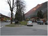
From Bovec or Tolmin we drive to Kobarid, where in the center we head towards the border crossing Robič. We follow this road only a few dozen meters to the parking lot, which we notice on the right side of the road at the spot where there used to be a gas station. During workdays the parking lot is often occupied.
Route description:
From the parking lot, we go back (towards the east) to a crossroad in the center of Kobarid. At the crossroad, we go left and after a few meters we will notice on the left side signpost »Stol 4h«. At the signpost, we continue right upward on a narrow road past houses. The road soon ends and we continue on a footpath in the forest. After a short ascent through the forest we come to a crossroad, where we go left towards Stol, and right leads the path towards Veliki Rob. Because the path runs through the forest there isn't much view, only occasionally we can through branches see Kobarid and Krn. The path then leads us past some ruins to a crossroad where we join the cart track. We go left on the cart track on which we are ascending past some old houses. The cart track soon ends, and we continue on a footpath which brings us to a crossroad. Left runs the path to the vantage point on Hom (1015m) to which is 5 minutes of walking.
We continue right on a marked path, which in approximately 10 minutes brings us on a ridge on which steepness decreases and also a nice view opens up on Kobarid and surrounding peaks. The path ahead runs on a ridge partly over grassy slopes, partly through a thin forest. We soon come to a crossroad, where from the left joins the path from Staro selo and from the right path from Trnovo ob Soči.
We continue on grassy slopes past a shepherd hut and hunting cottage Starijski vrh. A little before the hunting cottage our path joins a narrow mountain road which we follow to the nicely arranged bivouac Hlek.
From the bivouac, we then still follow the mountain road all the way to a crossroad, where the road branches off to the left towards Breginj, and right towards Učja and Žaga. We go straight following the signs »Stol 1 ura«. The road soon ends, and we continue right by the fence on quite steep grassy slope. When we get to the ridge we go left and then follows only a few more shorter ascents to the top of Kobariški Stol.

Photos:
 1
1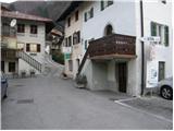 2
2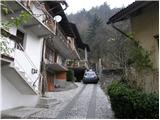 3
3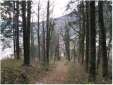 4
4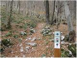 5
5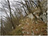 6
6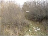 7
7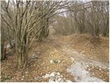 8
8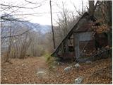 9
9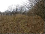 10
10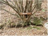 11
11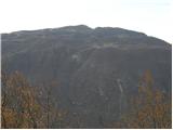 12
12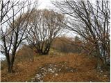 13
13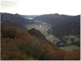 14
14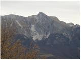 15
15 16
16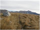 17
17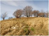 18
18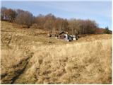 19
19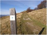 20
20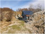 21
21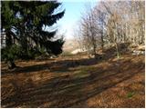 22
22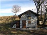 23
23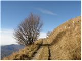 24
24 25
25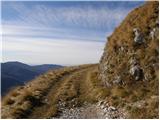 26
26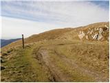 27
27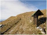 28
28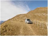 29
29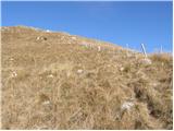 30
30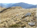 31
31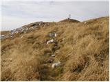 32
32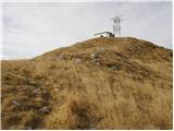 33
33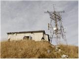 34
34
Discussion about the trip Kobarid - Stol (Julian Alps)
|
| mojcej'7212. 07. 2010 |
Ideal full-day trip. We did it by driving out of smog-filled Ljubljana on Saturday via the Gorenjska motorway, through Vršič to Trento, Bovec and pitching our tent at Koren camp (10 EUR/person) near Kobarid. In the morning we were closer to the starting point. At 7:50 we started from Kobarid (if you stand in front of Kotlar restaurant and look right from Simon Gregorčič monument you see the path as shown in the second picture in the description above). No orientation problems ahead, everything well marked. The sign says Stol 4h, but our trip took 5h10. The first marked 1h we walked in 50 min, so we know we're within the "average" range. We panted quite a bit for that hour and another 30 min, mainly due to the steepness and considerable humidity, then the path calmed a bit, with occasional breeze. Reaching the idyllic ridge and views made everything ahead pure enjoyment. Sun cover and sunscreen are mandatory, as you're VERY exposed to the sun here. Also recommend bringing plenty of water (at least 3-3.5 liters for the whole trip). I had 2 liters, which went quickly, but at halfway (at Bivak) it was possible to refill bottles with fresh cold water. A little further from Bivak (where you cross the sheep pasture) and Hlek is a section of the path that is one blooming botanical garden (from primroses with cowslips, to some lilies, blooming rosehip bushes, herbs and all sorts of colors of other little flowers whose names I don't know). Everything smells great and whoever misses this misses everything this path offers. Further on, you nicely stroll along a fairly wide path to the point where paragliders take off. From that point, where we had a snack, it's at least another 45 min to the summit, but note that you're actually only halfway. You also have to get back down (another 3.5-4h) so the trip really takes 9-10h (depending on breaks). On the way back, about 50 paragliders were still accompanying us in the air, circling contentedly along the ridge (obviously warm air from the sea and cold from the Julijci create thermal bliss) and not deterred even by some light gray clouds that might hint at a thunderstorm, but it didn't happen. After descending from the ridge, thunder was heard in the background somewhere, but we weren't caught by rain on the path. At 19h the tent was packed at the camp and we drove back to Ljubljana via Cerkno and Škofja Loka (winding roads, but definitely 3x emptier than via Nova Gorica on the motorway) and ended the day at 21:30. No regrets.
|
|
|
|
| ljubitelj gora6. 02. 2013 |
Even in winter people hike this path to the top of K. Stol.
|
|
|
|
| katja876. 05. 2013 |
On Friday 3.5. we took this path towards the summit of Kobariški Stol.
At the beginning we climbed steeply through a forest path for about two hours, where we gained the most elevation. Legs get quite tired on this part :p Then we reached beautiful meadows and later a wide path, which we walked for about an hour. Then the last hour the path steepens again and finally the summit cheered us 
On the way back, the cloud cover had lifted and views opened towards Krn and the Polovnik ridge. Eagles circled around us for a while.
Photos from the hike can be viewed on the website of Planinsko društvo Matica Murska Sobota: http://www.mojalbum.com/pdmaticams/20130503-kobariski-stol/pogled-v-dolino-proti-kobaridu/20746823
|
|
|
|
| LejaS29. 10. 2013 |
Is anyone else heading to Kobariški Stol at this time?
|
|
|
|
| dragon30. 10. 2013 |
Recently I walked this path, which I warmly recommend to everyone. Wonderful path, super views once you reach the ridge. But I have a couple of remarks or warnings. First regarding parking. I didn't find it on the right side, but you can park on the other side of the road behind the cinema hall. Take a good look at the second picture above to know which street to turn into. Namely, there is no sign for Stol on that house. The first marker is only on the last house in that alley, which cannot be seen from the road below. The third thing that bothered me is the stated walking time. I don't count myself among the slowest, but I needed quite a few more minutes than stated above. An average hiker should count on about five hours of walking. Similarly, the time specified at the top of Stol for return to Kobarid (two and a half hours) is not entirely realistic. The path is quite long and strenuous, so in these short days we shouldn't delay the start too much so that darkness doesn't catch us. Otherwise, as already said, an excellent trip
|
|
|
|
| hribolazec9028. 06. 2018 |
As a fairly good all-around recreational athlete, the sign with the 4h marking surprised me greatly. I expected to arrive in about 3h, but it took me a full 5h. At the top, the sign says return in 2.5h, but with fast walking I needed 3.5h.
I just want to warn you not to take this ascent too lightly and to definitely allow about 9h, otherwise darkness will catch you at the end
|
|
|
|
| britof25. 03. 2019 |
Kobariški Stol 1673m.
24.03.2019, at 10:50
Wonderful weather, starting point Kobarid, nicely marked trail, except under the top of the first ridge because it's full of branches from logging and poorly visible otherwise excellent along the ridge, last ridge has snow patches especially on the north side. 4h13min to the top with all photos. It was great. But you need to be somewhat prepared, as the first 900 and last 200 elevation meters are quite strenuous.
|
|
|
|
| SuperHribolazka26. 05. 2020 |
The cycling trail they advertise: https://www.slotrips.si/slo/gorsko-kolesarjenje/trip/1083/Stol-kobariski is extremely demanding in the upper part of the descent towards Trnovo, practically impassable in the upper third, as it is too steep, too narrow, too rocky. The trail in the upper third is suitable only for hiking, so I suggest all cyclists use the switchbacks on the southwestern part of Stol after the wonderful ride along the ridge (which are also great for ascent, on foot they probably drag on exceptionally).
|
|
|
|
| SuperHribolazka26. 05. 2020 |
I also agree with the predecessors that the time estimates are completely inappropriate and you need to count on longer times than written. The path is obviously rarely hiked - on the path on the east side of the ridge there are numerous nettles. 
|
|
|
|
| mornar28. 06. 2021 13:48:25 |
Has anyone gone by car towards planina Božca, what's the condition of the road. How far can one get with a regular car. L.P.
|
|
|
|
| Tolminc28. 06. 2021 14:44:24 |
Mornar, on 6.6.2021 I drove to the first "landslide" by the road. Up to there the road was super due to recent film shooting, further on it's so-so... If you have a higher car it should go, given that locals drive to the pasture.
http://sine771.blogspot.com/2021/06/stol-1673-m.html
|
|
|
|
| garmont8. 08. 2021 11:37:59 |
Yesterday I descended this path.
At the top it says to Kobarid 2.5 hours. OK.
After one hour of descent a new sign “Kobarid 2 hours”, after a further half hour of walking another sign “Kobarid 2 hours.”
To Kobarid I thus descended in 3.5 hours, which seemed to me a completely realistic time. And I'm not exactly a slowpoke…
|
|
|
|
| mirank8. 08. 2021 12:07:49 |
The guy who put up the signs wasn't at his confirmation, or he has a bad godfather
|
|
|
|
| bongo8. 08. 2021 20:04:13 |
One of the rare hikes where the marked time is quite a chunk even for a well-trodden hiker, up or down For the path to Stol from Kobarid and back, count on 8-9 hours of walking or start from Breginj or somewhere in between. But it's a beautiful and scenic ridge, I have to return
|
|
|
|
| mikkeni19. 01. 2026 12:04:54 |
On Saturday a hike along the ridge from Kobarid to Stol and partial return along the same path... Description
|
|
|
To post a comment you must log in:
If you do not yet have a username, you must first
register.