Koča Edmunda Čibeja v Tihi dolini - Mali Golak
Starting point: Koča Edmunda Čibeja v Tihi dolini (933 m)
| Latitude/Longitude: | 45,95290°N 13,87990°E |
| |
Walking time: 2 h
Difficulty: easy marked way
Elevation gain: 562 m
Elevation difference along the route: 600 m
Map: Goriška 1:50.000
Recommended equipment (summer):
Recommended equipment (winter): ice axe, crampons
Views: 115.539
 | 12 people like this post |
Access to starting point:
A) From central Slovenia, we first drive to Logatec, then continue driving in the direction of Idrija. At Kalce near Logatec, we turn left in the direction of Col, then continue driving on a winding road towards Col. At Col, we turn right and then after 100 m left in the direction of Predmeja. Further, we drive on an occasionally somewhat narrower and also partly still winding road to Predmeja. At Predmeja, we will notice signs for the sports park Tiha dolina, which direct us right onto a narrower asphalt road. We follow the mentioned road, which ascends past a few houses, to the parking lot by the mentioned sports park, where the Planinska koča Edmunda Čibeja v Tihi dolini is also located nearby.
B) From the expressway Razdrto - Nova Gorica, we take the Ajdovščina exit and follow the road ahead towards the village Lokavec (to Lokavec we come from the center of Ajdovščina, or from the old road Ajdovščina - Nova Gorica, where at the settlement Cesta we turn right). From Lokavec, we continue driving on an ascending winding road in the direction of Predmeja. When the road flattens a little, we come to a crossroads, where we continue right towards Predmeja and Col. On the road towards Col, we drive a few hundred meters, then signs for the sports park Tiha dolina direct us left onto a somewhat narrower asphalt road. We follow the mentioned road, which ascends past a few houses, to the parking lot by the mentioned sports park, where the Planinska koča Edmunda Čibeja v Tihi dolini is also located nearby.
Route description:
From the parking lot by the sports park, we continue on the road in the direction of Korenina. After a short ascent, the road brings us to a smaller crossroads, where we continue sharply left (direction Korenina). The road quickly brings us out of the forest, and we follow it with nice views of the landscape to Korenina, or the last house in the hamlet.
We continue the ascent on a marked cart track in the direction of Golaki. The cart track continues through the forest, through which it occasionally ascends more steeply. The path higher flattens entirely for a short time, then gradually begins to ascend moderately. Higher, we cross a forest road, and when we step onto it a second time, we follow it briefly to the left. After a few 10 meters of walking on the road, the blazes direct us right onto a marked footpath, which continues gently to moderately ascending through the forest. A little further, we step onto a larger clearing, at the edge of which there is an information board.
We continue on the marked path, which continues on the left side of the board (left on the road to Iztokova koča, slightly right across the larger clearing to Srednji Golak on an unmarked path) and returns to the forest. The path ahead continues moderately ascending through the forest for some time, then temporarily brings us to an indistinct ridge, from which it begins to descend transversely. After a short descent, the path flattens and brings us to the edge of a mighty sinkhole. We bypass the sinkhole on the left side and continue the ascent on the path, which returns to the forest. The path ahead ascends more steeply and after a few minutes of further walking brings us to an unmarked junction by a larger cairn.
Here we continue on the left marked but less trodden path (the right path also leads to Golaki). The path ahead crosses the slopes to the left, mostly moderately ascending except for a few shorter descents. Higher, the path turns somewhat more to the right and after a few minutes of further walking joins the path from Iztokova koča.
Here we continue right and follow the moderately steep path to a smaller saddle located west of the main peak. Here we continue right and the path quickly brings us out of the forest into a belt of dwarf pines, through which we ascend to the summit of Mali Golak in a few minutes.

The trip can be extended to the following destinations: Srednji Golak
Photos:
 1
1 2
2 3
3 4
4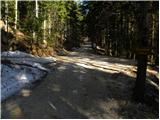 5
5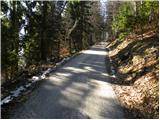 6
6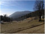 7
7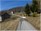 8
8 9
9 10
10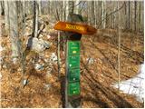 11
11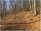 12
12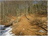 13
13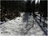 14
14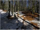 15
15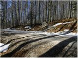 16
16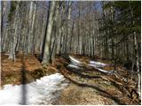 17
17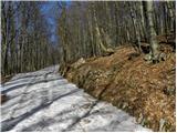 18
18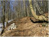 19
19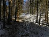 20
20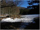 21
21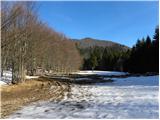 22
22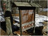 23
23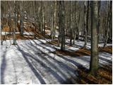 24
24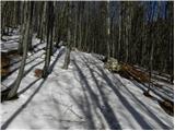 25
25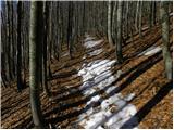 26
26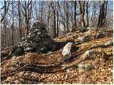 27
27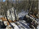 28
28 29
29 30
30 31
31 32
32 33
33 34
34 35
35 36
36 37
37 38
38 39
39 40
40 41
41 42
42 43
43 44
44 45
45 46
46 47
47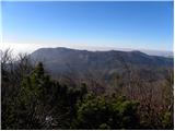 48
48 49
49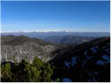 50
50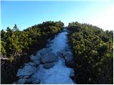 51
51 52
52
Discussion about the trip Koča Edmunda Čibeja v Tihi dolini - Mali Golak
|
| Gost22. 01. 2007 |
Good, super trip... Morning foggy, afternoon sunny. Only one problem arises... too loud pheasants
|
|
|
|
| d1licen24. 02. 2009 |
I was up there on carnival Sunday and had something to see. First up the steep path (crampons recommended). At the top, the reward - a view that stays in your memory and because of which you return to this place again. On the way back, a stop at the hut and joy again. At 10 a.m. they were already dancing merrily.
pictures are in the current conditions section.
|
|
|
|
| grahlck22. 03. 2009 |
I'm wondering how much snow is left on Golak?
|
|
|
|
| NEIC00823. 03. 2009 |
One of the most beautiful views from Slovenian hills. 
|
|
|
|
| ajax25. 03. 2009 |
This afternoon I was up there. Fresh from yesterday a couple of cm, under it solid ice. Snow over 1m. But it's really crusty, especially to the hut. Car gets easily to end of asphalt. At top no wind blowing, but light snow drifting. Regards
|
|
|
|
| NEIC00826. 03. 2009 |
Did you meet any little bear??
|
|
|
|
| predrag12. 04. 2009 |
Suitable hike to burn off ham and eggs for today.
|
|
|
|
| VKP23. 04. 2010 |
How is the snow on Golak currently?
Thanks and lp,
|
|
|
|
| robirobi25. 04. 2010 |
On Golak there's snow up to your ass. ha ha
|
|
|
|
| balirka26. 04. 2010 |
The time is greatly exaggerated, under normal conditions we need 45 minutes
|
|
|
|
| ziga.subic2. 10. 2010 |
Super short trip, but you can easily get lost if you're not careful.
|
|
|
|
| akbara3. 02. 2011 |
Maybe someone knows how much snow there is on the Golaks? Is anything trodden from the Predmeja direction? Thanks.
|
|
|
|
| anka 4. 02. 2011 |
Trodden, little snow, approx. 20 cm
|
|
|
|
| iztok21. 03. 2011 |
Yesterday a really nice and windy day on top with a wonderful view
|
|
|
|
| VanSims11. 04. 2011 |
On the summit really fantastic view of half of Slovenia, Karavanke, Kamnik Alps, Julian Alps like on the palm with prominent Triglav. Across the border view of Po Valley and Dolomites.
|
|
|
|
| IstrskiPlaninskiOdsek11. 04. 2011 |
Yesterday I was on Golak. Weather fantastic, warm, view wonderful. But the trail from Predmeja is quite poorly marked or the markers are poorly visible, sparse and/or faded, so I strayed off the path a few times. In winter in the snow it would probably be even harder to find the right trail.
|
|
|
|
| Kokta15. 01. 2012 |
I was at the top on Friday, 13.1.2011. I think there was no living soul up there that day . Fog from morning until 14h, then finally the sunshine started to show. The northern side opened up like on the palm of your hand. Really wonderful view, while the southern part remained in the fog. Well, regarding the markings I agree with Istrski...on some sections there are none or they are faded. Luckily the path is trodden in the snow, so I think it's easier to reach the top in winter than in summer, although I myself got off the path once . Here the PD could really fix things up a bit for those of us who are not from these parts. At the top there is a stamp in great condition and a logbook. Otherwise, I warmly recommend a visit.. Ahh... let me mention that I wanted to go to Iztokova koča as well. From the clearing where there is the sign "Naravni rezervat Golaki.." I went down the road a bit lower to the signpost where it barely read "Koča" and headed in that direction along the road. After about 20 min of walking, I gave up because I didn't spot any markings again or anything indicating that the hut is in that direction. The only thing I saw along the way was the inscription "Uscana skala". Well, probably need to try to reach the hut from some other side, although I have a feeling I was very close .
|
|
|
|
| gozdna meja29. 01. 2012 |
I was on Mali Golak for the first time last week (21.1.2012). Came from the Predmeja direction!
The path was slightly icy, but manageable... if I had crampons it would have been no problem at all... I'm totally thrilled with this cute summit amid the vast karst plains and mysteries of Trnovski gozd! The view on that clear day was dreamy
Highly recommended!!!
|
|
|
|
| Loni30. 01. 2012 |
Last winter they cut down quite a few trees, including some with markings, apparently no one has renewed them yet. The hut keeper also had a couple of remarks about it.
|
|
|
|
| NEIC00813. 03. 2012 |
Does anyone know what the snow conditions are like up there now? Any snow??
Thanks
|
|
|
|
| MrvdMr-8215. 03. 2012 |
Snow only towards the top, road drivable without problems, recommend crampons because the path is quite trampled..
best regards, good luck
|
|
|
|
| Janiel7412. 05. 2012 |
Yesterday quickly after work for another unconquered peak. Sun partially hidden behind clouds. At the summit completely alone for more than half an hour. Didn't meet anyone on the way Views nice. You can really see all around.
|
|
|
|
| soraya31. 10. 2012 |
On Monday we went to Golak in snowy and slightly windy conditions. Nice experience if you're well dressed and equipped, snow from 20 cm onwards, somewhere we waded knee-deep. White snowy blanket, blue sky and sun. Wow, something nice!
|
|
|
|
| uhan126. 12. 2012 |
Hello!
What are the snow conditions like on Golaki and Čavn?
Thanks and best regards
|
|
|
|
| dejboz27. 12. 2012 |
I was on Čavn on Sunday and there is plenty of snow, it starts right below the hut.
|
|
|
|
| zabava16. 03. 2015 |
At the end of the month I plan a hike to Golak. Given that down south with us in the forest there is still about half a meter of snow at 700m a.s.l., I assume there is even more at 1400 m. Is that correct?
|
|
|
|
| Fulcrum18. 03. 2015 |
Correct. Verified last Saturday (14.3.). The path described above (from the sports park directly to the top) is trodden and passable without crampons. Safe steps.
|
|
|
|
| Janezs20. 04. 2015 |
Yesterday Romana and I walked this path, at picture no. 23 we went right on an unmarked path. Higher up some obstacles from ice. We reached the saddle between Mali and Srednji Golak, on the SPP path that comes from Planina. From there along the marked path to the top of Mali Golak, we descended towards Iztokova koča. There are still some "patches" of old snow (new one, as quickly as it came, it will disappear too) Lp.
|
|
|
|
| zabava29. 04. 2015 |
Due to snow we only went to Golak on Saturday. I've been to Golak a second time already but always looking for the starting point. Where is this Strgarija pass and where is Iztokova koča. No signposts anywhere, so figure it out and search, good thing I start hikes early in the morning, otherwise there would be panic. Just forest, forest paths with ramps, no signposts anywhere. Of course we found it anyway but there was a lot of uncertainty, not a very pleasant trip.
|
|
|
|
| ajax29. 04. 2015 |
all paths are super marked, good thing you didn't end up in the little false one
|
|
|
|
| zabava30. 04. 2015 |
we also made it to the little false one 
|
|
|
|
| ajax30. 04. 2015 |
hehe
|
|
|
|
| darinka427. 02. 2017 |
This Golak is nice. Yesterday I went more blindly. There was quite some snow. I didn't know the path. But there was a track made from the parking lot at Predmeja. I couldn't miss it. But I didn't go to the hut, because I'd have to go back to the top. I walked in snow for two hours to the top, as it says.
|
|
|
|
| mukica28. 02. 2017 |
Darinka doesn't need to go back to the top, just follow the track to the hut and continue to the starting point to Predmeja, nice circular tour. We go every year on the traditional hike to the snowy Golak, it was last Sunday, so I assume that's why there's such a nice track.
|
|
|
|
| darinka428. 02. 2017 |
Yes, but it was my first time up there in snow and alone on top of that. I didn't want to risk too much. But the track was made, although it snowed again after. Last year I went without snow on the other side past the hut to the top. Ski tracks were visible. Someone skied down.
|
|
|
|
| piotr1. 03. 2017 |
Nothing about bears.
|
|
|
|
| piotr5. 03. 2017 |
Humorist.
|
|
|
|
| viharnik5. 03. 2017 |
Turbo, just so they don't end up on the culling list
|
|
|
|
| mirank19. 01. 2019 |
The road to Lokve is plowed, new dry snow up there (summit) about 50 cm. Last night by (almost) full moon and with little wind truly fairy-tale like. At 22h quite a few visitors so crowded in the hut.
|
|
|
|
| mornar22. 04. 2021 15:31:19 |
Please provide information about the path. Is there still any snow on the path? Regards.
|
|
|
|
| Eva198810. 05. 2021 10:00:58 |
A little below the summit there's still some snow, but you can easily get over that snow... hardly worth mentioning Walked 8.5.2021
|
|
|
|
| mirank28. 12. 2022 20:10:00 |
the entire section of the path between sl 14 and 23 has been turned into an ugly muddy forest path that has completely overrun the pl path
|
|
|
|
| darinka45. 07. 2023 18:21:53 |
Today we walked this path with the dog. Nothing special. Followable. It took us an hour and a half. Probably because we turned onto the upper steep path, which is shorter.
|
|
|
|
| darinka422. 12. 2024 21:04:50 |
Golak was nice today. Although in grayness and wind. Some of us gathered. The four of us went from Tihe doline a bit after ten. Track is made. Didn't need crampons. Snow was soft. On descent it started snowing. In the valley raining.
|
|
|
To post a comment you must log in:
If you do not yet have a username, you must first
register.