Koča na Klopnem vrhu - Rogla
Starting point: Koča na Klopnem vrhu (1260 m)
| Latitude/Longitude: | 46,50180°N 15,39910°E |
| |
Walking time: 2 h 45 min
Difficulty: easy marked way
Elevation gain: 257 m
Elevation difference along the route: 430 m
Map: Pohorje 1:50.000
Recommended equipment (summer):
Recommended equipment (winter): crampons
Views: 1.110
 | 1 person like this post |
Access to starting point:
A) First, we drive to Dravograd, then continue driving towards Maribor. Soon after the settlement Ožbalt, we leave the main road and continue driving right over the bridge across the Drava River towards the settlement Lovrenc na Pohorju. On the other side of the river, the road starts to ascend slightly and soon brings us to the next junction, where we continue left towards the village Činžat (right Lovrenc na Pohorju). In Činžat, where the road from Ruše also joins, we continue right towards the mountain hut Koča na Klopnem vrhu. Above the village, the road becomes macadam, which first ascends along Lamprehtov potok. Higher up, the road leads past the Lampreht farm, and we follow it at the junctions towards the mountain hut Koča na Klopnem vrhu. When we arrive at the mentioned hut, we park in a suitable place nearby.
B) We drive to Ruše (from Maribor or Selnica ob Dravi to here), then continue driving towards Lovrenc na Pohorju. When we arrive at the village Činžat, we leave the road leading towards Lovrenc na Pohorju and continue left along the initially still asphalt road towards the mountain hut Koča na Klopnem vrhu. Above the village, the road becomes macadam, which first ascends along Lamprehtov potok. Higher up, the road leads past the Lampreht farm, and we follow it at the junctions towards the mountain hut Koča na Klopnem vrhu. When we arrive at the mentioned hut, we park in a suitable place nearby.
C) From the Ljubljana - Maribor motorway, we take the Slovenske Konjice exit and continue driving towards the mentioned place. From Slovenske Konjice, we continue towards Zreče, and further we follow the road towards Rogla. When we arrive at Rogla, we continue along the main road, descending along it to the mountain hut Koča na Pesku. At the mentioned hut, we continue right towards Osankarica and the mountain hut Koča na Klopnem vrhu. Further along the macadam road, then at all subsequent junctions we follow towards the mountain hut Koča na Klopnem vrhu. We park in a suitable place near the mentioned hut.
Route description:
On the south side of the hut, we notice signs for Klopni vrh and Pesek, which direct us to the path that ascends transversely through the forest. The cart track along which we walk brings us in a few minutes to a macadam road, along which we continue the ascent. From the road, the first path to Klopni vrh soon branches off to the right, unmarked, and a few minutes further the second one, which is marked with direction signs.
We continue towards Pesek and continue walking along the road, which gradually starts to descend; after a short descent, when we reach the swampy area called Skrbinsko borovje, we leave the road to the left onto a marked path, which further on is quite wet due to the swamp. The path mostly continues alongside the cart track, and on less muddy sections also along the cart track. There follow some short ascents and descents, then we reach a marked junction where a marked path from Osankarica joins from the left; a little further, we reach a macadam road, which we follow to the right to the left bend, where the markings for Rogla direct us straight onto a cart track that ascends more steeply for a while. There follow some junctions where we follow the markings; the path continues on and alongside the cart track, from which a nice view towards Rogla and its lookout tower opens up for a while. There follows a somewhat longer descent, and at Zgornja brv we reach a road junction and marked junction.
We continue straight along the road leading towards Koča na Pesku and Rogla (right downhill along the marked path to Lovrenc na Pohorju); when the road bends slightly to the left, we leave it and at the poorly marked junction continue straight onto the cart track. Along the cart track, we ascend more steeply, carefully following the markings at numerous junctions. Higher up, the path levels out; in the area called Kocafurova koča, it turns left, continuing for a few minutes with some short ascents and descents. Later there follows some moderate descent, and when we leave the forest, we arrive at Koča na Pesku.
From Koča na Pesku, some 10 meters further along the asphalt road towards Rogla, then we continue right onto the cart track towards Rogla. We continue for some time along a gentle cart track, then immediately after crossing a small stream, left onto a somewhat steeper footpath, which further ascends through the forest. Higher up, the trail gradually levels out and leads us into a gradually sparser forest. From the point where the forest thins out, only a short walk separates us from the lookout tower on Rogla.
If there is no danger of thunderstorms, we can climb to the mentioned tower at our own risk, from which a nice view opens up over a large part of Pohorje, and with good visibility also towards the Karawanks, Kamnik-Savinja Alps and Triglav.
Koča na Klopnem vrhu - Zgornja brv 1:15, Zgornja brv - Koča na Pesku 1:00, Koča na Pesku - Rogla 0:30.

Photos:
 1
1 2
2 3
3 4
4 5
5 6
6 7
7 8
8 9
9 10
10 11
11 12
12 13
13 14
14 15
15 16
16 17
17 18
18 19
19 20
20 21
21 22
22 23
23 24
24 25
25 26
26 27
27 28
28 29
29 30
30 31
31 32
32 33
33 34
34 35
35 36
36 37
37 38
38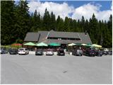 39
39 40
40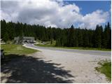 41
41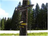 42
42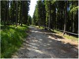 43
43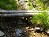 44
44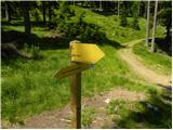 45
45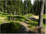 46
46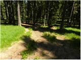 47
47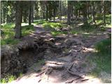 48
48 49
49 50
50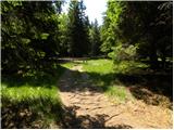 51
51 52
52 53
53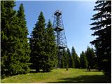 54
54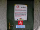 55
55 56
56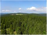 57
57 58
58
Discussion about the trip Koča na Klopnem vrhu - Rogla
To post a comment you must log in:
If you do not yet have a username, you must first
register.