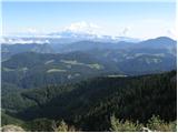
 | Sviščaki - Veliki Snežnik (variant through forest)
Veliki Snežnik, at 1796 meters, is the highest peak in the nearby and distant surroundings, offering beautiful views over much of Slovenia and ne...
2 h |
 | Korensko sedlo - Ofen/Peč
Peč (also known as Tromeja; in Italian Monte Forno, in German Dreiländereck or Ofen) is a 1508 m high peak located at the tripoint between Sloven...
2 h |
 | Korensko sedlo - Ofen/Peč (on marked path)
Peč (also known as Tromeja; in Italian Monte Forno, in German Dreiländereck or Ofen) is a 1508 m high peak located at the tripoint between Sloven...
2 h |
 | Dom pod Storžičem - Bela peč
The mountain, known mainly among climbers, is located north of Storžič on the slopes of Konjščica. From the summit there is a beautiful view of t...
2 h |
 | Bohinjsko sedlo - Kobla
The summit is located in the Lower Bohinj Mountains between Črna prst and Soriška planina. Directly below it is a railway tunnel connecting Bohin...
2 h 35 min |
 | Bohinjsko sedlo - Šavnik (by Lajnar)
Šavnik is a grassy peak situated between the ski resorts of Soriška Planina and Kobla. From the summit, which has a registration box with a stamp...
2 h |
 | Furlanovo zavetišče pri Abramu - Vojkova koča na Nanosu
Vojkova koča is located on the southern edge of the high karst Nanos plateau, near Pleša. This is the prominent peak with television transmitters...
2 h |
 | Golte (Alpine garden) - Smrekovec
Smrekovec is a mountain of volcanic origin on the eastern edge of the Smrekovec mountain range. The wide grassy summit features a pyramid with a ...
2 h 30 min |
 | Dom na Smrekovcu - Komen (Direct way)
At 1684 meters, Komen is the highest peak in the Smrekovec mountain range, which borders between Styria and Carinthia. In good weather, the summi...
2 h |
 | Planina Vodol - Komen
At 1684 meters, Komen is the highest peak in the Smrekovec mountain range, which borders between Styria and Carinthia. In good weather, the summi...
3 h 15 min |
 | Planina Vodol - Veliki Travnik (Turnovka)
Veliki Travnik, also known as Turnovka by the locals, is located on the western edge of the Smrekovec mountain range. From the summit, which has ...
2 h |
 | Škrbina - Mali Golak
Mali Golak is the highest peak in the Golaki group at 1495 meters above sea level and at the same time the highest point of the entire Trnovski g...
2 h |
 | Koča na Pesku - Jezerski vrh (via Lovrenška jezera)
Jezerski vrh is located on Ribniško Pohorje near the Ribniška koča mountain hut. Due to the unvegetated peak, there is a nice view of Pohorje and...
3 h 20 min |
| Rogla (Hotel Planja) - Jezerski vrh (via Lovrenška jezera)
Jezerski vrh is located on Ribniško Pohorje near the Ribniška koča mountain hut. Due to the unvegetated peak, there is a nice view of Pohorje and...
3 h 15 min |
| Rogla (Hotel Planja) - Jezerski vrh
Jezerski vrh is located on Ribniško Pohorje near the Ribniška koča mountain hut. Due to the unvegetated peak, there is a nice view of Pohorje and...
3 h 5 min |
 | Dom na Paškem Kozjaku - Basališče (Paški Kozjak)
Basališče is the highest peak of Paški Kozjak. A bench and a summit register have been placed on the summit. However, due to the forest, there is...
2 h |
 | Usek - Huhnerkogel/Košenjak (mimo sv. Urbana)
Košenjak is located north of Dravograd and the Drava River on the border with neighbouring Austria. Access to Košenjak is possible on foot or by ...
2 h |
 | St. John the Baptist on Ojstrica - Huhnerkogel/Košenjak (via Bivak Piramida)
Košenjak is located north of Dravograd and the Drava River on the border with neighbouring Austria. Access to Košenjak is possible on foot or by ...
2 h |
 | Jezero Sobote / Stausee Soboth - Huhnerkogel/Košenjak (on marked path)
Košenjak is located north of Dravograd and the Drava River on the border with neighbouring Austria. Access to Košenjak is possible on foot or by ...
2 h |
 | Rifugio Pelizzo - Monte Mataiur/Matajur (via Ledina)
Matajur is a panoramic mountain located on the border between Slovenia and Italy. From the summit there is a beautiful view of Kobariški or Bregi...
2 h |
 | Sveti Trije kralji - Žigartov vrh
Žigartov vrh, at 1,346 meters, is the highest peak in the eastern part of Pohorje. An "observation" tower once stood on the summit, erected solel...
2 h 45 min |
| Koča na Šumiku - Žigartov vrh
Žigartov vrh, at 1,346 meters, is the highest peak in the eastern part of Pohorje. An "observation" tower once stood on the summit, erected solel...
1 h 55 min |
 | Pohorje cable car - Žigartov vrh (via Razglednik)
Žigartov vrh, at 1,346 meters, is the highest peak in the eastern part of Pohorje. An "observation" tower once stood on the summit, erected solel...
2 h 15 min |
| Pohorje cable car - Žigartov vrh (via Mariborska koča)
Žigartov vrh, at 1,346 meters, is the highest peak in the eastern part of Pohorje. An "observation" tower once stood on the summit, erected solel...
2 h 20 min |
 | Platak - Vidikovac
Vidikovac is a 1,408-meter-high peak in Gorski Kotar. From its partly unforested summit, there is a very beautiful view of the nearby Veliki Risn...
2 h 45 min |
 | Dom na Osankarici - Klopni vrh (eastern path)
From the northwest, Klopni vrh closes off the lower-lying extensive plateau on eastern Pohorje. The horizontal cross-sectional area at 1300 m is ...
2 h 45 min |
| Koča na Šumiku - Klopni vrh (eastern path)
From the northwest, Klopni vrh closes off the lower-lying extensive plateau on eastern Pohorje. The horizontal cross-sectional area at 1300 m is ...
2 h |
 | Koča na Šumiku - Klopni vrh (northern path)
From the northwest, Klopni vrh closes off the lower-lying extensive plateau on eastern Pohorje. The horizontal cross-sectional area at 1300 m is ...
2 h |
 | Črni Kal - Mladi vrh (via Koprivnik)
Mladi vrh is the higher neighbor of the better-known Stari vrh, separated from it by a saddle. Covered in sparse beech forest, the summit offers ...
2 h 15 min |
| Preval - Mladi vrh
Mladi vrh is the higher neighbor of the better-known Stari vrh, separated from it by a saddle. Covered in sparse beech forest, the summit offers ...
2 h |
 | Polomova rajda - Veliki Rob (via Kucelj)
Veliki Rob is a panoramic peak situated between Kuclj (1237 m) and Čaven (1185 m). From the summit, where there is a cross, there is a nice view ...
2 h 45 min |
 | Ledine - Gladki vrh (Ratitovec) (via planina Klom)
Gladki vrh (Ratitovec), at 1,667 meters, is the most visited peak in the Ratitovec range. From its bare summit, which features a panorama board, ...
1 h 55 min |
 | Koprivna (Kumer) - Topitza
Topica, or Topitza in German, is a 1649-meter-high peak situated northeast of Železna Kapla. From the summit, where a cross stands, a nice view o...
2 h 10 min |
 | Soriška peč - Kremant (Ratitovec)
Kremant is a 1,654 m high peak located on the western part of Ratitovec. From the summit, where a stamp is attached to a metal pole, a nice view ...
2 h 30 min |
 | Bohinjsko sedlo - Kremant (Ratitovec)
Kremant is a 1,654 m high peak located on the western part of Ratitovec. From the summit, where a stamp is attached to a metal pole, a nice view ...
2 h 45 min |
 | Bohinjsko sedlo - Kačji rob (Ovharn)
Kačji rob (Ovharn) is a 1,552 m high peak situated between the Zgornji Jirn mountain pasture and the lesser-known Žbanjek peak. From the summit, ...
2 h |
| Soriška peč - Kačji rob (Ovharn)
Kačji rob (Ovharn) is a 1,552 m high peak situated between the Zgornji Jirn mountain pasture and the lesser-known Žbanjek peak. From the summit, ...
2 h 30 min |
 | Tuškov Grič - Medrce (by road)
Medrce is a 1,410-meter-high peak located between Porezen and Hum. From the summit, which features an old bunker, there are nice views of Kojca, ...
2 h 20 min |
 | Hebalm (Gasthaus Zur Rehbockhütte) - Weberkogel
Weberkogel is a less prominent peak located north to northwest of the alpine pass Weinebene. On the 1805-meter-high summit stands a medium-sized ...
2 h 35 min |
 | Ribniška koča - Ostruščica (via Lovrenška jezera)
Ostruščica is a 1,498-meter-high peak located west of the ski slopes on Rogla....
3 h 15 min |
| Ribniška koča - Ostruščica
Ostruščica is a 1,498-meter-high peak located west of the ski slopes on Rogla....
3 h 5 min |
 | Koča na Šumiku - Veliki vrh (on Pohorje)
Veliki vrh is a 1344-meter-high peak located above the RTC Jakec - Trije kralji ski slope. The highest point of the peak is in the forest, but ju...
2 h |
 | Teichalm (Teichalmsee) - Rote Wand (lower path)
Rote Wand is a 1,505-meter-high mountain in the Graz Mountains in Styria, Austria. The name "Rote Wand" (red wall) comes from its southeast-facin...
2 h 15 min |
| Teichalm (Teichalmsee) - Rote Wand (upper path)
Rote Wand is a 1,505-meter-high mountain in the Graz Mountains in Styria, Austria. The name "Rote Wand" (red wall) comes from its southeast-facin...
2 h 15 min |
 | Stoakoglhütte - Heulantsch
Heulantsch is a 1,473 m high grassy hill above Teichalm, which together with "Sommeralm" forms the largest area of mountain meadows in the Alps.F...
3 h |
 | Pfaffensattel - Grazer Stuhleck
Grazer Stuhleck is a 1,635-meter-high peak located southwest of Stuhleck, the highest summit of the Fischbacher Alpen mountain group. Numerous wi...
2 h 15 min |
 | Pfaffensattel - Geiereck
Geiereck is a panoramic peak located northeast of the Roseggerhaus hut and southeast of the Geiereckalm alpine pasture....
2 h 30 min |
 | Pfaffensattel - Peter-Bergner-Warte (Pretul)
The Peter-Bergner-Warte viewpoint is located on the 1,656-meter-high Pretul summit above the settlement of Rettenegg....
2 h 40 min |
 | Pfaffensattel - Amundsenhöhe
Amundsenhöhe is a 1,666-meter-high panoramic peak in the Fischbacher Alpen mountain group. From the summit there is a nice view of the hill count...
2 h 55 min |
 | Knödelhütte - Seinerkreuz
Seinerkreuz is a panoramic peak located above the Saureishütte hut and the settlement of Hirschegg. From the summit, a beautiful view opens up of...
2 h 40 min |
 | Planinski dom Orlove stine - Svilaja (past Umac)
Svilaja is a 1509-meter grassy peak above Peručko Lake, north of the town of Sinj. The summit features a cross and a concrete pillar. From the to...
2 h |
 | Alpl (Zisleranger Weg) - Teufelstein
Teufelstein is a 1,498-meter-high mountain in the Fischbacher Alpen group. At the summit there is a cross with a summit logbook, and slightly bel...
2 h 20 min |
| Alpl (Zisleranger Weg) - Teufelstein (past Edelweißhütte)
Teufelstein is a 1,498-meter-high mountain in the Fischbacher Alpen group. At the summit there is a cross with a summit logbook, and slightly bel...
2 h 40 min |
 | Nechnitz - Gerlerkogel (via Gschaidberg)
Gerlerkogel is a 1324-meter-high peak situated in the Almenland nature park. From the grassy peak, a beautiful view opens up of the surrounding m...
2 h 15 min |
 | Brandlucken - Plankogel
Plankogel is a 1531-meter-high mountain situated in the Almenland nature park. From the panoramic summit, where a cross stands, a beautiful view ...
2 h |
 | Sommeralm - Osser
Osser is a 1548-meter-high peak situated above the Teichalm plateau. From the summit, where a cross stands, a beautiful view opens up over the su...
2 h |
 | Hebalm (Gasthaus Zur Rehbockhütte) - Barofen
Barofen is a panoramic peak between the Weinebene Pass and the mountain road to Hebalm. On its 1,720 m high summit stands a cross with a summit r...
2 h |
 | Gasthof Pfeifferstocker - Barofen
Barofen is a panoramic peak between the Weinebene Pass and the mountain road to Hebalm. On its 1,720 m high summit stands a cross with a summit r...
2 h |
 | Zeller Kreuz - Stanglalpe
Stanglalpe is a peak in the Fischabacher Alpen mountain group, which lies in the hills east of the Mur. The peak itself is situated beside a road...
2 h 50 min |
| Schanzsattel - Stanglalpe
Stanglalpe is a peak in the Fischabacher Alpen mountain group, which lies in the hills east of the Mur. The peak itself is situated beside a road...
2 h 20 min |
 | Kugina kuća - Šatorina
Šatorina is the highest peak in Central Velebit. A geodetic point is on the summit. The peak is a checkpoint for HPO and the Velebit Mountain Tra...
2 h 30 min |
 | Schwarzkogelhütte - Angerlkogel
Angerlkogel is a 1,774-meter-high peak located along the marked trail from Klippitztörl to Zirbitzkogel....
2 h 45 min |