Koča pod slapom Rinka - Ledinski vrh
Starting point: Koča pod slapom Rinka (1024 m)
| Latitude/Longitude: | 46,36960°N 14,59860°E |
| |
Walking time: 3 h 30 min
Difficulty: partly demanding marked way
Elevation gain: 1084 m
Elevation difference along the route: 1082 m
Map: Kamniške in Savinjske Alpe 1:50.000
Recommended equipment (summer): helmet
Recommended equipment (winter): helmet, ice axe, crampons
Views: 82.536
 | 5 people like this post |
Access to starting point:
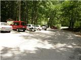
We drive to Luče (to here from Mozirje or over Kranjski rak) and onwards towards Logarska dolina. Soon after the village Solčava we come to the junction, where the road to Logarska dolina branches off to the left. We turn left towards Logarska dolina (toll payment) and drive along the road to the parking lot at the hut Koča pod slapom Rinka, where we park.
Route description:
From the parking lot, we head onto a wide tourist path that starts gently ascending. After a good ten minutes of walking, we come out of the forest and reach a junction. We go left (right Orlovo gnezdo 3 minutes) in the direction of Dom na Okrešlju. The path ahead crosses a small bridge and on the other side starts ascending more steeply. After a short ascent, the path brings us below the walls, from where a crossing to the top of the waterfall follows. This part is exposed to falling rocks. The path then crosses Savinja again and ascends further along the river with the help of steps. Next, we ascend on the right side (left bank) of Savinja. Soon we come to the source of Savinja, where we cross the water again. On the other side, the path enters dense forest and after a short ascent brings us to the winter shelter on Okrešlju. We continue left and in a few steps come to Dom na Okrešlju.
At the hut, we head onto the path in the direction of Kamniško sedlo and Savinjsko sedlo. Soon we come to the edge of a panoramic meadow, where there is a junction. We continue straight across the meadow in the direction of Češka koča and Kranjska koča (left Kamniško sedlo). The path ahead crosses a torrent and then ascends beside scree slightly upwards. Soon we come to the next junction, where to the left branches the path to Turški žleb and to the memorial plaque, which is just a few dozen steps away. We continue straight through the ever-narrower valley. The path starts ascending more steeply and brings us below the walls of Mrzla gora. The path ahead continues on the left side of the torrent, on a moderately steep grassy slope partly overgrown with dwarf pines. The path ahead passes to the left side below the scree of Štajerska Rinka. In a diagonal ascent, the path brings us below the walls, where there is danger of falling rocks. A short steep section follows, then the path heads slightly right onto grassy slopes, where we reach a junction. We continue straight, to the right branches the path to Mrzla gora. Soon we come again to a junction, where to the left upwards branches the climbing path to Rinke, while we continue straight on the path that soon turns right into steep slopes. Here the path ascends steeply and brings us in a few minutes to the bivouac pod Mrzlim vrhom. At the bivouac the path turns right and ascends steeply for a few more steps, then the steepness eases. A few steps of walking follow to Savinjsko sedlo, where there is the state border. Further, we continue on the Austrian side towards Kranjska koča. After a short ascent, the path descends a few meters, then in a gentle diagonal ascent over scree climbs to Jezersko sedlo. We continue right along the ridge and the path soon brings us to a junction, where to the right branches the path to Babe. We continue straight on the ridge path, which in a few-minute ascent brings us to the panoramic and crumbly summit.
Koča pod slapom Rinka - Okrešelj 1:15, Okrešelj - Ledinski vrh 2:15.

Photos:
 1
1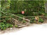 2
2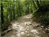 3
3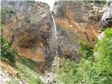 4
4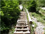 5
5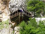 6
6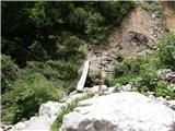 7
7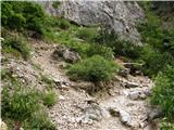 8
8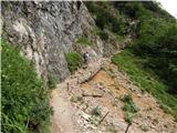 9
9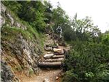 10
10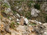 11
11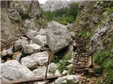 12
12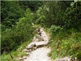 13
13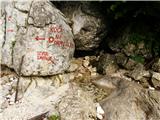 14
14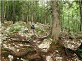 15
15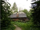 16
16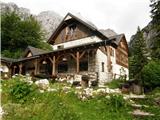 17
17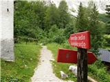 18
18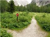 19
19 20
20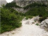 21
21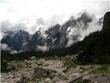 22
22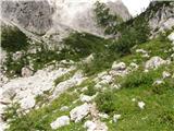 23
23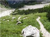 24
24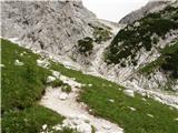 25
25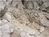 26
26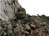 27
27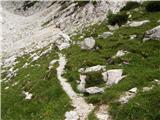 28
28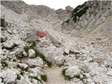 29
29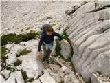 30
30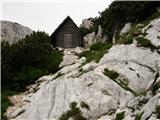 31
31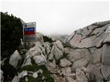 32
32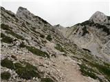 33
33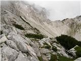 34
34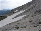 35
35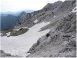 36
36 37
37 38
38 39
39 40
40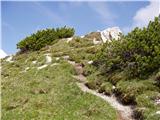 41
41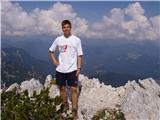 42
42 43
43
Discussion about the trip Koča pod slapom Rinka - Ledinski vrh
Show older messages
|
| Gost3. 08. 2007 |
2. 7. 2007
The weather was wonderful, almost too hot for this altitude, but still better than windy. On the path my husband and I met lots of interesting hikers heading to Okrešelj in espadrilles and flip-flops. Lubi ... they'd say. And one more thing, where are those real pet lovers dragging their dog into the mountains, even higher than Okrešelj at high temperatures like today. Don't they feel sorry for the animals at all?! One is simply horrified. And where is the Society against animal cruelty here? Good luck!
|
|
|
|
| klukc291. 07. 2008 |
is there still any snow on this mountain, I'm really curious
|
|
|
|
| Bali1. 07. 2008 |
There is no snow on Ledinski vrh.
You only find it in the hollows below.
|
|
|
|
| peterhaf26. 01. 2009 |
I'm interested if the path is suitable for a dog in summer. It has already been to Stožič.
|
|
|
|
| lepenatka26. 01. 2009 |
The path is not demanding, so the dog won't have problems, especially if it's used to walking in the hills.
Enjoy!
|
|
|
|
| peterhaf27. 01. 2009 |
Thanks for the prompt reply. The dog is used to hills and mountains, so when the snow melts we'll go. 
|
|
|
|
| lepenatka28. 01. 2009 |
You can also go with the dog from Jezersko from the cable car station along the hunting path to Ledine(Vodine) and then to Ledinski vrh...
But it's definitely nicer from Logarska...
|
|
|
|
| peterhaf28. 07. 2009 |
Can you already get up there or is there still too much snow?
|
|
|
|
| geppo28. 07. 2009 |
I was on the path from Okrešelj and then at Mrzlem dolu turned to Križ. On this path two snowfields, which don't pose problems on the path.
LP
|
|
|
|
| peterhaf28. 07. 2009 |
Thanks. But me and my girl would take the dog up. Will it be okay?
|
|
|
|
| geppo28. 07. 2009 |
To the bivouac at S. sedlo there won't be a problem - I checked that. Further on probably not either, since this path is not demanding!
Best regards and nice day in the mountains
|
|
|
|
| lazicku11. 08. 2009 |
We were up there on Sunday and I really warmly recommend visiting Ledinski vrh. Nice path, wonderful surroundings, snow,... Lots of people to the hut at Okrešelj, then the number drops drastically (thank God).
|
|
|
|
| velikanka21. 08. 2009 |
Experienced hikers, do you think it's wise to go to Ledinski vrh tomorrow given the not-so-great weather forecast?
|
|
|
|
| jersy21. 08. 2009 |
Life is one, why expose yourself? Lp
|
|
|
|
| kislimesec2. 01. 2010 |
On Sunday we plan to go to Ledinski vrh, what are the conditions like?
|
|
|
|
| Stingray13. 09. 2010 |
Yesterday I climbed to Ledinski vrh. I'm attaching a GPS export image of the above-described path in Google Earth for a better idea (maybe useful for someone):
IMAGE1
or the marked path on the hiking map:
IMAGE2
Some additional photos from the path are available HERE
|
|
|
|
| primoz9328. 09. 2011 |
I have one question, namely can you also ride down from Ledinski vrh on a board in winter?
thanks for answers
Best regards
|
|
|
|
| ljubitelj gora15. 02. 2012 |
Does anyone have information about this path, conditions, snow avalanche danger, currently level 2.
|
|
|
|
| socialac16. 02. 2012 |
I'm also curious about what the path is like and the dangers lurking now ? Thanks and best regards ? Thanks and best regards
|
|
|
|
| redbull16. 02. 2012 |
I'm wondering if it's possible to reach Savinjsko sedlo from Okrešelj, if it's trodden at all, or if you sink a meter deep, like I did in January. Let someone report best regards
dejan
|
|
|
|
| primoz9327. 04. 2012 |
Hi!
I'm wondering what the conditions are like these days on Ledinski vrh?
|
|
|
|
| mic29. 09. 2012 |
I'm interested if the trail to Ledinski vrh starting from Koča pod slapom Rinka is exposed anywhere? I get dizzy. I've been to Okrešlj several times. The trail further to Kamniško sedlo is not for me. LP
|
|
|
|
| PV30. 09. 2012 |
mic
This trail is nowhere exposed. Just trail under your feet
|
|
|
|
| mic1. 10. 2012 |
PV
Many thanks for the reply. I'll probably go on Wednesday. (nice weather)Best regards
|
|
|
|
| mic5. 10. 2012 |
On Thursday I was at Ledinski vrh. The starting point was the hut below Rinka waterfall.
Since I avoid exposed paths, this one was right for me. Really nice path. Wonderful weather, nice view, nature already in autumn colors.
Thanks again PV for the reply.
|
|
|
|
| pjoter2. 08. 2013 |
I'm interested if there's a summit book at the top and if the path is well marked
|
|
|
|
| pohodnik382. 08. 2013 |
The trail is well marked and if you follow the above description you'll reach the summit. There is a logbook and stamp and it's very nice.
PICTURE
|
|
|
|
| pjoter2. 08. 2013 |
Thanks, tomorrow heading to the summit
|
|
|
|
| pjoter20. 12. 2013 |
Did anyone happen to go up there these days? I'd repeat ascent but conditions interest me
thanks
|
|
|
|
| punči21. 12. 2013 |
pjoter did you maybe get some info on conditions? Me too I'd go tomorrow first time. Can you tell if path well marked so I don't stray?
|
|
|
|
| LidijaJesih21. 12. 2013 |
The last post under conditions is 15.12. Since then, the snow hasn't melted, markers don't help much because of the snow. Footprints help more. In fog, not even that Go for the first time when it's snow-free.
|
|
|
|
| punči21. 12. 2013 |
Lidija, thanks Tomorrow it looks like nice weather in KSA and I'd like to go somewhere I haven't been yet.
|
|
|
|
| pjoter23. 12. 2013 |
I haven't got info from punči yet but it's true that if there's snow it's better to postpone the hike to summer time I'll try anyway you can always turn back
|
|
|
|
| valerija11216. 09. 2014 |
Hello, can someone tell me if the hut at Okrešelj is still open and if the path over Jezersko and Savinsko sedlo is snowy, thanks,
|
|
|
|
| garmont16. 09. 2014 |
The hut is open. There is no new snow on the path, but there is still old snow under Prag; however, it does not pose problems.
|
|
|
|
| franjo663. 06. 2016 |
Has anyone been up there recently? I'd like to repeat the ascent and I'm interested in the conditions.
Thanks
|
|
|
|
| slainter7. 06. 2016 |
On 7.6. I was at Savinjsko sedlo. Snow starts above the memorial plaque and goes to the entrance of the last part under the saddle. The snow is soft and walks well without crampons. Just go on the trail and enjoy.
|
|
|
|
| Pujsapepa2. 08. 2016 |
On Saturday we were at Ledinski vrh with our dog.. I'd like to warn that the path is not the most suitable for dogs, especially in summer when the rocks are sharp and they can injure their paw pads, just like ours did (and she's been through quite a few hills), that scree drags on endlessly.. Otherwise really excellent views and a bit too many tourists wearing sneakers up to Okrešelj 
|
|
|
|
| redbull3. 08. 2016 |
it depends on what kind of sneakers; otherwise you can show how well you can move in them.
|
|
|
|
| planika7716. 12. 2016 |
Has anyone been to Ledinski vrh recently via this path (i.e. from the Koča pod slapom Rinka hut)? I'm interested in the current conditions and if there's any snow yet, is it icy anywhere? Thanks in advance for answers!
|
|
|
|
| redbull16. 12. 2016 |
small crampons on the north side before Jezersko sedlo will be enough.
good luck
|
|
|
|
| seinfeld19. 10. 2017 |
Did this easy route yesterday, great day, only on the saddle it was quite windy, few hikers. Up and down is 10km, with breaks 5 hours.
|
|
|
|
| jvali3. 07. 2018 |
Sunday (1st July holiday) developed into a wonderful day, perfect for visiting the mountains, although morning mists still hid the peaks. Later they were just for decoration. The walk to Ledinski vrh (Okrešelj, Savinjsko sedlo) was botanically colored. Snow remnants shortened the descent to the valley. Quite a few visitors at the summit, but enough space for everyone.
|
|
|
|
| golica1. 08. 2018 |
The trail is marked as partially difficult, which part of the trail does this refer to, towards Okrešelj or later where? thanks for info
|
|
|
|
| garmont1. 08. 2018 |
The trail from the waterfall to the source of Savinja is partially difficult.
Higher up, the passage over Prag is marked as difficult on the hiking map, but it is indeed very short.
|
|
|
|
| Barentoter2. 08. 2018 |
To Okrešelj must be an extremely easy trail, I've already met ladies in high heels. 
|
|
|
|
| potpodnoge2. 08. 2018 |
Good that they are not yet walking to Okrešelj barefoot and in swimsuits. There is enough heat.
|
|
|
|
| golica3. 08. 2018 |
Garmont, many thanks for the info. I don't know who hikes there in heels 
regards
|
|
|
|
| zokipoki4. 08. 2018 |
The path to Okrešelj can also be very dangerous. It depends on the hiker. Serious injuries happen even on flat terrain, unfortunately that's how it is. No path should be underestimated. Garmont's info is correct.
|
|
|
|
| nommi22. 07. 2019 |
Does anyone know if there's still any snow in Mrzli dol under Savinjsko sedlo?
Regards
|
|
|
|
| jax22. 07. 2019 |
Quite possible. But the terrain there is flat anyway so no special problems...
|
|
|
|
| panoramik22. 07. 2019 |
No more snow on the path to Savinjsko sedlo.
|
|
|
|
| edelweiss9614. 10. 2019 |
Yesterday on this beautiful path. The basic plan was only to Savinjsko sedlo, but the day was so warm and nice that we extended to Ledinski vrh. The path is beautiful, views excellent.
|
|
|
|
| Planinecizgg24. 05. 2020 |
As I saw today from Kamniško sedlo there is still snow on the path to Savinjsko sedlo. But I'm not 100%
|
|
|
|
| dklaric25. 05. 2020 |
I would go to Savinjsko sedlo, so I'd ask if anyone knows where the snow line starts? Is it after Okrešelj, or earlier? And what are the snow conditions there?
|
|
|
|
| panoramik25. 05. 2020 |
Usually the snow starts somewhere 100m below Mrzli dol
|
|
|
|
| kalina22. 07. 2021 22:39:08 |
Today I took my mom, who hasn't climbed a two-thousander for over 10 years, and she's not really a keen athlete either, we arrived up half an hour slower, but completely without problems views are great, some snow still under Savinjsko sedlo, but nothing major.
|
|
|
|
| jahorv31. 07. 2023 09:13:23 |
Hello,
does anyone have any information on the path to Ledinski vrh starting from the hut below Rinka waterfall.
Thanks for information
|
|
|
|
| garmont31. 07. 2023 14:35:43 |
The path to Okrešelj is really bad and objectively dangerous after these storms. From Okrešelj onwards, the path below Prag has been washed away, but there are no major issues. Higher up everything is OK.
Regards
|
|
|
|
| Kafetarca31. 07. 2023 19:35:13 |
Do you have any photo so I can imagine how wretched the path is?
|
|
|
|
| garmont31. 07. 2023 22:00:55 |
I have no photos.
Just imagine that all the fine sand holding the smaller and larger boulders, especially above the waterfall, has been washed away by the water. And now these rocks are just waiting to...
|
|
|
|
| jahorv1. 08. 2023 09:14:27 |
Thank you for the quick response to my question.
|
|
|
|
| Kafetarca1. 08. 2023 09:43:18 |
Ugh, then I'd rather not venture onto this path for now...
|
|
|
|
| veja58. 10. 2023 11:11:52 |
We were up there yesterday. The road to Logarska is drivable, just some one-way traffic. The path is fine, markings renewed almost to Savinjsko sedlo.
Best regards. Venčeslav
|
|
|
To post a comment you must log in:
If you do not yet have a username, you must first
register.