Koča pod slapom Rinka - Štajerska Rinka (via Turski žleb)
Starting point: Koča pod slapom Rinka (1024 m)
| Latitude/Longitude: | 46,36960°N 14,59860°E |
| |
Route name: via Turski žleb
Walking time: 4 h 45 min
Difficulty: very difficult marked way
Elevation gain: 1350 m
Elevation difference along the route: 1348 m
Map: Kamniške in Savinjske Alpe 1:50.000
Recommended equipment (summer): helmet, self belay set
Recommended equipment (winter): helmet, self belay set, ice axe, crampons
Views: 12.839
 | 2 people like this post |
Access to starting point:
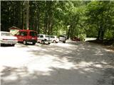
We drive to Luče (from Mozirje or via Kranjski Rak) and continue towards Logarska dolina. Soon after the village Solčava we come to a junction, where the road to Logarska dolina branches off to the left. We turn left towards Logarska dolina (toll payment) and drive along the road to the parking lot at Koča pod slapom Rinka, where we park.
Route description:
From the parking lot, we head onto a wide tourist path that starts to ascend gently. After a good ten minutes of walking, we come out of the forest, where we reach a junction. We go left (right Orlovo gnezdo 3 minutes) in the direction of Dom na Okrešlju. The path ahead crosses a small bridge and on the other side starts to ascend more steeply. After a short ascent, the path brings us below the walls, from where a crossing to the top of the waterfall follows. This section is exposed to falling rocks. The path then crosses Savinja again and ascends further along the river with the aid of steps. Next, we ascend on the right side (left bank) of Savinja. Soon we come to the source of Savinja, where we cross the water again. On the other side, the path enters a dense forest and after a short ascent brings us to the winter shelter on Okrešelj. We continue left and in a few steps reach Dom na Okrešlju.
At the hut we head onto the path in the direction of Kamniško sedlo and Savinjsko sedlo. Soon we reach the edge of a panoramic meadow, where there is a junction. We continue straight across the meadow in the direction of Češka koča and Kranjska koča (left Kamniško sedlo). The path ahead crosses a torrent and then ascends beside scree slightly upwards. Soon we reach the next junction, where we turn left following the signs for Turski žleb. At the junction there is also a memorial plaque. The path then starts to ascend more steeply and brings us to the entrance into Turski žleb. Due to falling rocks, helmet use is mandatory on the path through the gully, and self-belaying is highly recommended. The path then leads us along the right side of the gully and soon brings us to the start of the climbing section. Here the path ascends vertically via numerous pegs, then turns left and with the aid of cables and pegs crosses the more or less vertical wall above the gully. After crossing via numerous pegs, the path gradually becomes less demanding and soon the last cables end. A relatively steep ascent on scree terrain to the top of the gully follows. In the upper part, when ascending on scree, take great care not to dislodge rocks. At the top of Turski žleb, where there is also a junction, we head right towards Rinke and Skuta; left leads the path to Turska gora. The path then ascends below the slopes of Mala Rinka (2289m) and brings us to two successive junctions. In both cases we go right following the signs for Rinke; left leads the path towards Kokrsko sedlo and Skuta.
The path ahead ascends steeply for a short time, then brings us to an indistinct ridge along and beside which we then ascend. Just before the marked path reaches the summit of Mala Rinka, it turns slightly left and descends slightly to the col between Mala and Štajerska Rinka. On the other side of the col the marked path starts ascending again; we follow it only a few steps, then on the right we notice a less trodden path, via which we ascend to the summit of Štajerska Rinka in 10 minutes of moderate ascent.

Photos:
 1
1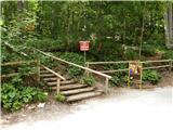 2
2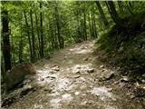 3
3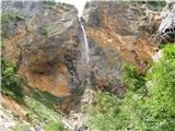 4
4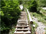 5
5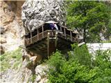 6
6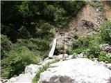 7
7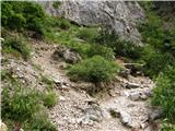 8
8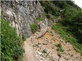 9
9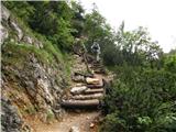 10
10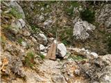 11
11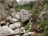 12
12 13
13 14
14 15
15 16
16 17
17 18
18 19
19 20
20 21
21 22
22 23
23 24
24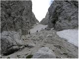 25
25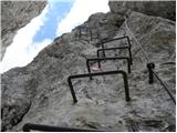 26
26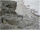 27
27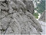 28
28 29
29 30
30 31
31 32
32 33
33 34
34 35
35 36
36 37
37 38
38 39
39 40
40 41
41 42
42 43
43 44
44 45
45 46
46 47
47 48
48 49
49 50
50 51
51 52
52 53
53 54
54 55
55 56
56 57
57
Discussion about the trip Koča pod slapom Rinka - Štajerska Rinka (via Turski žleb)
To post a comment you must log in:
If you do not yet have a username, you must first
register.