Koča pod slapom Rinka - Turska gora (via Kotliči)
Starting point: Koča pod slapom Rinka (1024 m)
| Latitude/Longitude: | 46,36960°N 14,59860°E |
| |
Route name: via Kotliči
Walking time: 4 h 30 min
Difficulty: very difficult marked way
Elevation gain: 1227 m
Elevation difference along the route: 1354 m
Map: Kamniške in Savinjske Alpe 1:50.000
Recommended equipment (summer): helmet, self belay set
Recommended equipment (winter): helmet, self belay set, ice axe, crampons
Views: 41.057
 | 3 people like this post |
Access to starting point:
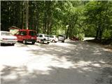
We drive to Luče (to here from Mozirje or over Kranjski rak) and continue towards Logarska dolina. Soon after the village Solčava we come to the crossroads, where the road to Logarska dolina branches off to the left. We turn left towards Logarska dolina (toll payment) and drive along the road to the parking lot at the mountain hut Koča pod slapom Rinka, where we park.
Route description:
From the parking lot, we head onto a wide tourist path which starts gently ascending. After a good ten minutes of walking, we come out of the forest, where we come to a junction. We go left (right Orlovo gnezdo 3 minutes) in the direction of Dom na Okrešlju. The path ahead crosses a small bridge and on the other side it starts ascending steeper. After a short ascent, the path brings us below the mountain walls, from where a crossing to the top of the waterfall follows. This part is exposed to falling stones. After that, the path crosses Savinja again and then ascends upwards along the river with the help of stairs. Next we ascend on the right side (left bank) of Savinja. Soon, we come to the source of Savinja, where we again cross the water. On the other side, the path goes into a dense forest and after a short ascent, it brings us to the winter shelter on Okrešelj. We continue left and in a few steps we come to the mountain hut Dom na Okrešlju.
At the hut we head onto a path in the direction of Kamniško sedlo and Savinjsko sedlo. Soon, we come to the edge of a panoramic meadow, where there is a junction. We continue left in the direction of Kamniško sedlo on the path which first moderately ascends through the forest and then across a belt of bushes. The path then flattens completely and in a short crossing brings us to a scree, on which along a well-made path we ascend to the entrance into a less demanding wall. Further, with the help of numerous fixed protections we ascend one level higher, where the steepness somewhat eases, but the path is still quite steep and exposed to falling stones. Higher, the path brings us to a steep and in snow dangerous for slipping scree, which we merely cross. A short ascent follows on a wide and somewhat exposed ledge, behind which the path brings us to the extensive grassy slopes of Kamniško sedlo. Just a few steps further we come to a junction, where we continue right in the direction of Turska gora and Brana (left Kamniška koča na Kamniškem sedlu 10 minutes). The path, which further ascends on an increasingly rocky slope, quickly brings us to a scree which is in snow dangerous for slipping. We cross the scree in a slight diagonal ascent, then the path brings us to the next junction, where we continue on the right path (left Brana). The path then crosses the slopes below Brana for some time, then with the help of fixed protections descends into a distinct notch called Kotliči. A well-secured and very steep path then brings us to the most scenic part of the path. Along a still well-secured path we ascend through the "sod brez dna" natural window in the wall of Turska gora. The steepness then gradually eases and the increasingly panoramic path quickly brings us to the summit of Turska gora.
Koča pod slapom Rinka - Dom na Okrešlju 1:15, Dom na Okrešlju - Turska gora 3:15.

Photos:
 1
1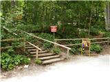 2
2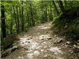 3
3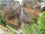 4
4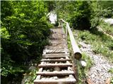 5
5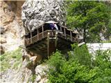 6
6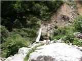 7
7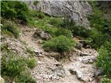 8
8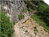 9
9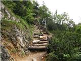 10
10 11
11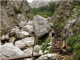 12
12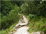 13
13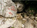 14
14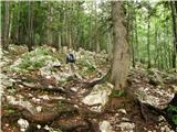 15
15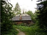 16
16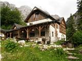 17
17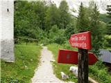 18
18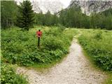 19
19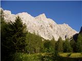 20
20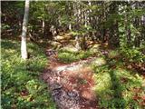 21
21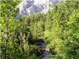 22
22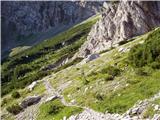 23
23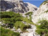 24
24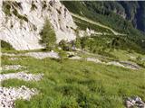 25
25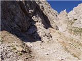 26
26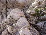 27
27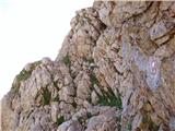 28
28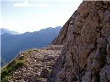 29
29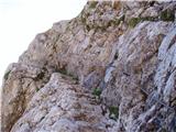 30
30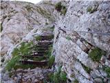 31
31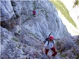 32
32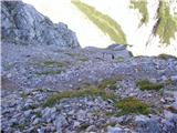 33
33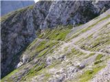 34
34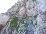 35
35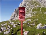 36
36 37
37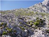 38
38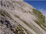 39
39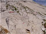 40
40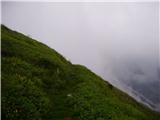 41
41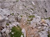 42
42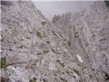 43
43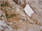 44
44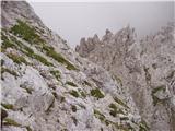 45
45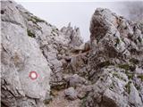 46
46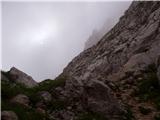 47
47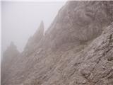 48
48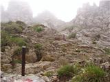 49
49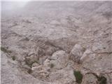 50
50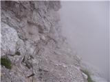 51
51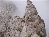 52
52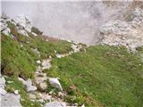 53
53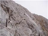 54
54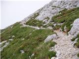 55
55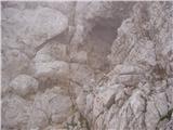 56
56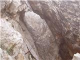 57
57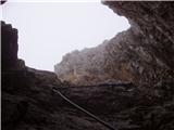 58
58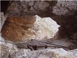 59
59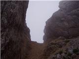 60
60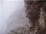 61
61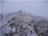 62
62
Discussion about the trip Koča pod slapom Rinka - Turska gora (via Kotliči)
|
| Gost30. 07. 2007 |
Nice path. Currently excellent protections through Boštjanco. Some free climbing on not too difficult terrain. The cable through Sod without bottom is well tensioned  Recommended! (but it's still somewhat harder and also two hours longer than the path to Brana) Recommended! (but it's still somewhat harder and also two hours longer than the path to Brana)
|
|
|
|
| Nickster25. 07. 2008 |
If it's too difficult for someone, let them head to Stol, which is only 20m lower and much easier
lp 
|
|
|
|
| klavdipo25. 07. 2008 |
There are many paths leading to every mountain, from easy to very demanding ones, so Turska gora cannot be compared to Stol, since Stol also has quite a demanding climbing route! There is also a not too difficult path to Turska gora from Kam.Bistrica via Žmavčarje, which apart from a bit of orientation does not present major difficulties! There is also a not too difficult path to Turska gora from Kam.Bistrica via Žmavčarje, which apart from a bit of orientation does not present major difficulties!
|
|
|
|
| sam-zee19. 08. 2008 |
Missing the variant via Turski žleb. Extremely beautiful circular tour starting at Okrešelj. So to Okrešelj as described, then right towards Turski žleb and Savinjsko sedlo. At the top of Turski žleb (the path through the gully is described here) we turn left and in a few minutes we are at Turska gora. Descent in the opposite direction from the described one via Kotliče and Kamniško sedlo with obligatory goulash (personally nowhere eaten better ).
|
|
|
|
| panda19. 08. 2008 |
Sam-zee: And where do you go in your variant to Savinjsko sedlo? Then you would have to turn right at the top of T.žleb - to Križ and descend to Jezersko and later to Savinjsko sedlo! Then down through Mrzli dol to Okrešelj. That's how I went at least, but in the opposite direction. Then down through Mrzli dol to Okrešelj. That's how I went at least, but in the opposite direction.
|
|
|
|
| panda19. 08. 2008 |
I'm interested if anyone has done the variant: from Okrešelj /Frischauf/ to the start of the climbing path to Kamniško sedlo and then not up the climbing path but through scree to Kotliče, if it goes of course, and then via shortcut to the entry of the path/ledge/ to Soda brez dna? Probably an unmarked path (pathless), but I don't know where the entry is possible (shortening the path) to Soda brez dna? If anyone knows or has pictures, the info would be very welcome. Thanks.
|
|
|
|
| geppo19. 08. 2008 |
Panda!
Read the description Kotliči - page 2 -K+S Alpe. We went Turski ž. - Turska gora - Kotliči - Brana- K. sedlo- Okrešelj. I don't know that path you want??
Lp
|
|
|
|
| panda20. 08. 2008 |
Geppo: I would like to avoid the ascent to K.sedlo. Before entering the wall (climbing route to K.sedlo) I would continue up the scree to Kotliče. But I don't know where to turn up (if it's possible at all) for the bottomless barrel. I wouldn't want to walk back to the entrance. That's what I meant.
|
|
|
|
| sam-zee22. 08. 2008 |
panda: I haven't been to Savinjsko sedlo yet (mountaineer though ) I added it just for orientation from Okrešelj.
Tadej: super 
|
|
|
|
| Sujcic18. 07. 2014 |
Does anyone know if the scree on picture 39 is still snowy?
|
|
|
|
| rokeg18. 07. 2014 |
There is a patch of snow in between, but you can go around the snowfield.
|
|
|
|
| redbull18. 07. 2014 |
if number 39 would be a problem for you. then a pleasant surprise awaits you in the Kotliči.
|
|
|
|
| garmont30. 09. 2015 |
This is a very difficult trail, not just "difficult" as stated in the above description.
|
|
|
|
| bobo6. 08. 2016 |
Has anyone hiked through Kotliče in the last week? Any snow on the path? What about the scree under Brana? Planning a circular tour to Turska gora tomorrow via T. žleb and down through Kotliče to K. sedlo and back to Okrešelj. Thanks in advance for all information. lp.
|
|
|
|
| redbull6. 08. 2016 |
Here I would have expected you to ask if there's any snow in the Turski žleb? The path is dry. The scree under Brana was already dry in June.
good luck
|
|
|
|
| bobo6. 08. 2016 |
Thanks for the answer. The TolK gully doesn't worry me, because we'll go up right via cables and pegs. Probably no snow there, do you agree?
|
|
|
|
| garmont20. 09. 2018 |
Tadej, as I wrote three years ago. It's a "very demanding path".
|
|
|
|
| Tadej20. 09. 2018 |
Thanks for the warning, I've corrected it.
|
|
|
|
| trdi25. 07. 2019 |
Interesting, beautiful and dynamic path, one of the nicer ones. Caution required on return due to huge amount of scree on the path, markings are also more faded.
|
|
|
To post a comment you must log in:
If you do not yet have a username, you must first
register.