Koča pod slapom Rinka - Velika (Koroška) Baba
Starting point: Koča pod slapom Rinka (1024 m)
| Latitude/Longitude: | 46,36960°N 14,59860°E |
| |
Walking time: 4 h 30 min
Difficulty: partly demanding marked way
Elevation gain: 1103 m
Elevation difference along the route: 1129 m
Map: Kamniške in Savinjske Alpe 1:50.000
Recommended equipment (summer): helmet
Recommended equipment (winter): helmet, ice axe, crampons
Views: 26.468
 | 2 people like this post |
Access to starting point:
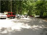
We drive to Luče (from Mozirje to here or via Kranjski Rak) and continue towards Logarska dolina. Soon after the village Solčava we come to a junction, where the road to Logarska dolina branches off to the left. We turn left towards Logarska dolina (toll payment) and drive along the road to the parking lot at Koča pod slapom Rinka, where we park.
Route description:
From the parking lot, we head onto a wide tourist path that starts ascending gently. After a good ten minutes of walking, we come out of the forest, where we reach a junction. We go left (right Orlovo gnezdo 3 minutes) in the direction of Dom na Okrešlju. The path ahead crosses a small bridge and on the other side starts ascending more steeply. After a short ascent, the path brings us below the walls, from where a crossing to the top of the waterfall follows. This part is exposed to falling rocks. The path then crosses Savinja again and continues upwards along the river with the help of steps. Next, we ascend on the right side (left bank) of Savinja. Soon we come to the source of Savinja, where we cross the water again. On the other side, the path enters a dense forest and after a short ascent brings us to the winter shelter on Okrešlju. We continue left and in a few steps we come to Dom na Okrešlju.
At the hut, we head onto the path in the direction of Kamniško sedlo and Savinjsko sedlo. Soon we come to the edge of a panoramic meadow, where there is a junction. We continue straight across the meadow in the direction of Češka koča and Kranjska koča (left Kamniško sedlo). The path ahead crosses a torrent and then ascends alongside the scree slightly upwards. Soon we come to the next junction, where the path to Turški žleb and to the memorial branches off to the left, to which it is only a few dozen steps. We continue straight along the ever narrower valley. The path starts ascending more steeply and brings us below the walls of Mrzla gora. The path ahead continues on the left side of the torrent, on a moderately steep grassy slope that is partly overgrown with dwarf pines. The path ahead passes to the left side below the scree of Štajerska Rinka. In a traversing ascent, the path brings us below the walls, where there is a danger of falling rocks. A shorter steep section follows, then the path heads slightly right onto grassy slopes, where we reach a junction. We continue straight, to the right the path to Mrzla gora branches off. Soon we come again to a junction, where the climbing path to Rinke branches off to the left upwards, and we continue straight on the path that soon turns right into steep slopes. Here the path ascends steeply and brings us in a few minutes to the bivouac pod Mrzlim vrhom. At the bivouac the path turns right and ascends steeply for a few more steps, then the steepness eases. A few steps of walking follow to Savinjsko sedlo, where there is the state border. Further, we continue on the Austrian side towards Kranjska koča. After a short ascent, the path descends for a few meters, then in a gentle traversing ascent over scree ascends to Jezersko sedlo. We continue right along the ridge and the path soon brings us to a junction, where the path to Babe branches off to the right. We continue right downwards in the direction of Velika Baba, left along the ridge the path leads to Ledinski vrh. The path from the saddle first descends over scree then turns slightly left and crosses the slopes below Ledinski vrh. A shorter ascent follows and from the left a very demanding path from Koča na Ledinah joins us.
The path further becomes somewhat more demanding and starts ascending towards the north. Later the path turns left and withdraws from the steep walls on the western side of the mountain. The path then crosses the western slopes towards the north, in the last part it turns right and follows a short ascent to the very panoramic summit.

Photos:
 1
1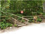 2
2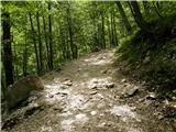 3
3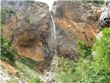 4
4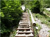 5
5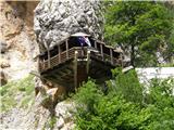 6
6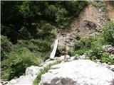 7
7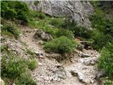 8
8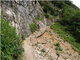 9
9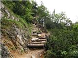 10
10 11
11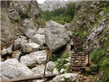 12
12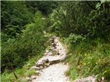 13
13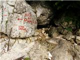 14
14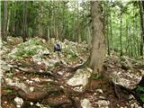 15
15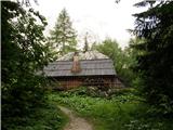 16
16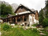 17
17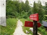 18
18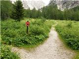 19
19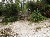 20
20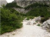 21
21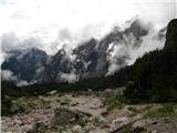 22
22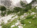 23
23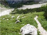 24
24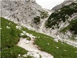 25
25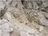 26
26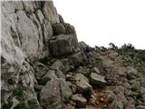 27
27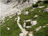 28
28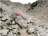 29
29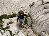 30
30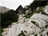 31
31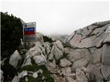 32
32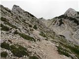 33
33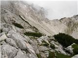 34
34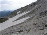 35
35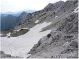 36
36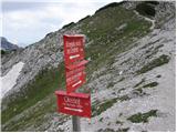 37
37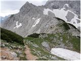 38
38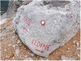 39
39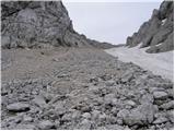 40
40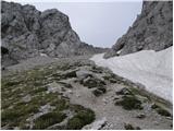 41
41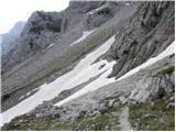 42
42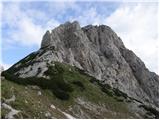 43
43 44
44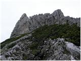 45
45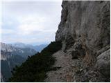 46
46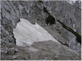 47
47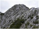 48
48 49
49
Discussion about the trip Koča pod slapom Rinka - Velika (Koroška) Baba
|
| pjoter27. 10. 2013 |
I'm wondering if anyone knows what the condition of the trail is at this time, if there's any snow yet
thanks
|
|
|
|
| Domch27. 10. 2013 |
Yesterday I was up there, specifically via the climbing ascent and Austrian descent. The trail is dry, no snow, yesterday it was summer up there - short sleeves, panoramic views all around. No snow in KSA anymore except some patches on the glacier under Skuta. No worries on the trail and enjoy.
|
|
|
|
| Zeljo22. 08. 2014 |
I'm interested what this path to Velika Baba is like? Demanding for insufficient fitness? Regarding fitness I'm half-half. Tomorrow we plan to go up.
thanks
|
|
|
|
| Daaam22. 08. 2014 |
If you have half Triglav fitness then just go, but if only half an hour of walking then better go only to Okrešelj... Hand on heart, your question didn't turn out that well. cheers
|
|
|
|
| garmont22. 08. 2014 |
Better stay home tomorrow. The weather won't be on your side.
|
|
|
|
| citam13. 06. 2015 |
Is the section in picture 46 exposed?
|
|
|
|
| ŠpRo2913. 06. 2015 |
Otherwise I went up from Ledin and as far as I remember, this is not exposed. You bypass the wall more.
|
|
|
|
| ŠpRo2913. 06. 2015 |
Sorry, on my phone it shows something else under picture 46.
|
|
|
|
| Kr_okar2. 06. 2018 |
Is the path suitable for a dog? Thanks
|
|
|
|
| garmont2. 06. 2018 |
Except that the path is mostly in the sun and consequently can be quite hot, I think the dog could handle it without problems.
Lp
|
|
|
|
| pohodnik3820. 09. 2020 |
On Saturday 12.9. the path to Velika Baba was done; the path is without special features very beautiful and worth every step and not overly technically demanding.
VIDEO
Regards! Tone
|
|
|
|
| ImbusKljuc10. 09. 2021 20:30:07 |
Today 10.9.21 lost a watch on the descent on this trail. It's not worth much - but I liked it. Finder private.
It's a very nice trail if dry. The final ascent has a nice steep start and you need to use your hands a bit but there are footholds, the rest is easy. No fear, that ledge bypasses the wall and is not exposed.
|
|
|
To post a comment you must log in:
If you do not yet have a username, you must first
register.