Koča Porze - Porze / Cima Palombino (via Tilliacher Joch (Italian ferrata))
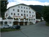
Starting point: Koča Porze (1942 m)
| Latitude/Longitude: | 46,6597°N 12,5824°E |
| |
Route name: via Tilliacher Joch (Italian ferrata)
Walking time: 2 h 30 min
Difficulty: very difficult marked way
Elevation gain: 657 m
Elevation difference along the route: 657 m
Map: Austria On-line; Tabacco 01; BEV list 196; Freytag, Berndt und Artaria, list 182
Recommended equipment (summer): helmet, self belay set
Recommended equipment (winter): helmet, self belay set, ice axe, crampons
Views: 6.475
 | 2 people like this post |
Access to starting point:
From Slovenia into the upper Gail Valley we can come through the Karawanks Tunnel, over Korensko Saddle or through Trbiž over Megvarje/Maglern. Past Šmohor/Hermagor we continue through the valley to the settlement Kotschach-Mauthen and continue into Lesachtal to the settlement Obertilliach. At the end of the village, at the sign which marks the name of the settlement, we drive on a narrower asphalt road with a small sign Porzehütte towards the south. After a good kilometer the asphalt ends. A good macadam road runs by the stream Dorfbach to the lake Klapfsee, on Saturdays and Sundays to the hut. If the road is closed, it is from the lake to the hut around an hour of walking on a comfortable footpath which in a few hairpin turns ascends over wide pastures.
From Obertilliach on and by the road to the hut is 2 hours and a half of walking.
A kilometer longer is the access through the Drava Valley past Spittal, Lienz and Sillian, but the road is a little wider there.
Route description:
From the hut in a few hairpin turns on the footpath we reach the road and along it the saddle Tilliacher Joch/Forcela Dignas. We follow the marks along the old trade road, which also served for supplying the front between Italy and Austria-Hungary in the First World War. Along the road we descend to the Italian side, in the first bend we step onto the marked footpath over a short scree slope, which leads to the entry into the so-called Italian ferrata. The path, marked with number 172, which is extensively marked, initially runs along a wide ledge. It is secured with a steel cable, two shorter ladders, some brackets and some pins. Except at two places it is nowhere particularly exposed. Then it runs along the fall line of the ridge, where it skilfully uses natural passages. The difficulties or ferrata pleasures end when we reach the main ridge. Here at elevation 2388 m path 142 joins from the left from the Italian pastures. The continuation to the summit is a combination of views into the steep northern precipices and admiration of the diverse flora on the grassy slopes below the ridge. We walk along the former military supply path. We also notice remains of fortified positions and caverns. On the last section below the summit the path becomes narrower and runs over rocks. On the summit there are two crosses. At the highest point the cross is provisional, on the adjacent, a few metres lower boulder above the cavern there is a huge memorial (pacifist) cross with inscriptions in several languages and a summit logbook. On the summit the Italian secured path meets the Austrian one, which comes over the gap Porzescharte. Both paths are part of the Carnic High Mountain Trail. The view is appropriate to the altitude and the neighbouring mountains.

Along the route: sedlo Tilliacher Joch/Forcella Dignas (2094m), odcep pozi na Barenbadeck 2431m (2094m), razcep poti 172 in 142 (2388m)
Photos:
 1
1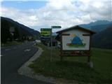 2
2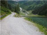 3
3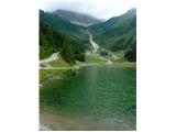 4
4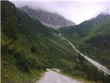 5
5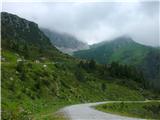 6
6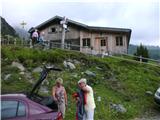 7
7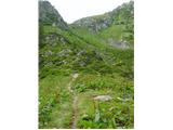 8
8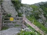 9
9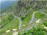 10
10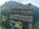 11
11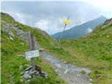 12
12 13
13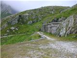 14
14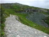 15
15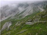 16
16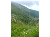 17
17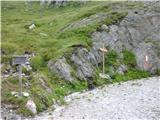 18
18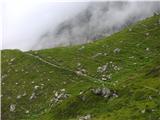 19
19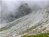 20
20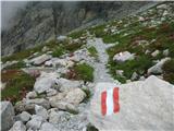 21
21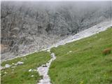 22
22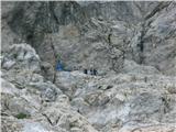 23
23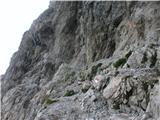 24
24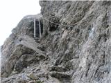 25
25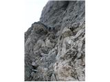 26
26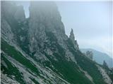 27
27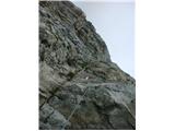 28
28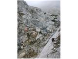 29
29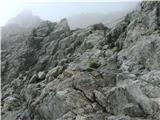 30
30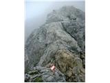 31
31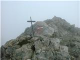 32
32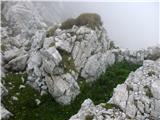 33
33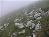 34
34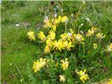 35
35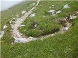 36
36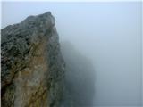 37
37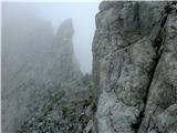 38
38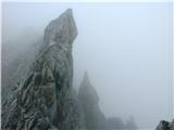 39
39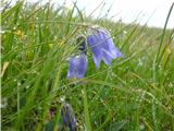 40
40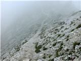 41
41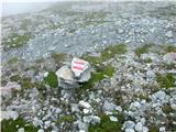 42
42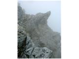 43
43 44
44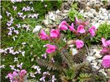 45
45 46
46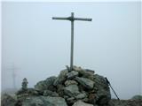 47
47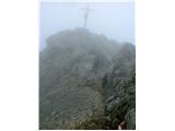 48
48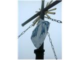 49
49
Discussion about the trip Koča Porze - Porze / Cima Palombino (via Tilliacher Joch (Italian ferrata))
To post a comment you must log in:
If you do not yet have a username, you must first
register.