Koča pri Savici - Batognica (via Krn lake and Prag)
Starting point: Koča pri Savici (653 m)
| Latitude/Longitude: | 46,28960°N 13,80220°E |
| |
Route name: via Krn lake and Prag
Walking time: 7 h 30 min
Difficulty: easy marked way
Elevation gain: 1511 m
Elevation difference along the route: 1995 m
Map: Julijske Alpe - zahodni del 1:50.000
Recommended equipment (summer):
Recommended equipment (winter): ice axe, crampons
Views: 63
 | 1 person like this post |
Access to starting point:
From the Ljubljana - Jesenice motorway we turn off at the Lesce exit and follow the road towards Bled and further towards Bohinjska Bistrica. We continue driving towards Bohinjsko jezero (Ribčev laz), at which we arrive at an intersection, where we continue straight on the left (southern) side of the lake in the direction of Ukanca and Slap Savica. We then follow this increasingly narrow road to the large parking lot at koči Savica. The parking lot is chargeable.
Route description:
From the parking lot we head onto the wide footpath in the direction of Slap Savica and Dom na Komni (right path over Komarča). Already after a short gentle ascent the path brings us to a marked junction, where the tourist path to Slap Savica branches off to the right, we continue slightly left or straight on the wide footpath in the direction of Komne. The path ahead still climbs for a short time along the Savica, then brings us to the first of the marked 48 serpentines. After an hour and a half of moderate ascent through the forest, the path brings us to the mentioned 48th serpentine, from which a nice view of Bohinjsko jezero opens up. Here the path turns somewhat to the right and passes into the valley named Pekel, where it climbs gently for some time, then turns to the right and climbs somewhat more steeply again. Already after a few dozen steps the path turns left again and continues climbing parallel to the valley. Further the gentle to moderately steep path gradually passes into a sparser forest, from which we soon see Dom na Komni. The path ahead leads us past a smaller interesting cave, higher it brings us to a junction, where the path to Črno jezero branches off to the right, we continue left and still continue on the wide path. There follows some transverse ascent; at the natural abyss, which is fenced for safety, the path turns right, then climbs to the next junction, where the path from Črno jezero joins us.
A little further the path branches once more, we choose the left path in the direction of Dom na Komni, or we can also take the somewhat shorter path that continues straight and bypasses Dom na Komni (right Koča pri Triglavskih jezerih).
There follows also the ascent past bajte Pri Hubertu and in a few minutes we reach Dom na Komni.
From Dom na Komni we go past a smaller chapel and follow the signs for Kočo pod Bogatinom (left Vogel, Tolminski Kuk and Planina Govnjač); we already quickly join with the previously mentioned somewhat shorter path.
We continue slightly left in the direction of Koče pod Bogatinom and along the wide and quite scenic path we quickly arrive at Planina na Kraju, where passing the pyramid (kostnica pri Koči pod Bogatinom - mountain memorial monument) we reach Kočo pod Bogatinom, which is located in the middle of the planina.
We bypass the kočo on the right side and quickly arrive at the marked junction, where the path over Lepo Komno branches off to the right, which leads further towards Lanževica or Oslovi škrbini, we continue straight, still on the wider gentle path in the direction of Bogatinskega sedla. On the western part of Planine na Kraju a path to Planini Govnjač branches off to the left, we continue a few more minutes in an easy ascent on the southern side of Kozlovega roba. The path ahead flattens completely for some time and passes to the edge of the valley Gracije, where we begin to climb transversely, first on the slopes of Srednjega vrha, later on the slopes of the fore-summit Vrha nad Gracijo. In the continuation the path becomes somewhat steeper and with beautiful views brings us to the place where it branches.
We can continue further on the mulatjera, which makes a longer serpentine, or on the somewhat shorter steep path, which climbs directly to Bogatinskega sedla, where both paths join.
From the junction at Bogatinskem sedlu, from which a nice view of Krn and surrounding mountains opens up, we head straight down in the direction of Lepene, Prehodcev, Krna, Krnskega jezera and Doma pri Krnskih jezerih (left Mahavšček and Bogatin, right Lanževica) on the path, which gradually begins to descend.
The path ahead leads us on the old military mulatjera, which brings us a few minutes lower to the slopes overgrown with rušje, even a little lower the path flattens.
We continue past a few old objects, which are part of the former Rapalske meje.
Here in a kind of small valley a passage opens or the old path leads towards Velika Montura, we continue on the marked path, which barely noticeably descends to the central part of the valley Za Lepočami, where there are still a few old Italian buildings, which are still quite well preserved.
Here to the left branches off the marked path to Krn via Prehodcev and Batognice, we continue further to the west and specifically on the path, which leads through the valley south of Velike Monture; when we arrive in the small valley under Mala Montura then to the left branches off another path towards Prehodci or Izvir Tolminke.
The path ahead temporarily descends through the small valley overgrown with rušje and rare larch trees, when the small valley widens then to the left branches off the path to Mali Šmohor.
There follows a few minutes of easy walking and we arrive at the southern edge of Planine Duplje, where we hold to the left directions, or markings for Krnsko jezero and Krn (right planšarija on Planini Duplje, Dom pri Krnskih jezerih and Lepena).
In the continuation we climb a bit to the saddle between Mali Šmohor on the left and Glava on the right.
From here there follows only a short descent to Krnskega jezera, from which a nice view of Krn opens up.
The marked path, which continues higher into the world of Krna, bypasses Krnsko jezero on the left, southern side, where we initially walk on the screes of Malega Šmohorja. When we leave the shore of the lake we initially still continue easily on the already partly overgrown screes, then the path turns a bit to the left and for a shorter time climbs more steeply on a steeper slope. At the top of the steep part a path joins us from the left, which runs transversely across the scree, but is mainly abandoned due to the danger of falling rocks, then the slope flattens, the path turns slightly to the right and brings us on the torrent deposits of stones and sand to the grassy Planino na Polju, where on the right side we notice a hunting hut.
On the planina to the right branches off an unmarked path to sedlo Čez Potoče, we with wonderful views of the surrounding mountains follow the marked path towards Krnu. The path already quickly from the planina passes into a small valley at the foot of Vrha nad Peski, along which we begin to climb. We continue also past the branch to the spring, which however in dry days dries up, the path higher becomes more and more stony and in the area Pri kolu temporarily flattens and brings us to an unmarked junction, from which we continue on the slightly left, but unmarked path, which leads towards Pragu or Batogniškemu sedlu (right Krn and Krnska škrbina).
The path ahead climbs transversely on the screes of Vrha nad Peski, we on such a path walk about half an hour, or to the place where we reach Prag.
From Praga, where a view of the Primorska side opens up, we continue right in the direction of the summit Batognice (left Prehodci and Koča na Planini Razor, left and then right Jezero v Lužnici, sharp right Krnska škrbina), where we first begin to climb gently on the eastern ridge of Batognice, which higher turns towards northwest. We then follow this increasingly scenic path, which on parts of the ridge moves a bit left onto steep slopes, to the summit of Batognice, which we reach after about 20 minutes of walking from Praga.
Izhodišče - odcep k Črnemu jezeru 2:15, odcep k Črnemu jezeru - Spominska plošča Mateju Koblarju 0:10, Spominska plošča Mateju Koblarju - Dom na Komni 0:05, Dom na Komni - Koča pod Bogatinom 0:15, Koča pod Bogatinom - Bogatinsko sedlo 1:15, Bogatinsko sedlo - odcep za Veliko Monturo 0:20, odcep za Veliko Monturo - Za Lepočami 0:15, Za Lepočami - odcep za Prehodce 0:20, odcep za Prehodce - odcep za Mali Šmohor 0:10, odcep za Mali Šmohor - Planina Duplje 0:05, Planina Duplje - Krnsko jezero 0:10, Krnsko jezero - Planina na Polju 0:30, Planina na Polju - Pri kolu 0:50, Pri kolu - Prag 0:30, Prag - Batognica 0:20.

Along the route: Jama ob poti na Komno (1303m), Odcep k Črnemu jezeru (1411m), Brezno pod lovsko kočo na Komni (1430m), Spominska plošča Mateju Koblarju (1481m), Pri Hubertu (1492m),
Dom na Komni (1520m), Piramida (1520m),
Koča pod Bogatinom (1513m), Bogatinsko sedlo (1803m), Odcep za Veliko Monturo (1712m), Za Lepočami (1617m), Doliči (1472m), Pod Šmohorjem (1420m), Planina Duplje (1371m), Preval pri Krnskem jezeru (1401m),
Lake Krnsko jezero (1391m),
Planina na Polju (1530m), Pri kolu (1842m), Prag (2058m), Kavernenhof (2131m)
Photos:
 1
1 2
2 3
3 4
4 5
5 6
6 7
7 8
8 9
9 10
10 11
11 12
12 13
13 14
14 15
15 16
16 17
17 18
18 19
19 20
20 21
21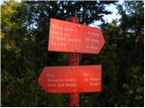 22
22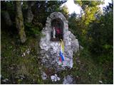 23
23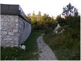 24
24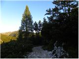 25
25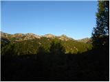 26
26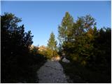 27
27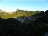 28
28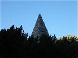 29
29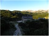 30
30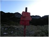 31
31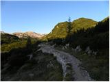 32
32 33
33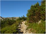 34
34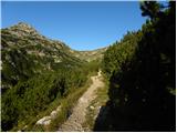 35
35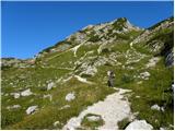 36
36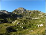 37
37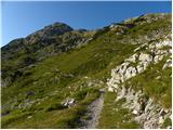 38
38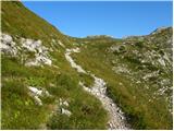 39
39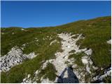 40
40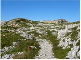 41
41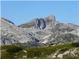 42
42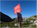 43
43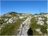 44
44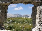 45
45 46
46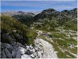 47
47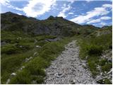 48
48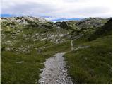 49
49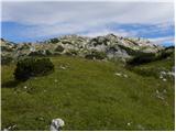 50
50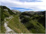 51
51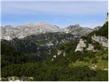 52
52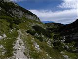 53
53 54
54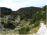 55
55 56
56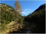 57
57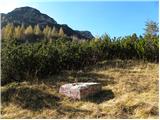 58
58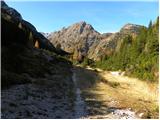 59
59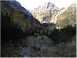 60
60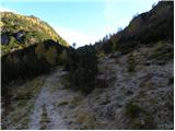 61
61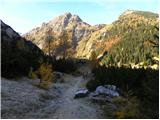 62
62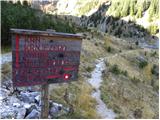 63
63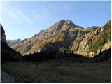 64
64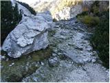 65
65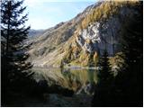 66
66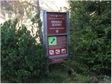 67
67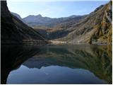 68
68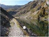 69
69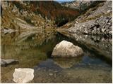 70
70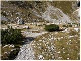 71
71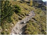 72
72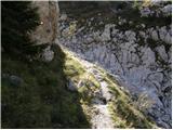 73
73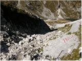 74
74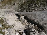 75
75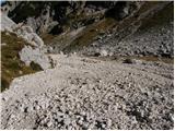 76
76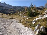 77
77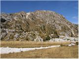 78
78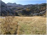 79
79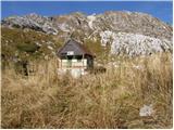 80
80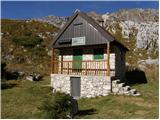 81
81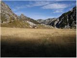 82
82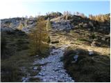 83
83 84
84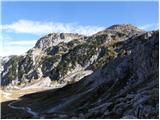 85
85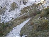 86
86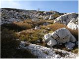 87
87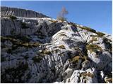 88
88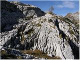 89
89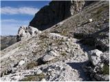 90
90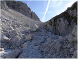 91
91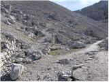 92
92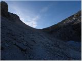 93
93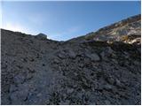 94
94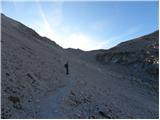 95
95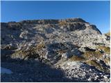 96
96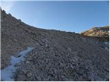 97
97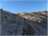 98
98 99
99 100
100 101
101 102
102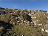 103
103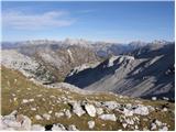 104
104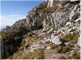 105
105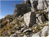 106
106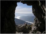 107
107 108
108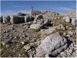 109
109 110
110 111
111
Discussion about the trip Koča pri Savici - Batognica (via Krn lake and Prag)
To post a comment you must log in:
If you do not yet have a username, you must first
register.