Koča pri Savici - Gomiščkovo zavetišče na Krnu (via Prehodci)
Starting point: Koča pri Savici (653 m)
| Latitude/Longitude: | 46,28960°N 13,80220°E |
| |
Route name: via Prehodci
Walking time: 7 h 55 min
Difficulty: partly demanding marked way
Elevation gain: 1529 m
Elevation difference along the route: 2000 m
Map: TNP 1:50.000
Recommended equipment (summer): helmet
Recommended equipment (winter): helmet, ice axe, crampons
Views: 36
 | 1 person like this post |
Access to starting point:
From the Ljubljana - Jesenice motorway take the Lesce exit and follow the road towards Bled and further towards Bohinjska Bistrica. Continue driving towards Lake Bohinj (Ribčev laz), where we reach a junction, continuing straight along the left (southern) side of the lake in the direction of Ukanc and Savica Waterfall. Follow this increasingly narrow road to the large car park at Koča pri Savici. The car park is paid.
Route description:
From the parking lot head to the wide footpath in the direction of Savica Waterfall and Dom na Komni (right path via Komarča). After a short gentle ascent, the path takes us to a marked junction where the tourist path to Savica Waterfall branches right; we continue slightly left or straight on the wide footpath towards Komna. The path continues ascending briefly along the Savica, then takes us to the first of the marked 48 serpentines. After one and a half hours of moderate ascent through the forest, the path takes us to the mentioned 48th serpentine from which a nice view opens to Lake Bohinj. Here the path turns slightly right and enters the valley named Pekel, where it ascends gently for some time, then turns right and ascends somewhat steeper again. After just a few dozen steps the path turns left again and ascends parallel to the valley. The further gentle to moderately steep path gradually enters thinner forest from which we soon see Dom na Komni. The path leads past a small interesting cave, higher up to a junction where the path to Črno jezero branches right; we continue left and further on the wide path. Some traverse ascent follows; at a natural abyss fenced for safety the path turns right, then ascends to the next junction where the path from Črno jezero joins.
A little further the path forks again; we choose the left path towards Dom na Komni or the somewhat shorter path continuing straight bypassing Dom na Komni (right Koča pri Triglavskih jezerih).
Follows ascent past bajta Pri Hubertu and in a few minutes we reach Dom na Komni.
From Dom na Komni go past a small chapel and follow signs for Koča pod Bogatinom (left Vogel, Tolminski Kuk and Planina Govnjač); soon we join the previously mentioned somewhat shorter path.
Continue slightly left towards Koča pod Bogatinom and along the wide fairly panoramic path quickly reach Planina na Kraju where past the pyramid (ossuary at Koča pod Bogatinom - mountaineering memorial) we reach Koča pod Bogatinom located in the middle of the pasture.
Bypass the hut on the right and quickly reach a marked junction where the path via Lepa Komna branches right leading further to Lanževica or Oslova škrbina; we continue straight further on the wider gentle path towards Bogatinsko sedlo. On the western part of Planina na Kraju another path to Planina Govnjač branches left; we continue a few more minutes in easy ascent along the southern side of Kozlov rob. The path levels completely for a while and reaches the edge of Gracija valley where we start traversing up, first on slopes of Srednji vrh, later on slopes of forepeak Vrh nad Gracijo. Further the path becomes somewhat steeper and with nice views takes us to where it forks.
We can continue on the mule track making a longer serpentine or the somewhat shorter steep path ascending directly to Bogatinsko sedlo where both join.
From the junction at Bogatinsko sedlo, from where a nice view opens to Krn and surrounding peaks, head straight down towards Lepena, Prehodci, Krn, Krnsko jezero and Dom pri Krnskih jezerih (left Mahavšček and Bogatin, right Lanževica) on the path that gradually starts descending.
The path further leads on the old military mule track which a few minutes lower takes us to slopes overgrown with brush; a bit lower the path levels.
Continue past some old structures that are part of the former Rapallo border.
Here in a kind of small valley a passage opens or an old track leads to Velika Montura; we continue on the marked path barely descending noticeably to the central part of Za Lepočami valley where some old Italian buildings still stand quite well preserved.
Here from the marked junction go left towards Prehodci (straight down Krnsko jezero and Dom pri Krnskih jezerih), passing more structures that the Italians built between the wars for guarding the Rapallo border. Continue on the panoramic path which at Smrečje section joins the path from Planina Razor to Krn.
Follow the mentioned path right towards Prehodci and Krn where first gentle ascent, then short descent to junction at Prehodci.
Continue straight to Krn (left down Izvir Tolminke and Planina Polog); a little further the path from Dom pri Krnskih jezerih joins from right.
Further follow signs for Krn; the path from plateau terrain transitions to steep mostly southeast slopes from which nice view to Tolmin side opens (this path section leads through area named Na Tminskem). Later path turns slightly right gradually taking us to small high alpine valley where steeper ascent begins. Continue past Črna njiva area, then ascend to large monument to fallen in WWI, Spomenik Peski.
Continue right on marked path (left down unmarked path branches by which we can reach Rdeči rob or descend to valley or Planina Polog) which traverses under Greben malih Peskov, passing remains from WWI, then reach saddle between Mali Pesek left and lesser known Piramida right (Piramida sort of forepeak of Vrhov nad Peski).
Follows crossing screes of Piramide and Vrh nad Peski; when reaching highest point of scree crossing a pathlet to Vrh nad Peski branches right (branch marked, onward path not); we continue on marked path to which at end of screes from left joins path past Jezero v Lužnici; we reach junction at Prag.
At Prag slightly right branches path bypassing Batognica peak, right down descend to Krnsko jezero possible; we continue straight or west starting ascent on eastern ridge of Batognica. Follow this increasingly panoramic path which partly steps back left to steep slopes to Batognica summit reached after about 20 min walk from Prag.
From Batognica continue on initially less visible path continuing on left southern side of peak. Path initially slight descent soon takes to steeper terrain where steeper descent begins. After short descent reach fairly steep steps down which steep descent. On this section high slip risk due to scree. Path gradually levels bringing us shortly to Krnska škrbina with marked junction (to notch also via so-called Northern path from Prag bypassing Batognica; somewhat shorter but much less panoramic).
From notch continue right to Krn (sharp left Prag, left Batognica, straight Planina Kuhinja) on path ascending grassy slope of Krn. Steep path few min higher levels somewhat and forks.
Choose slightly left lower path to Gomiščkovo zavetišče na Krnu (slightly right Krn summit).
Follows slight traverse ascent on southern slopes of Krn arriving at Gomiščkovo zavetišče na Krnu.
Start - junction to Črno jezero 2:15, junction to Črno jezero - Matej Koblar memorial plaque 0:10, Matej Koblar memorial plaque - Dom na Komni 0:05, Dom na Komni - Koča pod Bogatinom 0:15, Koča pod Bogatinom - Bogatinsko sedlo 1:15, Bogatinsko sedlo - junction to Velika Montura 0:20, junction to Velika Montura - Za Lepočami 0:15, Za Lepočami - Smrečje 0:15, Smrečje - Prehodci 0:15, Prehodci - Spomenik Peski 1:10, Spomenik Peski - junction to Vrh nad Peski 0:25, junction to Vrh nad Peski - Prag 0:10, Prag - Batognica 0:20, Batognica - Krnska škrbina 0:15, Krnska škrbina - Gomiščkovo zavetišče 0:30.

Along the route: Jama ob poti na Komno (1303m), Odcep k Črnemu jezeru (1411m), Brezno pod lovsko kočo na Komni (1430m), Spominska plošča Mateju Koblarju (1481m), Pri Hubertu (1492m),
Dom na Komni (1520m), Piramida (1520m),
Koča pod Bogatinom (1513m), Bogatinsko sedlo (1803m), Odcep za Veliko Monturo (1712m), Za Lepočami (1617m), Smrečje (1642m), Prehodci (1635m), Spomenik Peski (1975m), Odcep za Vrh nad Peski (2059m), Prag (2058m),
Batognica (2164m), Krnska škrbina (2058m)
Photos:
 1
1 2
2 3
3 4
4 5
5 6
6 7
7 8
8 9
9 10
10 11
11 12
12 13
13 14
14 15
15 16
16 17
17 18
18 19
19 20
20 21
21 22
22 23
23 24
24 25
25 26
26 27
27 28
28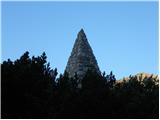 29
29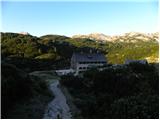 30
30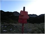 31
31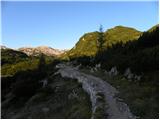 32
32 33
33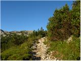 34
34 35
35 36
36 37
37 38
38 39
39 40
40 41
41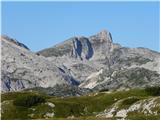 42
42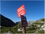 43
43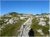 44
44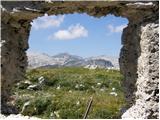 45
45 46
46 47
47 48
48 49
49 50
50 51
51 52
52 53
53 54
54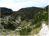 55
55 56
56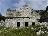 57
57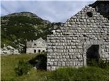 58
58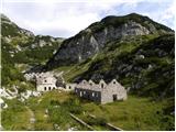 59
59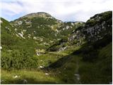 60
60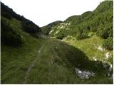 61
61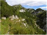 62
62 63
63 64
64 65
65 66
66 67
67 68
68 69
69 70
70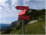 71
71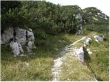 72
72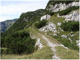 73
73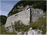 74
74 75
75 76
76 77
77 78
78 79
79 80
80 81
81 82
82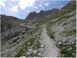 83
83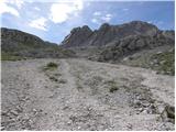 84
84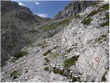 85
85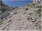 86
86 87
87 88
88 89
89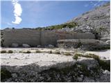 90
90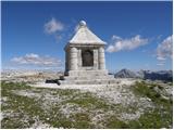 91
91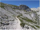 92
92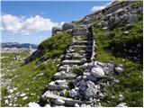 93
93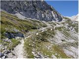 94
94 95
95 96
96 97
97 98
98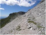 99
99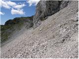 100
100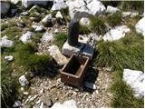 101
101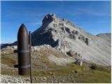 102
102 103
103 104
104 105
105 106
106 107
107 108
108 109
109 110
110 111
111 112
112 113
113 114
114 115
115 116
116 117
117 118
118 119
119 120
120 121
121 122
122 123
123 124
124 125
125 126
126 127
127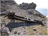 128
128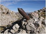 129
129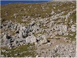 130
130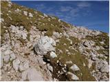 131
131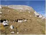 132
132 133
133 134
134 135
135 136
136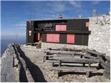 137
137
Discussion about the trip Koča pri Savici - Gomiščkovo zavetišče na Krnu (via Prehodci)
To post a comment you must log in:
If you do not yet have a username, you must first
register.