Starting point: Koča pri Savici (653 m)
| Latitude/Longitude: | 46,28960°N 13,80220°E |
| |
Walking time: 4 h 30 min
Difficulty: easy marked way
Elevation gain: 1247 m
Elevation difference along the route: 1350 m
Map: TNP 1:50.000
Recommended equipment (summer):
Recommended equipment (winter): ice axe, crampons
Views: 5.969
 | 1 person like this post |
Access to starting point:
From the Ljubljana - Jesenice highway, take the Lesce exit and follow the road towards Bled and further towards Bohinjska Bistrica. Continue driving towards Lake Bohinj (Ribčev Laz), at which you reach a crossroads, where you continue straight along the left (southern) side of the lake in the direction of Ukanc and Savica Waterfall. Follow this increasingly narrow road to the large parking lot at Koča pri Savici. The parking lot is paid.
Route description:
From the parking lot at Koča pri Savici, head onto the wide footpath in the direction of Savica Waterfall and Dom na Komni (right path via Komarča). After a short gentle ascent, the path reaches a marked junction where the tourist path to Savica Waterfall branches off to the right; continue slightly left or straight on the wide footpath towards Komna. The path continues ascending briefly along the Savica river before reaching the first of the marked 48 switchbacks. After one and a half hours of moderate ascent through the forest, the path arrives at the 48th switchback, offering a beautiful view of Lake Bohinj. Here the path turns slightly right and enters the valley called Pekel, ascending gently for a while before turning right and steepening again. After a few dozen steps, it turns left once more and continues parallel to the valley. The gentle to moderately steep path gradually enters sparser forest, soon revealing Dom na Komni. The path passes a small interesting cave and higher reaches a junction where the path to Črno jezero branches right; continue left on the wide path. A short traverse follows; at a fenced natural abyss, the path turns right and ascends to the next junction where the path from Črno jezero joins.
A little further, the path splits again; take the left branch towards Dom na Komni, or the slightly shorter straight option that bypasses Dom na Komni (right Koča pri Triglavskih jezerih).
Continue ascending past the bajta Pri Hubertu and reach Dom na Komni in a few minutes.
From Dom na Komni, pass a small chapel and turn left towards Planina Govnjač, Vogel, and Mahavšček (right towards Koča pod Bogatinom, Bogatinsko sedlo, and Krn) on a path that soon steepens downhill after the hut and after about five minutes reaches a marked junction; continue right towards Planina Govnjač (slightly left Vogel and Škrbina).
The path follows an old military mule track, initially ascending slightly before gradually descending. After a few minutes walking through dwarf pine, arrive at Planina Govnjač with its ruins and information board.
From the board, follow the faintly visible path towards Mahavšček (left Vogel, right Planina na Kraju), soon reaching numerous ruins (rear of the Krn battlefield from World War I). Beyond the ruins, reach the next signpost with two options.
Continue straight towards “Mahavšček – shortcut” (slightly right Mahavšček, on the TNP 1:50.000 PZS map, the "shortcut" is marked) on an initially faint path that soon becomes clearer and then starts steepening under steep cliffs. The path, which traverses several small scree fields in a transverse ascent, flattens higher up and a gentle path joins from the right.
Resume the ascent on the old military mule track, which a little higher leads to a pleasant and relatively large grassy plain. In the upper part of the plain, the path turns right and starts moderately ascending through a smaller valley. Just a few steps further, the smaller valley splits into two parts (here we will notice a cairn marking the beginning of the unmarked path to Tolminski Kuk), while the marked path continues along the edge of the right valley. The path ahead leads past a few smaller depressions, then starts steeper ascending over initially grassy slopes. Higher up, the path crosses a smaller scree field, then with increasingly beautiful views leads to the marked junction below Vrh Škrli.
Continue left towards Tolminski Kuk (right Mahavšček and Bogatin) on a path that after a few steps further walking leads to a small saddle between Kser on the left and Vrh Škrli on the right.
Continue left (right unmarked path to Vrh Škrli) and after a few dozen steps further walking reach the indistinct summit named Kser.
Trailhead - junction to Črno jezero 2:15, junction to Črno jezero - Matej Koblar memorial plaque 0:10, Matej Koblar memorial plaque - Dom na Komni 0:05, Dom na Komni - junction below Izpica 0:05, junction below Izpica - Planina Govnjač 0:25, Planina Govnjač - junction for Tolminski Kuk 0:45, junction for Tolminski Kuk - junction below Vrh Škrli 0:35, junction below Vrh Škrli - Kser 0:10.

Along the route: Jama ob poti na Komno (1303m), Odcep k Črnemu jezeru (1411m), Brezno pod lovsko kočo na Komni (1430m), Spominska plošča Mateju Koblarju (1481m), Pri Hubertu (1492m),
Dom na Komni (1520m), Razpotje pod Izpico (1474m),
Planina Govnjač (1480m), Razcep Škrli (1675m), Razpotje pod vrhom Škrli (1864m), Sedlo pod Kserom (1884m)
Photos:
 1
1 2
2 3
3 4
4 5
5 6
6 7
7 8
8 9
9 10
10 11
11 12
12 13
13 14
14 15
15 16
16 17
17 18
18 19
19 20
20 21
21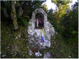 22
22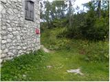 23
23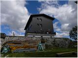 24
24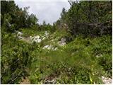 25
25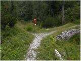 26
26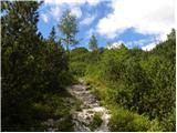 27
27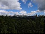 28
28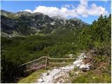 29
29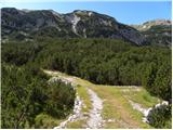 30
30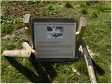 31
31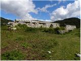 32
32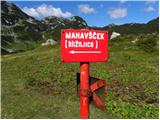 33
33 34
34 35
35 36
36 37
37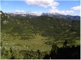 38
38 39
39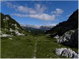 40
40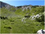 41
41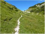 42
42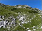 43
43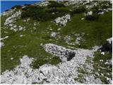 44
44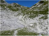 45
45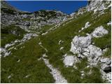 46
46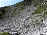 47
47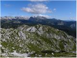 48
48 49
49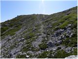 50
50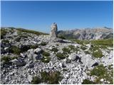 51
51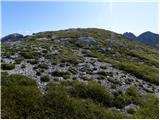 52
52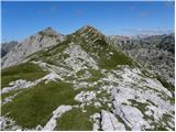 53
53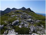 54
54
Discussion about the trip Koča pri Savici - Kser
To post a comment you must log in:
If you do not yet have a username, you must first
register.