Soboški prelaz / Koglereck - Huhnerkogel/Košenjak
Starting point: Soboški prelaz / Koglereck (1347 m)
| Latitude/Longitude: | 46,66900°N 15,00970°E |
| |
Walking time: 1 h
Difficulty: easy marked way
Elevation gain: 175 m
Elevation difference along the route: 225 m
Map: Koroška 1:50.000
Recommended equipment (summer):
Recommended equipment (winter): ice axe, crampons
Views: 9.073
 | 1 person like this post |
Access to starting point:
First, we drive to Dravograd, and then we continue driving towards Austria. Next, we drive through the border crossing Vič and follow the main road to the beginning of the settlement Labot / Lavamünd, where signs for Gradec / Graz and Ivnik / Eibiswald direct us right onto an ascending road. We then follow the nicely maintained and wide Alpine road to the mountain pass Koglereck (also Soboth), where we turn left towards the settlement Ettendorf. Immediately after the crossroads, we will notice a larger macadam parking lot on the left side, where we leave the car.
Route description:
From the parking lot, we return to the main road, cross it and continue in the direction of the peak Hühnerkogel (Slov. Košenjak). The path ahead runs on a wide gentle cart track which is surrounded on both sides by ample "plantations" of blueberries. The dense lane of blueberries soon ends, and a gentle path further brings us into a lane of bushes and sparse forest, where the footpath becomes a little more overgrown. At the crossings, we follow the blazes, and an occasionally moderately steep path, from which a nice view opens towards Golica / Koralpe, brings us into the forest, where the cart track widens again. When the cart track widens, a marked path from the settlement Soboth also joins from the left, and we continue in the already familiar direction towards Košenjak. A little further, we arrive at a wider macadam road, which we reach right at the marked crossroads.
We continue on the narrower macadam road in the direction of Košenjak and mountain hut Roßhütte, to the latter we have only 3 minutes of walking.
From the mountain hut, where the road ends and by which there is a control stamp, we continue in the direction of Košenjak / Hühnerkogel, on the path which through a shorter meadow leads into the forest. A moderate ascent through the forest follows, then the path brings us onto a gentle grassy slope, from which a nice view opens onto Golica / Koralpe. The path then returns into the forest and brings us to the state border, where we join a better beaten path which comes from the Slovenian side. Here we continue right and along the edge of the forest in 2 minutes of additional walking we ascend to the summit of Košenjak.

Along the route: Roßhütte (1438m)
Photos:
 1
1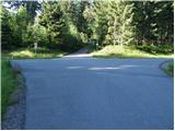 2
2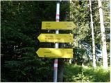 3
3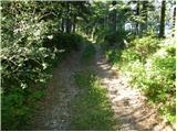 4
4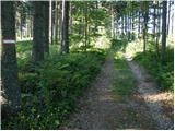 5
5 6
6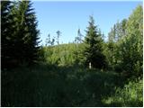 7
7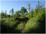 8
8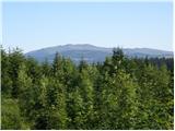 9
9 10
10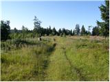 11
11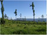 12
12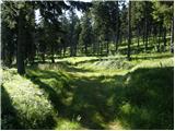 13
13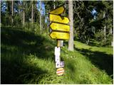 14
14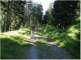 15
15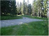 16
16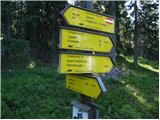 17
17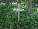 18
18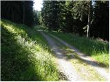 19
19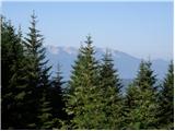 20
20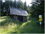 21
21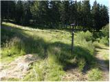 22
22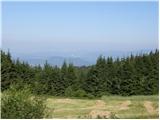 23
23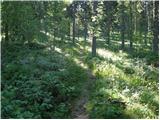 24
24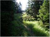 25
25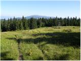 26
26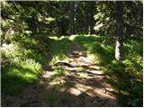 27
27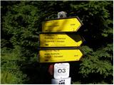 28
28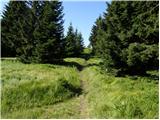 29
29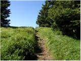 30
30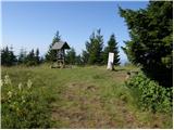 31
31 32
32
Discussion about the trip Soboški prelaz / Koglereck - Huhnerkogel/Košenjak
To post a comment you must log in:
If you do not yet have a username, you must first
register.