Konec ceste na Pokljuki - Koča na Doliču
Starting point: Konec ceste na Pokljuki (1312 m)
| Latitude/Longitude: | 46,33860°N 13,90450°E |
| |
Walking time: 4 h 45 min
Difficulty: easy marked way
Elevation gain: 839 m
Elevation difference along the route: 1100 m
Map: Triglav 1:25.000
Recommended equipment (summer): helmet
Recommended equipment (winter): helmet, ice axe, crampons
Views: 32.280
 | 3 people like this post |
Access to starting point:a) We leave the Gorenjska motorway at the Lesce exit, then follow the signs for Bled and Pokljuka. We continue through Gorje and past the Zatrnik ski resort to Rudno polje on Pokljuka, where there is a large paid parking lot, and nearby also a barracks and shooting range. From here we continue straight on the gravel road, which a little further on brings us to a junction, where we continue right (left Uskovnica). We then follow this road to the former parking lot Za Ribnico, which is located at the end of the road (nearby are mountain signs for planina Konjščica).
Recently, parking at the end of the road is prohibited, so we park already at Rudno polje, which lengthens our route by about 40 minutes. It is more appropriate to choose the marked path that starts already at Rudno polje.
b) From Železniki or Podbrdo we drive to Bohinjska Bistrica, then continue driving in the direction of Bled. Shortly after the Petrol gas station, which is located a little after Bohinjska Bistrica, we continue left in the direction of Pokljuka and Jereka. In the continuation the road first climbs steeply, then after Korita it gradually levels out and brings us to a junction at the bus stop, where we continue right in the direction of Pokljuka, Koprivnik and Jereka (straight Srednja vas). Immediately after the junction we arrive in Jereka, and from the junction in front of the church we continue straight towards Pokljuka (left Podjelje). After Jereka the road starts to climb more steeply again, higher up it levels out and continues along the Mrzli potok. When we join the road from Bled we go left and drive to Rudno polje, where there is a large paid parking lot, and nearby also a barracks and shooting range. From here we continue straight on the gravel road, which a little further on brings us to a junction, where we continue right (left Uskovnica). We then follow this road to the former parking lot Za Ribnico, which is located at the end of the road (nearby are mountain signs for planina Konjščica).
Recently, parking at the end of the road is prohibited, so we park already at Rudno polje, which lengthens our route by about 40 minutes. It is more appropriate to choose the marked path that starts already at Rudno polje.
Traffic regime in the area of Pokljuka and Uskovnica from 15.6. to 15.10.
Route description:
From the former parking lot at the end of the road we continue along a wide and initially ascending cart track in the direction of planina Konjščica. The cart track, which immediately enters a dense forest, quickly levels out and after a few minutes of easy walking turns into a footpath that continues along the left bank of the Ribnica stream. When the path gets very close to the mentioned stream it turns slightly to the right and ascends more steeply. Higher up the path levels out and brings us out of the forest to the lower edge of the extensive planina Konjščica. Here the path turns slightly to the left, crosses a small stream and after a few more steps brings us to the cheese dairy on planina Konjščica.
From the dairy we continue along a pleasant path that in a few minutes of gentle ascent brings us to the upper edge of the pasture. Here the path enters a belt of dwarf pines and shrubs and gradually begins to ascend more steeply. In the upper part of the ascent towards Jezerce, the path from Rudno polje joins us from the right, and we continue straight on a moderately steep path that in a few minutes of further walking brings us to Jezerce, where the path levels out and turns left (here to the right branches off the path to Srenjski preval).
This is followed by easy walking to the sign marking the central area of TNP, then the path begins to ascend moderately along the torrent, initially still a small stream. Higher up the path crosses to the right side of the torrent, viewed from the direction of ascent, and then ascends transversely to Studorski preval, from which a beautiful view of the mountains above Bohinj opens up.
Here the demanding path from Srenjski preval joins us from the right, and from our path also branch off unmarked trails to Ablanca and Veliki Draški vrh.
From the saddle we first descend more steeply for a short time, then the path turns to the right, and we then for a longer time with some shorter easy ascents and descents traverse the slopes to the left. From the slopes of Veliki Draški vrh we gradually arrive at the slopes of the massive Tosc, and with beautiful views we continue past the turnoff to Tosc and the crossroads where the path from Uskovnica joins us from the left.
At all crossroads, including the one where the partially abandoned path leading over planina Zgornji Tosc joins us, we continue straight, the path gradually brings us to the steeper and also precipitous southwestern slopes of Tosc mountain, where there was a landslide a few years ago, so additional caution is needed due to falling rocks. A fairly wide path leads across the precipitous part, so there are no special difficulties on this section, but when the slope becomes less steep the path from Stara Fužina or the Voje valley joins us from the left.
Here we continue slightly left in the direction of Velo polje (sharply left Voje, straight Vodnikov dom and Velska dolina along the path past Vodnikov dom). The path ahead begins to descend transversely to the right and quickly brings us to an unmarked crossroads. We continue on the right marked path (left hunting lodge), which soon levels out, then continues traversing the slopes below Vodnikov dom. After a few minutes the path turns slightly to the left and begins to descend towards Malo and Velo polje. After a short descent the path from the Voje valley joins us from the left, and we continue right and after a few dozen steps we arrive at the shepherd's huts on planina Velo polje.
From the pasture we continue slightly right or straight along the path that crosses the extensive pasture. On the other side of the pasture we come to stone barriers that prevent torrents from filling this wonderful pasture. Just a few meters before the mentioned stone barrier the path turns slightly left and ascends into a sparse, mostly larch forest. The path then turns even more to the left and brings us along gentle and slightly grassy slopes to the previously mentioned torrent, where the path that leads past Vodnikov dom joins us from the right. The path ahead continues to ascend gently along the torrent for some time, then ascends steeply below the walls of Šmarjetna glava. The steepness then quickly eases and the increasingly rocky path brings us below the walls and screes of the surrounding peaks to the Dolič saddle, where there is a marked crossroads.
We continue straight (left Hribarice, right Dom Planika pod Triglavom) along the path that begins to gradually descend and after about ten minutes brings us to Koča na Doliču.
Starting point - Planina Konjščica 0:30, Planina Konjščica - Klanci 0:40, Klanci - Jezerce 0:05, Jezerce - Studorski preval 0:30, Studorski preval - Planina Zgornji Tosc 0:35, Planina Zgornji Tosc - Na Zagonu 0:20, Na Zagonu - Velo polje 0:20, Velo polje - Velska dolina 0:25, Velska dolina - sedlo Dolič 1:15, sedlo Dolič - Koča na Doliču 0:05.

Photos:
 1
1 2
2 3
3 4
4 5
5 6
6 7
7 8
8 9
9 10
10 11
11 12
12 13
13 14
14 15
15 16
16 17
17 18
18 19
19 20
20 21
21 22
22 23
23 24
24 25
25 26
26 27
27 28
28 29
29 30
30 31
31 32
32 33
33 34
34 35
35 36
36 37
37 38
38 39
39 40
40 41
41 42
42 43
43 44
44 45
45 46
46 47
47 48
48 49
49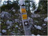 50
50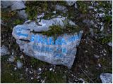 51
51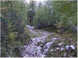 52
52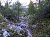 53
53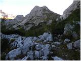 54
54 55
55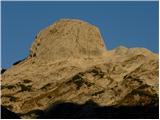 56
56 57
57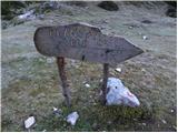 58
58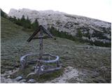 59
59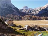 60
60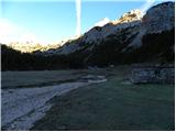 61
61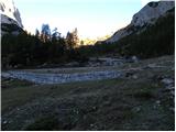 62
62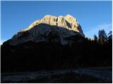 63
63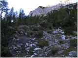 64
64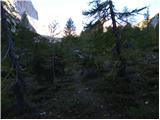 65
65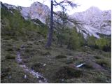 66
66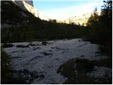 67
67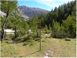 68
68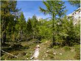 69
69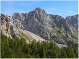 70
70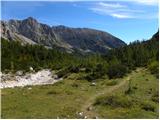 71
71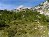 72
72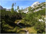 73
73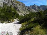 74
74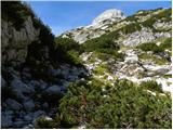 75
75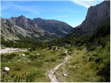 76
76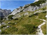 77
77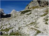 78
78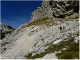 79
79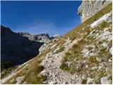 80
80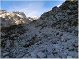 81
81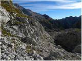 82
82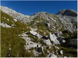 83
83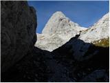 84
84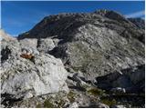 85
85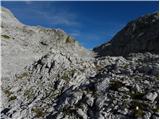 86
86 87
87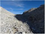 88
88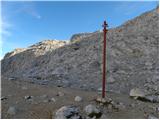 89
89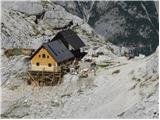 90
90
Discussion about the trip Konec ceste na Pokljuki - Koča na Doliču
|
| anamarija22. 07. 2012 |
Next weekend I want to do a tour from the end of the road on Pokljuka towards Vodnikov dom. The next day I'll summit Tosc, then I'd like to continue to Tržaška koča. But today I heard that hut is closed. Is that true? Any advice where to continue the next day from Tosc so I can overnight another day in the mountains? Where? Any idea for continuing the tour from Tosc?
|
|
|
To post a comment you must log in:
If you do not yet have a username, you must first
register.