Kopališče Lajšt - Putrihove klavže (on forest road past Brusove klavže)
Starting point: Kopališče Lajšt (392 m)
Starting point Lat/Lon: 45.96323°N 13.97972°E 
Path name: on forest road past Brusove klavže
Time of walking: 1 h 25 min
Difficulty: easy unmarked way
Difficulty of skiing: no data
Altitude difference: 178 m
Altitude difference (by path): 178 m
Map: OSM, OTP
Access to starting point:
With a car:
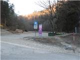
The main road between Godovič (connection from the direction of Logatec and Planina via Kalce and Ajdovščina via Col and Črni Vrh) and Idrija (connection from Tolmin and Cerkno) we leave at the turnoff in Podroteja, approximately 2 km south of Idrija; the junction is marked with signposts for Idrijska Bela, Divje jezero, and Klavže. On an asphalt but narrow road with blind turns, we drive approximately 6 km upstream along the Idrijca. Upon arriving in Idrijska Bela, we continue on the main road until we reach the Lajšt bathing area at the confluence of the Belca and Idrijca rivers. At the bathing area, several large parking lots are available where we can park. In July and August, on weekends and public holidays (August 15), parking is subject to a fairly high fee.
Public transport:
During the summer school holidays, on weekends and public holidays, a free bus is available from Idrija and Črni Vrh to the bathing area. Current information about the service and timetables can be found on the website of the Občina Idrija. Otherwise, the nearest bus stop is at the junction in Podroteja. There, we find a footbridge over the Idrijca, and on the opposite bank, we turn left onto the "Pot ob rakah" path from Idrija to the Kobila dam, then continue approximately 6 km along the footpath on the left bank of the Idrijca to the starting point.
Path description:
At the crossing immediately after the wooden bridge at the bathing area, we turn left and then keep straight along the road by the left bank of the Belca stream. Initially, the asphalt road leads past a few more houses, and then, after the traffic sign marking the end of the settlement, it turns into a macadam forest road. Also at the crossing at the end of the settlement, we keep straight. The road mildly ascends all the time, occasionally offering views through the vegetation of the Belca stream gorge on our left. Initially oriented towards the southwest, the road soon, at the footbridge (caution, it appears worn out; on the other side, we might notice a torrent waterfall), turns towards the northwest and then approximately follows this direction. Among the more interesting points, in order, are the solitary rock "Babji zob" on our left, a dam on the Belca stream, a religious symbol (chapel) below Tršanovše on our right, and all the time, scenic torrent cascades on the steep slope on our right, depending, of course, on the recent weather. The road on a slightly steeper section briefly gets an asphalt covering, and soon after, in about an hour of walking from the starting point, we reach Brusove or Belčne klavže, which we can view at our own discretion on our own responsibility (otherwise, they are well maintained).
We continue on the road and already after about 100 meters reach the crossing. The path branches off to the left, which safely brings us to the bank of Belca and the rear side of the klavže. Otherwise, we continue straight. The gorge narrows again, and in a left turn, we notice the "needle", which projects from the rock. After about 25 minutes of walking from Brusove klavže, we reach Putrihove klavže, which can also be visited at our own responsibility.
The description and photos refer to the condition at the beginning of March 2025.
Pictures:
 1
1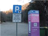 2
2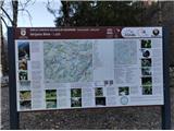 3
3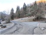 4
4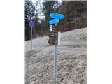 5
5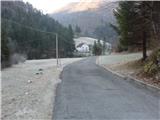 6
6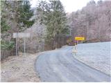 7
7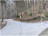 8
8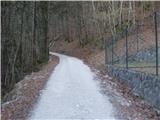 9
9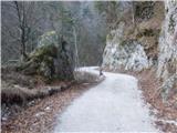 10
10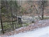 11
11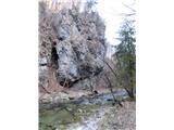 12
12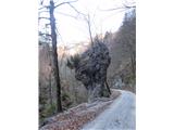 13
13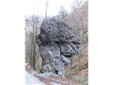 14
14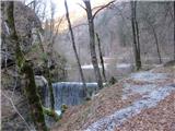 15
15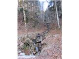 16
16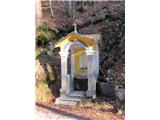 17
17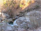 18
18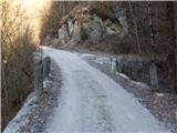 19
19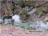 20
20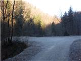 21
21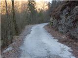 22
22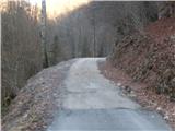 23
23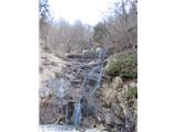 24
24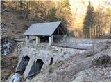 25
25 26
26 27
27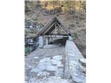 28
28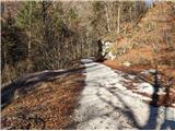 29
29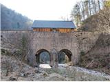 30
30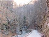 31
31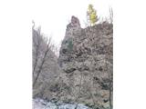 32
32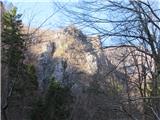 33
33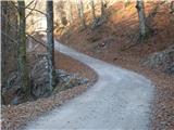 34
34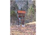 35
35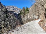 36
36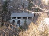 37
37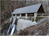 38
38