Pod Peco/Koprein Petzen - Končnikov vrh (Peca)
Starting point: Pod Peco/Koprein Petzen (1280 m)
| Latitude/Longitude: | 46,50720°N 14,71230°E |
| |
Walking time: 3 h 15 min
Difficulty: easy marked way
Elevation gain: 829 m
Elevation difference along the route: 950 m
Map: Kamniške in Savinjske Alpe 1:50.000
Recommended equipment (summer):
Recommended equipment (winter): ice axe, crampons
Views: 6.035
 | 1 person like this post |
Access to starting point:
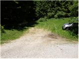
Over the border crossing Jezersko or Pavličevo sedlo we drive to Železna Kapla, and there in the beginning of the settlement, we notice signs for Lepeno / Leppen, which point us to the right. The mentioned road then through the mentioned village brings us to the village Pod Peca / Koprein-Petzen, where it starts ascending steeper. The road higher flattens and past the starting point for Topica / Topitza brings us to a small church. We continue on the main road which loses the asphalt covering and only a little after that starts descending. Only about 100 meters ahead we come to a crossroad, where we continue right in the direction of Peca / Petzen (left Globasnica / Globasnitz) on the road which only a little further brings us to a gate, near which we also park.
Route description:
From the starting point, we continue on the forest road closed to traffic, which in 5 minutes of light descent brings us to a crossroad at the beginning of the mountain pasture Luža.
We continue left in the direction of "Petzen" on the road which starts ascending by the edge of the mountain pasture. After approximately 20 minutes of walking, we will notice on the left side of the road the mountain markers for Peca, which direct us sharply left onto an ascending cart track. The mentioned cart track in a diagonal ascent quickly brings us to a newly built forest road, which we follow to the left. After some tens of meters of walking on the mentioned road we turn right onto an ascending cart track, on which we ascend through the spruce forest. After approximately 1 hour of walking from the starting point, we step again onto a macadam road, on which in a few steps we ascend to the mountain pasture Zgornja Luža.
From the mountain pasture, we continue on a marked path (at first still a road) in the direction of Peca. After some tens of steps the road turns to the right, and we continue left on a footpath which starts moderately ascending through the forest. The path gradually starts to ascend more steeply, and it brings us higher out of the forest onto slopes covered with dwarf pines. Further we ascend on increasingly panoramic slopes of Peca, on a path which after some time brings us to the main ridge, where we also step onto a junction.
We continue right in the direction of Bistriška špica and Peca (left Globasnica / Globasnitz) on the path which levels out completely and continues first along a precipitous ridge, then across the plateau-like terrain of Peca. Somewhat further, the path from the lower station of the cableway to Peca also joins us from the left, and we continue straight on the path which rises slightly and after less than 5 minutes of further walking brings us to Bistriška špica.
From Bistriška špica we continue on a marked path which starts descending along the ridge (southeast direction). After a short descent the path enters among dwarf pines, and it gradually starts ascending toward one of the peaks in the Peca range (nameless on maps). From that summit the path descends slightly and brings us to the place where we reach the state border. We continue the ascent along and on the border ridge, on the path which in a moderate ascent across a pleasant grassy slope brings us to Končnikov vrh.
Starting point - Zgornja Luža 1:00, Zgornja Luža - Bistriška špica 1:30, Bistriška špica - Končnikov vrh 45 minutes.

Photos:
 1
1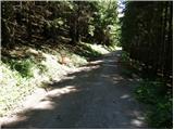 2
2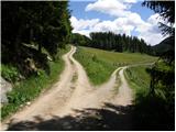 3
3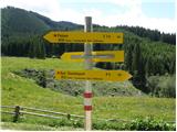 4
4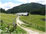 5
5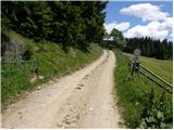 6
6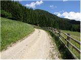 7
7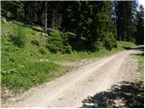 8
8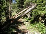 9
9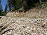 10
10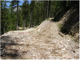 11
11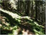 12
12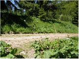 13
13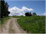 14
14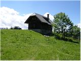 15
15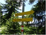 16
16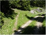 17
17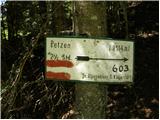 18
18 19
19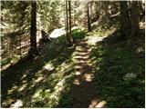 20
20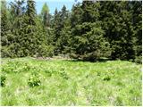 21
21 22
22 23
23 24
24 25
25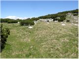 26
26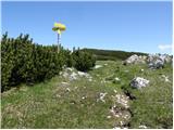 27
27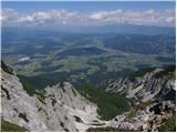 28
28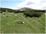 29
29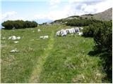 30
30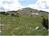 31
31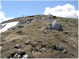 32
32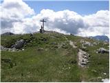 33
33 34
34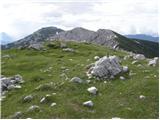 35
35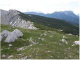 36
36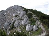 37
37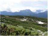 38
38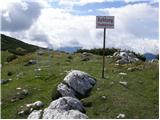 39
39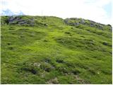 40
40 41
41
Discussion about the trip Pod Peco/Koprein Petzen - Končnikov vrh (Peca)
|
| Stingray16. 08. 2010 |
Whoever finds an hour's drive through Austria too much can leave the car on the Slovenian side in Koprivna and walk 5 minutes along the bike path from there to the hut on Planina Luža. The parking lot for the car is in Koprivna directly at the Slovenian-Austrian border, specifically at the GPS coordinates below:
46.497934
14.720921
|
|
|
To post a comment you must log in:
If you do not yet have a username, you must first
register.