Starting point: Koroška Bela (600 m)
| Latitude/Longitude: | 46,42640°N 14,10310°E |
| |
Walking time: 1 h 30 min
Difficulty: easy marked way
Elevation gain: 446 m
Elevation difference along the route: 446 m
Map: Karavanke - osrednji del 1 : 50.000
Recommended equipment (summer): helmet
Recommended equipment (winter): helmet, ice axe, crampons
Views: 14.138
 | 2 people like this post |
Access to starting point:
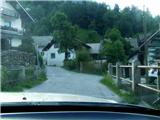
From the Ljubljana-Jesenice highway, take the Lipce exit and drive right towards Jesenice. At the first traffic-light intersection (Javornik), drive right in the direction of Lj. Next follows the second intersection with traffic lights, where we turn left and drive under the railway underpass, and in the next smaller intersection we go right towards Koroška Bela. We drive into the village, which is located in the northeast direction, where at a suitable place (e.g. block settlement near the fire station) we park. We can also continue driving.
Route description:
(On foot or by car) we look for the intersection in the centre of the village, where a church landmark stands. From here we head along the main road through the village, which goes barely noticeably uphill towards the north. After approx. 100 m on the right we cross the bridge over the stream Bela, where nearby (Stranska pot street) we can notice the first blazes. We continue on foot along the asphalt road between two houses (appearance of a yard), which here turns right.
After a short time, before it flattens, on the trees we notice blazes and the remains of an old sign "valvasor", we turn from the road onto the cart track on our left. The cart track, along which a smaller stream flows, quickly brings us to a junction, where we continue straight ahead following the blazes. The path leads us past a spring on the left, uphill towards the east and from here onwards only occasionally ascends. Only after approx. 10 min, when it turns left and loses the appearance of a cart track, does it become steeper. When the steepness eases, we step back onto a cart track and head right onto an otherwise unmarked but more used and trodden shortcut, which after a few metres turns left uphill over a clearing. The path heads towards the east and higher up brings us again onto a cart track that leads into the forest. Along it, or along numerous shortcuts on the right side of the marked path, we continue for quite some time. When the path starts to take on the appearance of a forest road, on the flat we cross the Sevnik stream. Stick to the widest path. Soon we reach a junction before a forest clearing, where on a tree on the left we notice the inscription "valvasor", and on the right an older sign "Ajdna archaeological site". Here we turn right into the forest onto a poorly visible and marked, partly overgrown path, which leads us from the forest across a clearing. Here it becomes somewhat lost, but over the slope, to follow it more easily, we walk more or less at the same altitude. The path crosses a cart track and descends only slightly. A clearing follows, where among fallen trees, with a little attention we can ascertain that the path continues in the same direction at the same altitude. It descends and ascends only a few metres. We cross a smaller stream and after a few minutes turn left slightly downhill below the northern wall of Ajdna. The path then ascends to a junction at a bench located right below the wall. Here we go right, where we quickly encounter arranged steps, on which we climb the steep slope towards the summit. When we step onto the summit ridge, we go left. After some 10 m we come upon a archaeological site similar to a smaller settlement, through and beyond which the path continues to lead us towards the summit of Ajdna. We also notice steel cables that protect the climbing path and turn right to the viewpoint with the logbook.

Photos:
 1
1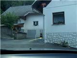 2
2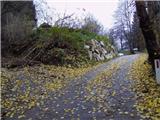 3
3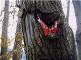 4
4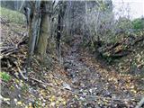 5
5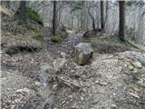 6
6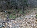 7
7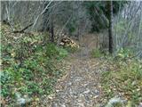 8
8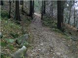 9
9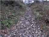 10
10 11
11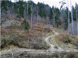 12
12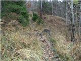 13
13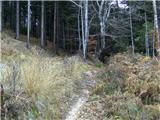 14
14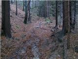 15
15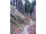 16
16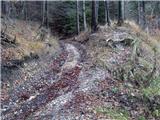 17
17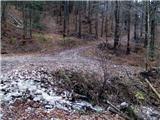 18
18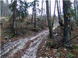 19
19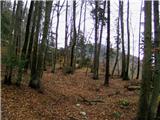 20
20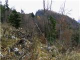 21
21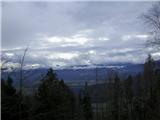 22
22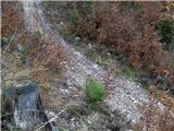 23
23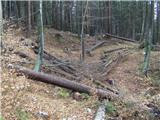 24
24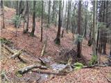 25
25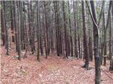 26
26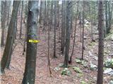 27
27 28
28 29
29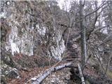 30
30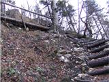 31
31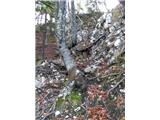 32
32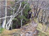 33
33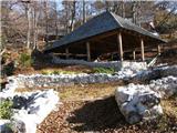 34
34 35
35 36
36 37
37
Discussion about the trip Koroška Bela - Ajdna
|
| pemi29. 11. 2015 |
Really poorly signposted and marked path, big minus for Pd who owns this path.
|
|
|
|
| d_sebjanic19. 05. 2025 10:56:15 |
We were yesterday - I recommend the other path - at picture 5. the path is quite muddy - it sinks and slips - 60-100m. At picture 19. choose the path towards Valvazor - it is more passable than this one where you have the Ajdna sign - the path is not visible at all because it is so overgrown - no markers either. We lost at least half an hour to get back to the right path.
|
|
|
To post a comment you must log in:
If you do not yet have a username, you must first
register.