Koroška Bela - Ajdna (climbing way)
Starting point: Koroška Bela (600 m)
| Latitude/Longitude: | 46,42640°N 14,10310°E |
| |
Route name: climbing way
Walking time: 1 h 30 min
Difficulty: difficult marked way
Elevation gain: 446 m
Elevation difference along the route: 446 m
Map: Karavanke - osrednji del 1 : 50.000
Recommended equipment (summer): helmet, self belay set
Recommended equipment (winter): helmet, self belay set, ice axe, crampons
Views: 10.828
 | 4 people like this post |
Access to starting point:
From the Ljubljana - Jesenice highway, take the Lipce exit and drive right towards Jesenice. At the first traffic-light intersection (Javornik), drive right in the direction of Lj. Next comes the second intersection with a traffic light, where we turn left and drive under the railway underpass, and in the next smaller intersection we head right towards Koroška Bela. We drive into the village, which lies in the northeast direction, where at a suitable place (e.g. block settlement near the fire station) we park. We can also continue driving.
Route description:
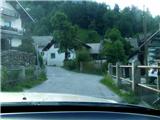
(On foot or by car) we look for the intersection in the center of the village, where a church marker stands. From here we head along the main road through the village, which rises barely noticeably towards the north. After approx. 100 m on the right we cross the bridge over the stream Bela, where nearby (Stranska pot street) we can notice the first blazes. We continue on foot along the asphalt road between two houses (appearance of a courtyard), which here turns right.
After a short time, before it levels out, we notice blazes on the trees and the remnant of an old sign "valvasor", and turn from the road onto the cart track on our left. The cart track, along which a smaller stream flows, quickly brings us to a junction, where we continue straight ahead following the blazes. The path leads past a spring on the left, uphill towards the east, and from here only occasionally ascends. Only after approx. 10 min, when it turns left and loses the appearance of a cart track, does it become steeper. When the steepness eases, we step back onto the cart track and head right onto an otherwise unmarked but more used and trodden shortcut, which after a few meters turns left uphill over a clearing. The path heads east and higher brings us back to a cart track leading into the forest. Along it, or along numerous shortcuts on the right side of the marked path, we continue for some time. When the path begins to take on the appearance of a forest road, on a flat section we cross the Sevnik stream. Stick to the widest path. Soon we reach a junction before a forest clearing, where on a tree on the left we notice the inscription "valvasor", and on the right an older sign "Ajdna archaeological site". Here we turn right into the forest onto a poorly visible and marked, partly overgrown path, which leads us from the forest across the clearing. Here it fades somewhat, but across the slope, to follow it more easily, we walk more or less at the same elevation. The path crosses a cart track and descends only slightly. A clearing follows, where among fallen trees, with some attention we can ascertain that the path continues in the same direction at the same elevation. It descends and ascends only a few meters. We cross a stream and after a few minutes turn left slightly downhill below the northern wall of Ajdna. The path then ascends to a junction at a bench located right below the wall. Here we head left towards the saddle between Ajdna and Mala Ajdna, where before entering the secured path we encounter signs. We head upwards, quickly encountering the first pitons, steel cables and pegs. Along the secured climbing path we soon arrive at the summit, where we head right to the viewpoint with the logbook.

Photos:
 1
1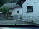 2
2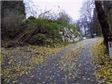 3
3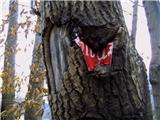 4
4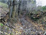 5
5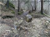 6
6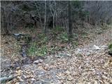 7
7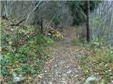 8
8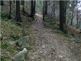 9
9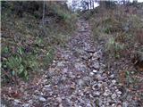 10
10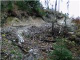 11
11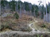 12
12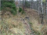 13
13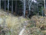 14
14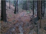 15
15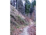 16
16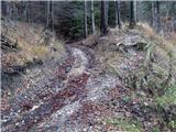 17
17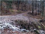 18
18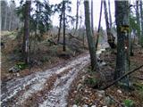 19
19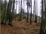 20
20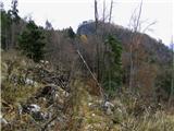 21
21 22
22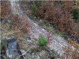 23
23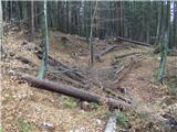 24
24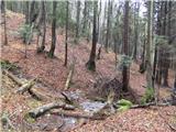 25
25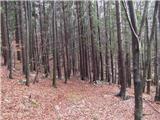 26
26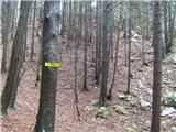 27
27 28
28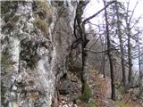 29
29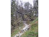 30
30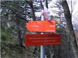 31
31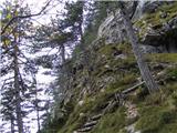 32
32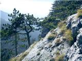 33
33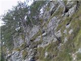 34
34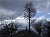 35
35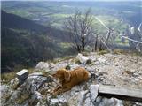 36
36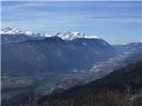 37
37
Discussion about the trip Koroška Bela - Ajdna (climbing way)
|
| heinz9. 05. 2013 |
Correction of the 5th sentence from the end in the route description: instead of - "We cross the stream and after a few minutes turn LEFT, slightly downhill, under the north face of Ajdna."- , the sentence correctly reads - "We cross the stream and after a few minutes turn RIGHT, slightly downhill, under the north face of Ajdna.
So right, instead of left.
Sorry for the error!
|
|
|
|
| matej7126. 04. 2021 22:33:04 |
On this path yesterday. As there's really little parking higher in the village, we left the car at the school. Path extends by about 5-10 min. From the sign on pic 19 onwards the path is passable, but some fallen trees on it. For return took shortcut from the bench on pic 3 between houses downhill, over footbridge and between blocks back to school. From below easiest to find path by going past Mercator uphill and after ~200m turn right (sign), between blocks find footbridge and straight up slope (sign).
|
|
|
To post a comment you must log in:
If you do not yet have a username, you must first
register.