Kozarnice - Srednji Golak (unmarked eastern way)
Starting point: Kozarnice (1068 m)
| Latitude/Longitude: | 45,96940°N 13,85820°E |
| |
Route name: unmarked eastern way
Walking time: 1 h 45 min
Difficulty: easy unmarked way
Elevation gain: 412 m
Elevation difference along the route: 420 m
Map: Goriška 1:50.000
Recommended equipment (summer):
Recommended equipment (winter): ice axe, crampons
Views: 4.629
 | 2 people like this post |
Access to starting point:
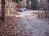
A) From central Slovenia we first drive to Logatec, then continue driving in the direction of Idrija. At Kalcah near Logatec we turn left in the direction of Col, then continue driving on a winding road towards Col. At Col we turn right and then after 100 m left in the direction of Predmeja. Further we drive on an occasionally somewhat narrower and also partly still winding road to Predmeja. At the end of Predmeja we turn right towards Lokvam (left downhill Ajdovščina), we follow the main road for less than 2 km, or to the signpost for Golake, which directs us right onto the forest road. The initially still asphalted road soon becomes macadam, and at the first intersection we follow straight, at the second right, and then drive approximately 100 m to the parking lot at the end of the drivable road.
B) From the expressway Razdrto - Nova Gorica we head to the exit Ajdovščina and follow the road ahead towards the village Lokavec (to Lokavec we come from the center of Ajdovščina, or from the old road Ajdovščina - Nova Gorica, where at the place Cesta we turn right). From Lokavec we continue driving on the ascending winding road in the direction of Predmeja. When the road levels out somewhat, we reach an intersection where the road from Col joins from the right, we continue straight and follow the main road for less than 2 km, or to the signpost for Golake, which directs us right onto the forest road. The initially still asphalted road soon becomes macadam, and at the first intersection we follow straight, at the second right, and then drive approximately 100 m to the parking lot at the end of the drivable road.
Route description:
From the parking lot we continue along the road by which we parked. The road immediately changes into a wide cart track. We follow it for approximately 15 minutes to the place where it brings us to the forest road. Here we turn right and after a few steps we come to a fork of two roads. One goes left, the other right. We turn onto the right road, where there is a barrier. We follow the road which almost horizontally crosses the slopes of Golaki towards the east past "Uscane skale" for approximately 20 minutes to the place where a wide cart track branches sharply to the left. We turn onto the cart track which in a few minutes brings us to a large meadow where a hunting observatory stands.
Here we encounter signs for Iztokova koča, we cross the meadow and on the other side spot a path that goes into the forest. Since the path is not marked we must carefully follow the path, which in moderate ascent through the forest in half an hour of walking from the meadow brings us to the marked path which comes from Idrija. Here is a small saddle and we turn left upwards. The path ascends steeply in places and brings us out of the forest. The path in the summit section runs among scrub with beautiful views. When we reach the highest point we are on the indistinct summit.

The trip can be extended to the following destinations: Mali Golak
Photos:
 1
1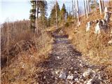 2
2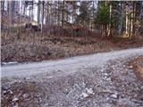 3
3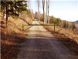 4
4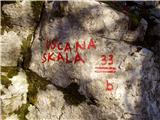 5
5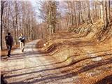 6
6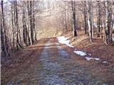 7
7 8
8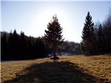 9
9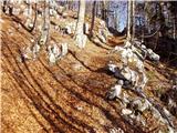 10
10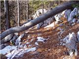 11
11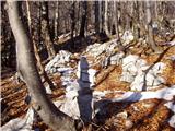 12
12 13
13 14
14 15
15
Discussion about the trip Kozarnice - Srednji Golak (unmarked eastern way)
To post a comment you must log in:
If you do not yet have a username, you must first
register.