Kramarica - Smrekovec (by road)
Starting point: Kramarica (1154 m)
| Latitude/Longitude: | 46,42600°N 14,90350°E |
| |
Route name: by road
Walking time: 1 h 30 min
Difficulty: easy marked way
Elevation gain: 423 m
Elevation difference along the route: 423 m
Map: Kamniške in Savinjske Alpe 1:50.000
Recommended equipment (summer):
Recommended equipment (winter):
Views: 16.571
 | 1 person like this post |
Access to starting point:
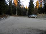
A) From the highway Ljubljana - Maribor, we go to the exit Šentrupert, and then we continue driving in the direction of Mozirje and Logarska dolina. Immediately after the village of Ljubija and just before the beginning of Mozirje, at the roundabout, we turn right in the direction of Bele Vode. Further, we again drive through Ljubija, and at first we still follow the asphalt road through the valley of the river Ljubija and higher the stream Štajerska Kramarica. At the homestead Rebršak, the asphalt road from Bele Vode joins from the right, and we still continue straight. Further, we again follow the macadam road steeply upwards, and then at the first crossroad, we continue left (right homestead Prevnik), in the second right (left homestead Zgornji Brložnik) and in the third left (right road towards Andrejev dom na Slemenu). When the road brings us to a crossroad of three roads and mountain signposts, we are on the mountain pass Kramarica, where we park.
B) From Koroška, we first drive to Črna na Koroškem, and from there we continue driving towards Topla and Koprivna. In the settlement Pristava, we turn left and further we drive through the valley of the river Bistra. At the next crossroad at an altitude of 731 m, we turn left towards homesteads Vrtačnik and Pudgarsko. At the homestead Pudgarsko, we continue straight and on a macadam road we drive to the mountain pass Kramarica, where we park.
Route description:
From the saddle Kramarica we continue on a macadam road in the direction of the mountain hut Dom na Smrekovcu. Already after a few 10 m of walking, we will get to a marked junction, where we have two options to continue.
We continue straight and continue the path in the direction of the mountain hut Dom na Smrekovcu - on the road (right Dom na Smrekovcu over Bukov stan). Ahead we gently ascend for quite some time on a macadam road which mostly runs through the forest, and then it brings us to a smaller crossroad, where we continue on the upper wider road.
From the crossroad, we follow the road only for a few minutes, and then signs for the mountain hut Dom na Smrekovcu direct us to the right on an ascending cart track, on which through the forest we ascend to the nearby larger meadow. When we step on the meadow, we continue right and ascend across it to the mountain hut Dom na Smrekovcu.
From Dom na Smrekovcu, we continue slightly right in the direction of Komen and Smrekovec. The path ahead first moderately ascends across a panoramic grassy slope, and then turns slightly to the left, where it brings us into a belt of forest. When the forest thins out, we turn slightly right and the path brings us to a marked junction, where we continue right in the direction of Smrekovec (left Komen and Raduha). Ahead we ascend for a short time through increasingly sparse forest, and then we arrive at expansive grassy slopes, across which with increasingly beautiful views we ascend to the nearby Smrekovec, which we reach after approximately 10 to 15 minutes of further walking.

The trip can be extended to the following destinations: Krnes,
Komen
Photos:
 1
1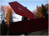 2
2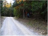 3
3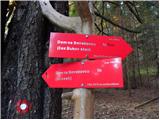 4
4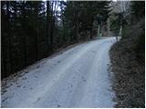 5
5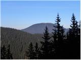 6
6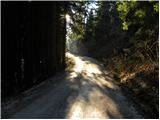 7
7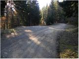 8
8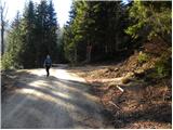 9
9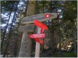 10
10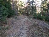 11
11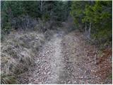 12
12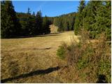 13
13 14
14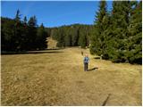 15
15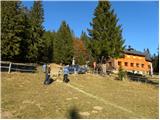 16
16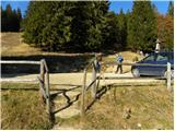 17
17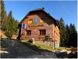 18
18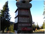 19
19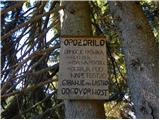 20
20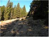 21
21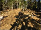 22
22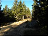 23
23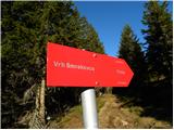 24
24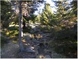 25
25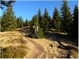 26
26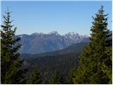 27
27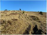 28
28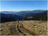 29
29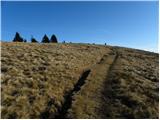 30
30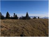 31
31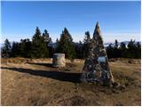 32
32 33
33
Discussion about the trip Kramarica - Smrekovec (by road)
To post a comment you must log in:
If you do not yet have a username, you must first
register.