Križovec - Barentaler Kotschna/Struška (footpath)
Starting point: Križovec (1222 m)
| Latitude/Longitude: | 46,46990°N 14,08380°E |
| |
Route name: footpath
Walking time: 2 h 30 min
Difficulty: easy unmarked way
Elevation gain: 722 m
Elevation difference along the route: 800 m
Map: Karavanke - osrednji del 1:50.000
Recommended equipment (summer):
Recommended equipment (winter): ice axe, crampons
Views: 30.487
 | 5 people like this post |
Access to starting point:
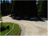
From the motorway Ljubljana - Jesenice, take the Lipce exit and follow the road ahead in the direction of Jesenice. When we come to the traffic-light junction, where we join the old road, we continue right in the direction of Žirovnica. We follow this road only for a short while, since at the next somewhat larger junction (traffic lights) we continue left in the direction of Javorniški Rovt. The road then goes through the underpass (railway) and then turns left (right Koroška Bela). We follow the road, which higher up starts to ascend steeply, in the direction of Javorniški Rovt. The road ahead runs past the mountain hut Dom Pristava (the mountain hut is a little above the road) and behind the hut we come to the next (smaller) junction, where we go right. Ahead we drive on a macadam road all the way to Križovec, which we recognise by the junction of several roads (near the junction there are a few smaller parking spots and a cross).
Route description:
From Križovec we continue past the cross on the road in the direction of Pusti Rovt. The road at the beginning leads past a gate and then slightly ascends through the forest. After approximately 15 minutes of walking, the road turns left and brings us out of the forest to the lower edge of Pusti Rovt. We continue on the road to which from the right joins the marked path from the mountain hut Dom Pristava in Javorniški Rovt, which after a few dozen steps of further walking brings us to the shepherd hut on Pusti Rovt.
From the shepherd hut we continue on the road, which in the upper part of Pusti Rovt turns right into the forest. Only a little further we come to the marked junction, where we continue slightly right (left Golica) on a moderately steep path, which a few metres higher crosses a relatively new road leading to the mountain pasture Belska planina - Svečica. We only cross the mentioned road and continue the ascent on the marked path, which soon emerges from the forest onto panoramic slopes below the saddle Sedlo Kočna. We continue the ascent past a smaller hunting hut, behind which we soon come to a watering place for animals. Only a short ascent follows and the path brings us to the saddle Sedlo Kočna, from which a nice view opens onto the Austrian side.
On the saddle we continue right in the direction of Struška (left Golica and Ptičji vrh) on a relatively gentle path that continues along the main ridge. After a few minutes the path starts to ascend more steeply and then turns sharply right, where in a traversing ascent it crosses the slopes to the right. Higher up the path brings us from the belt of sparse forest and scrub onto a panoramic ridge, where after a few dozen metres of further ascent we cross a grazing fence.
Immediately after crossing the grazing fence, the trail splits into two parts. We continue on the right lower and marked path (slightly left Struška along the ridge or along and beside the state border), which further crosses slopes towards the southeast. The path ahead continues through the forest for some time and then passes into a belt of dwarf pines, where it starts to ascend visibly again. Higher the path briefly returns to the forest and then passes onto the grazing areas of the mountain pasture Belska planina - Svečica. Here we continue slightly left and after a few minutes of further walking arrive at the shepherd hut on the mentioned pasture.
From the hut we continue eastwards at first only slightly uphill. After five minutes of walking from the hut the path brings us to a less steep gully, where we continue left onto a poorly visible unmarked path (straight ahead mountain pasture Seča).
Further we ascend the grass-covered gully surrounded by dwarf pines. The still somewhat harder-to-follow little trail, at the top of this gully, turns right into the open terrain of Struška. The path ahead in a moderate ascent crosses the southwestern slopes of Struška, which are partly covered with dwarf pines (since the path is harder to follow we can quickly stray into the dwarf pines). A little below the summit the "path" brings us to the ridge, which we follow to the top.
Orientation from the mountain pasture to the summit is somewhat harder, in fog very difficult.
Križovec - Svečica 1:45, Svečica - Struška 45 minutes.

Photos:
 1
1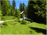 2
2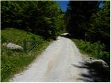 3
3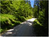 4
4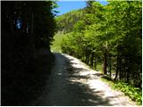 5
5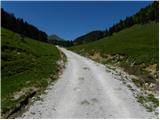 6
6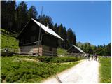 7
7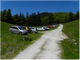 8
8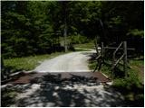 9
9 10
10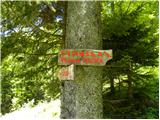 11
11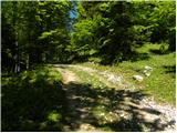 12
12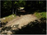 13
13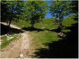 14
14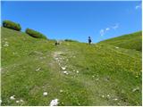 15
15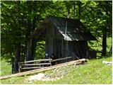 16
16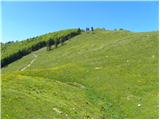 17
17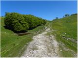 18
18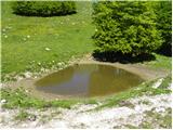 19
19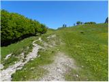 20
20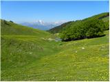 21
21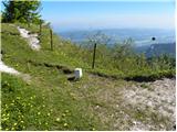 22
22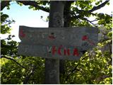 23
23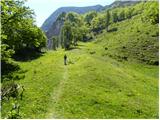 24
24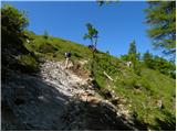 25
25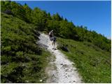 26
26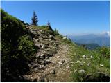 27
27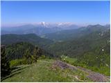 28
28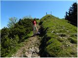 29
29 30
30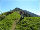 31
31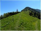 32
32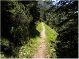 33
33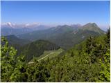 34
34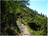 35
35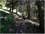 36
36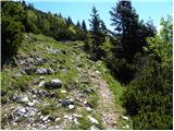 37
37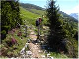 38
38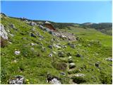 39
39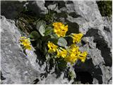 40
40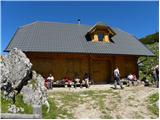 41
41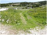 42
42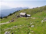 43
43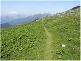 44
44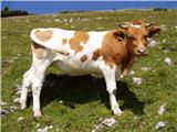 45
45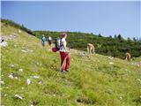 46
46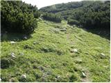 47
47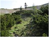 48
48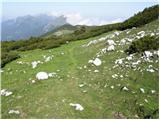 49
49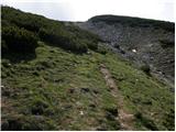 50
50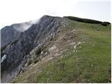 51
51 52
52
Discussion about the trip Križovec - Barentaler Kotschna/Struška (footpath)
|
| Gost20. 05. 2007 |
Extremely nice excursion, especially in spring time. The view is wonderful, especially interesting is the nature full of flowers, and also medicinal herbs. I recommend
Franci
|
|
|
|
| heinz29. 05. 2008 |
Beautiful thing, I agree that it's nicest there in spring, especially because of the flowers. Currently, you can drive by car to Pusti Rovt, because the "barrier" at Križovec is open. I was there first today, but will definitely return soon.
|
|
|
|
| tonej2. 06. 2008 |
On Saturday, May 31st I was up there. On the return at Pristava I talked with a local who said that the name "Struška" until recently no one used - for them it's only and solely Belska pl.
What's with this naming?!
|
|
|
|
| MiR20. 05. 2010 |
Hello! Can anyone tell me about the flower situation on Struška? Has spring arrived yet, or is it still winter up there? Thanks for replies and regards!
|
|
|
|
| heinz20. 05. 2010 |
No, spring hasn't come to Struška yet. You'll need to wait another cca 2 weeks or more for the flowers..
There's only a little snow left.
|
|
|
|
| MiR21. 05. 2010 |
Heinz, thanks for the reply. We'll wait a little longer. Good luck!
|
|
|
|
| Majdag21. 05. 2010 |
20.5.2010
Around the Svecice hut there is already some avrikeljna,
mačeh and gentian are still very scarce,(pictures)
|
|
|
|
| rober22. 05. 2010 |
About like this it was a few days ago on the circular path through Belska planina around the hut, which is nicely renovated...
|
|
|
|
| sunshine24. 04. 2012 |
Please can someone tell me what the conditions on Struška are like?:
|
|
|
|
| heinz24. 04. 2012 |
snow, but not really suitable for touring..
|
|
|
|
| sunshine26. 04. 2012 |
Thanks, I was thinking of going tomorrow, nice weather.
|
|
|
|
| francimedved21. 05. 2012 |
That's how it was yesterday on Struška.
|
|
|
|
| Majdag3. 06. 2019 |
Mala Golica, Ptičji vrh, Planina Svečica ali Belska planina, Veliki vrh ... was my yesterday's ramble. Narcissus bloom all under Krvavka. On Belska planina there is a colourful symphony of wonderful flowers. On Veliki vrh Struška there is still quite a lot of snow in the hollows. The scree is scattered and passages are difficult in many places. There is not much flowers on the top, but enough around the hut.
https://jelenkamenmajdag.blogspot.com/2019/06/belo-in-modro-in-rumeno-incvetoci-raj.html
|
|
|
|
| zlatica6. 06. 2019 |
Majda, you had a nice time and walked a lot. I was also at Belska planina on Tuesday, and that was already enough, both in beauty and walking. That's how it is. But do you perhaps know why this hut, which is so beautiful, is never open? At least I've never come across open doors yet.
|
|
|
|
| Majdag6. 06. 2019 |
It is open during the grazing season, definitely on weekends. It is a shepherd's hut and I don't know if anyone sells anything.
|
|
|
|
| zlatica7. 06. 2019 |
Thanks, Majda for the reply.
|
|
|
|
| Majdag7. 06. 2019 |
You too, Zlatica.
|
|
|
|
| donat8. 06. 2019 |
If the shepherd is there, you might get some pear.
|
|
|
|
| megla14. 02. 2020 |
On a couple of shorter sections icy, but it's manageable.
|
|
|
|
| babim17. 06. 2021 18:39:33 |
Today to Belska planina and to the top of Struška. The flowers on Belska planina are slowly fading, but there are still plenty on Struška, we went up part of the path on snow. A nice day was spoiled by a quad bike, whose rattling we heard on the descent towards Križovec. When we got lower, we noticed a huge cloud of dust over the entire parking lot, as the rascal was doing circles around the parking lot past the cars at full speed and braking. We started warning him and waving our poles, then he drove off on the road, I think towards Golica.
Maybe hikers and cars annoy some local, I don't know how to explain it. What the cars were like, I'd rather not say. The car is the least problem, the intention and recklessness is more concerning.
|
|
|
|
| Majdag28. 09. 2023 16:42:08 |
26.9...Last hairpin - Belska planina - Struška...The road through Savske jame is currently well maintained. Drive through Pusti rovt at your own risk. Calves, donkeys, horses, cows, probably also bulls, all graze on Pusti rovt. Wonderful day, mists and sun. Great views, just the grass is already wet and good footwear comes in handy. Struška is always nice and at this time of year has little visitors.
|
|
|
To post a comment you must log in:
If you do not yet have a username, you must first
register.