Križovec - Kahlkogel/Golica (via mountain hut)
Starting point: Križovec (1222 m)
| Latitude/Longitude: | 46,46990°N 14,08380°E |
| |
Route name: via mountain hut
Walking time: 2 h
Difficulty: easy marked way
Elevation gain: 613 m
Elevation difference along the route: 625 m
Map: Karavanke - osrednji del 1:50.000
Recommended equipment (summer):
Recommended equipment (winter): ice axe, crampons
Views: 102.624
 | 2 people like this post |
Access to starting point:
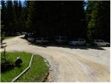
From the Ljubljana–Jesenice highway, take the Lipce exit and follow the road ahead towards Jesenice. When we reach the traffic-light intersection where we join the old road, continue right towards Žirovnica. Follow this road only for a short time, as at the next somewhat larger intersection (traffic lights) we continue left towards Javorniški Rovt. The road then goes through the underpass (railway) and then turns left (right to Koroška Bela). Follow the road, which starts ascending steeply higher up, towards Javorniški Rovt. The road ahead passes Dom Pristava (the hut is a little above the road) and after the hut we reach the next (smaller) intersection, where we turn right. Ahead we drive on a macadam road all the way to Križovec, which we recognise by the intersection of several roads (there are a few smaller parking spots and a cross at the intersection).
Route description:
From Križovec we continue past the cross along the road towards Pusti Rovt. The road at the beginning leads past a ramp and then gently ascends through the forest. After approximately 15 minutes of walking, the road turns left and brings us out of the forest to the lower edge of Pusti Rovt. We continue along the road to which a marked path from Dom Pristava na Javorniškem Rovtu joins from the right; this then brings us to the shepherd's hut on Pusti Rovt after a few dozen steps of further walking.
From the shepherd's hut we continue along the road, which in the upper part of Pusti Rovt turns right into the forest. A little further on we reach a marked junction, where we continue left (slightly right Sedlo Kočna and Struška) along the road, which ahead in a gentle ascent crosses the slopes to the left. A little further, a path from Markljev Rovt joins from the left, and the road quickly brings us to Sedlo Suha.
From the saddle we continue briefly along the road, then the signs for Koča na Golici direct us slightly right onto a footpath, which ahead ascends transversely towards the west. The path soon levels out completely, crosses some scenic slopes, and then joins the path from Planina pod Golico in a gentle descent.
We continue towards Golica and continue the ascent along a fairly wide path, which we follow all the way to Koča na Golici, reaching it after a good 10 minutes of further walking.
From the hut we continue along the marked path towards Golica. The path ahead first ascends transversely across the slopes of Krvavka, then turns left, crossing a small valley between the aforementioned peak and Golica. When we reach the western side of the valley, the path begins to ascend more steeply, and then, just a few dozen metres before reaching the ridge, the "ridge" path from Sedlo Suha joins from the right. We continue left and follow the increasingly panoramic path all the way to the summit of Golica, which we reach without major difficulties.

Photos:
 1
1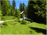 2
2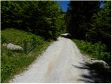 3
3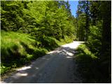 4
4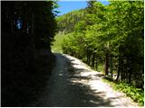 5
5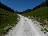 6
6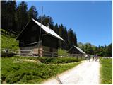 7
7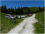 8
8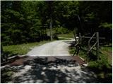 9
9 10
10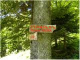 11
11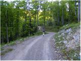 12
12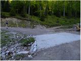 13
13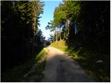 14
14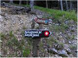 15
15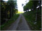 16
16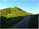 17
17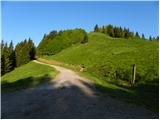 18
18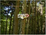 19
19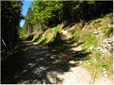 20
20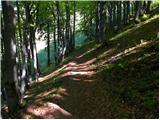 21
21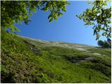 22
22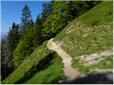 23
23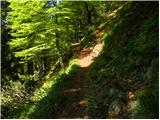 24
24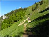 25
25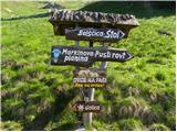 26
26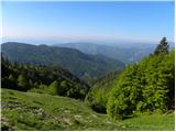 27
27 28
28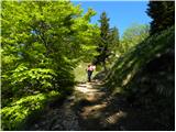 29
29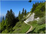 30
30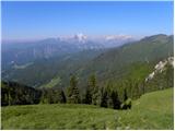 31
31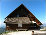 32
32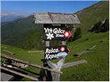 33
33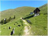 34
34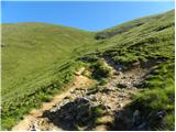 35
35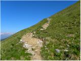 36
36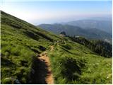 37
37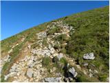 38
38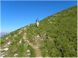 39
39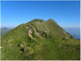 40
40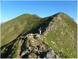 41
41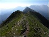 42
42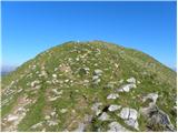 43
43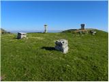 44
44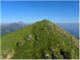 45
45 46
46
Discussion about the trip Križovec - Kahlkogel/Golica (via mountain hut)
|
| bostjan8530. 09. 2010 |
I'm interested in how the road to this starting point is arranged.
|
|
|
|
| Bojan_A30. 09. 2010 |
The road is good: some potholes can be found, otherwise it's a quite solid gravel road.
|
|
|
|
| banananjam15. 07. 2013 |
we went yesterday and it really has a nice view and it was sunny too, only it bothered me a bit because they graze sheep, and we were already looking forward to some cheese but there's none available. pity but otherwise a nice trip also for slightly younger mountain participants
|
|
|
|
| balon18. 08. 2013 |
how long is the hike if you start from picture 18?
Thanks
|
|
|
|
| otiv18. 08. 2013 |
I think during grazing season you can't drive higher than Križovec.
|
|
|
|
| balon2. 05. 2014 |
How long is the walk from Križovec?
|
|
|
|
| viharnica2. 05. 2014 |
I left the car at Križovec and walked (where picture no. 18 is) to the right, up the hill and along the top all the way to the goal. I liked the path because you can enjoy views on both sides right from the start. I recommend it.
What are the current conditions on Golica and how are the narcissus?
|
|
|
|
| Pohodnica562. 05. 2014 |
Yesterday from Križovec towards Golica, but unfortunately not yet up the hill, chose a slightly lower path (picture 18, a bit further along the road and then up the slope). Narcissi haven't reached yet, but soon will. They are down in Javorniški rov, at Dom Pristava.
|
|
|
|
| balon11. 05. 2014 |
Thanks for the answers. I'm interested where the stamp is located.
|
|
|
|
| balon25. 06. 2014 |
I overlooked it in the description. 
|
|
|
|
| Pohodnica564. 05. 2015 |
This year I'd also like to go to Golica, but due to issues (lungs-operation....) for now I can't tackle steeper trails. On picture 20 a footpath branches off the road, but it's steep. Can one continue along the road to the hut, I'd manage a longer but slightly less steep trail more easily. Thanks for answers and safe steps everyone.
|
|
|
|
| sirt14. 05. 2015 |
Pohodnica56
The path that branches off at pic.20 rises very gently towards the Golica hut. Only the last ~100m are steeper. Altogether less than 150m elevation gain.
|
|
|
|
| Pohodnica564. 05. 2015 |
@Sirt1 thanks, thanks, if I'll "really" puff, I'll go more slowly  One more question, if I may. That section on picture 23 was almost "erased" last year by snow sliding, plus a bit more wet, so I almost turned back, because I have a nasty experience-slip, is the trail better maintained this year? I promise, I won't ask anymore, so no one gets too annoyed Thanks a thousand times again for this answer. One more question, if I may. That section on picture 23 was almost "erased" last year by snow sliding, plus a bit more wet, so I almost turned back, because I have a nasty experience-slip, is the trail better maintained this year? I promise, I won't ask anymore, so no one gets too annoyed Thanks a thousand times again for this answer.
|
|
|
|
| Valant9926. 04. 2017 |
And who knows how long it takes to drive to the starting point from Celje or Ljubljana?
THANKS!
|
|
|
|
| Edina26. 04. 2017 |
Roughly speaking; good 70 km and a good hour's drive from Ljubljana, that should be precise enough for planning the tour. Good luck and best
|
|
|
|
| saram30. 05. 2020 |
Today on this path. At eight (8) o'clock empty parking lot. Path OK. At the hut already quite a few visitors. Descent from Golica via Mala Golica. On return parking lot full. Lp
|
|
|
|
| zaspanka15. 06. 2023 12:32:34 |
On Saturday at 6 am the parking lot was almost completely empty. On the way back around 10 am it was all full.
From this starting point to the top or hut it's almost 3km of walking on a flat gravel road, so this part is a bit more boring. On this road I noticed several gates and signs "bull on pasture", currently there was no bull and you can easily drive another 3km towards the Golica signs and start your hiking trail there (at picture 18).
|
|
|
|
| jprim16. 06. 2023 21:15:56 |
@zaspanka
Maybe the bulls were resting then.
LP!
|
|
|
|
| balon26. 09. 2023 09:26:20 |
Hello,
has anyone been to Golica in the last few days? I'm just wondering if there's anything special.
I've already checked under current conditions but there's no record.
Thanks in advance.
|
|
|
|
| balon27. 09. 2023 08:34:23 |
bbugari1 thanks for the reply.
|
|
|
|
| Majdag21. 12. 2024 08:17:43 |
Notice from PD Jesenice..
IMPORTANT NOTICE FOR THE HUT ON GOLICA!
Much more snow has fallen than expected, so the caretaker couldn't reach the hut. On Saturday there will be club members in the hut, only limited offer available. On Sunday the hut will be closed.
Due to the large amount of fresh snow, use the winter path obligatorily. The road to Križovcev is not passable.
Please share!
|
|
|
To post a comment you must log in:
If you do not yet have a username, you must first
register.