Križovec - Koča na Golici
Starting point: Križovec (1222 m)
| Latitude/Longitude: | 46,46990°N 14,08380°E |
| |
Walking time: 1 h 20 min
Difficulty: easy marked way
Elevation gain: 360 m
Elevation difference along the route: 375 m
Map: Karavanke - osrednji del 1:50.000
Recommended equipment (summer):
Recommended equipment (winter): ice axe, crampons
Views: 21.329
 | 2 people like this post |
Access to starting point:
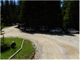
From the highway Ljubljana - Jesenice we go to the exit Lipce and follow the road ahead in the direction of Jesenice. When we come to the traffic-light crossroads, where we join the old road, we continue right in the direction of Žirovnica. We follow this road only a short time because at the next somewhat larger crossroads (traffic light) we continue left in the direction of Javorniški Rovt. The road then goes through the underpass (railway) and then turns left (right Koroška Bela). We follow the road, which higher up starts to ascend steeply, in the direction of Javorniški Rovt. The road ahead runs past Dom Pristava (the hut is a little above the road) and behind the hut we come to the next (smaller) crossroads, where we go right. Ahead we drive on a macadam road all the way to Križovec, which we recognize by the crossroads of several roads (by the crossroads there are a few smaller parking spots and a cross).
Route description:
From Križovec we continue past a cross on the road in the direction of Pusti Rovt. The road at the beginning leads past a gate and then slightly ascends through the forest. After approximately 15 minutes of walking, the road turns to the left and out of the forest brings us to the bottom edge of Pusti Rovt. We continue on the road to which from the right joins the marked path from Dom Pristava na Javorniškem Rovtu, which after some 10 steps of additional walking brings us to the shepherd hut on Pusti Rovt.
From the shepherd hut we continue on the road, which in the upper part of Pusti Rovt turns right into the forest. Only a little further we come to a marked junction, where we continue left (slightly right Sedlo Kočna and Struška) on the road which ahead in a gentle ascent crosses the slopes to the left. A little further from the left also joins the path from Markljev Rovt, and the road quickly brings us to Sedlo Suha.
From the saddle we continue a short time on the road, then the signs for Koča na Golici direct us slightly to the right onto a footpath which further traverses ascending towards the west. The path soon entirely flattens, crosses some panoramic slopes, and then in a gentle descent joins the path from Planina pod Golico.
We continue in the direction of Golica and continue the ascent on a quite wide path, which we follow all the way to Koča na Golici, which we reach after good 10 minutes of additional walking.

Photos:
 1
1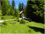 2
2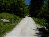 3
3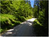 4
4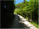 5
5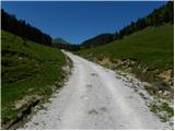 6
6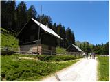 7
7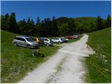 8
8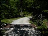 9
9 10
10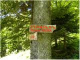 11
11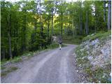 12
12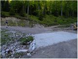 13
13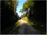 14
14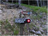 15
15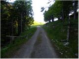 16
16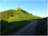 17
17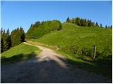 18
18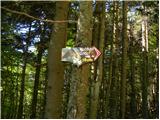 19
19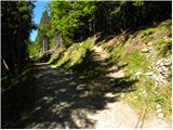 20
20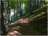 21
21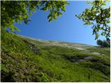 22
22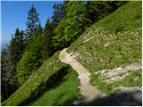 23
23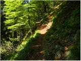 24
24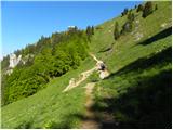 25
25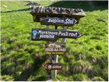 26
26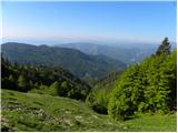 27
27 28
28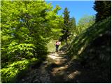 29
29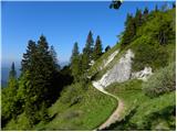 30
30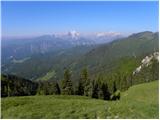 31
31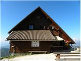 32
32
Discussion about the trip Križovec - Koča na Golici
|
| marezt30. 03. 2012 |
Does anyone have time to add an entry up there also from Dom Pristave to Koča na Golici
|
|
|
|
| Tadej30. 03. 2012 |
The trail description is on the link below.
|
|
|
|
| mpogac29. 05. 2019 |
Just one question ... Is there possibly still snow anywhere on this path and further to the summit?
|
|
|
|
| Edina29. 05. 2019 |
This path crosses steep gullies where snow sometimes lingers for a long time, but it's not visible from the east side. Definitely none on the path from Suha saddle along the ridge over Mala Golica and Krvavka, at least not on Sunday. Definitely a better option during narcissus season
|
|
|
|
| Majdag23. 04. 2025 15:29:15 |
21.4.... Ptičji vrh, sedlo Suha, koča pod Golico... We started at the end of Pusti rovt, at the junction of roads, behind Kočna, sedlo Suha and Belska planina. Continued towards Ptičji vrh. Lots of chirping in the bushes and snowdrops blooming towards the summit. Plenty through the forest too. No narcissus yet, not even greenery. Lots of visitors at the hut and also hikers to the top of Golica. Across Pusti rovt there are wide and deep ditches dug on the sides. On the grassy area there are rocks, parking won't be possible. The road to Križovci is in good condition, good luck!
https://jelenkamenmajdag.blogspot.com/2025/04/pticji-vrh-in-koca-pod-golico.html
|
|
|
To post a comment you must log in:
If you do not yet have a username, you must first
register.