Laško - Storžič (on southwest ridge)
Starting point: Laško (757 m)
| Latitude/Longitude: | 46,32560°N 14,39690°E |
| |
Route name: on southwest ridge
Walking time: 4 h 5 min
Difficulty: difficult unmarked way
Elevation gain: 1375 m
Elevation difference along the route: 1392 m
Map: Karavanke - osrednji del 1:50.000
Recommended equipment (summer):
Recommended equipment (winter): ice axe, crampons
Views: 11.540
 | 1 person like this post |
Access to starting point:
a) From the Ljubljana - Jesenice motorway, take the Kranj - east exit, then continue driving towards Jezersko. When we arrive in Preddvor, leave the main road and continue left towards the centre of the mentioned town, from there follow the signs to the Bašelj settlement. When we arrive in Bašelj, at the beginning of the left bend a narrower road continues straight ahead to the parking lot at the TD Bašelj cabin (starting point Bašelj in descriptions), but we continue along the main road for another good 100 m to the next intersection, where we turn right onto the road towards Gamsov raj and the Laško hamlet. About 50 m further, continue on the left road, which gradually begins to ascend moderately. At the Laško hamlet, turn left again, then the asphalt ends and we continue driving on a steep gravel road, which we follow to the parking lot at a small intersection. Red mountain direction signs are located at the intersection.
b) From the Jesenice - Ljubljana motorway, take the Kranj - west exit and at the first intersection continue left. Then we drive through the underpass under the motorway, then arrive at a roundabout, from which we continue driving towards Golnik. The road ahead leads through the Mlaka pri Kranju settlement, but at the end of the settlement we turn right towards the Srakovlje settlement. This is followed by driving through Srakovlje, Spodnja Bela, Srednja Bela, Zgornja Bela (in Zgornja Bela we join the road from Preddvor) to Bašelj, where the main road makes a long left bend, where a narrower road continues straight ahead to the parking lot at the TD Bašelj cabin (starting point Bašelj in descriptions), but we continue along the main road for another good 100 m to the next intersection, where we turn right onto the road towards Gamsov raj and the Laško hamlet. About 50 m further, continue on the left road, which gradually begins to ascend moderately. At the Laško hamlet, turn left again, then the asphalt ends and we continue driving on a steep gravel road, which we follow to the parking lot at a small intersection. Red mountain direction signs are located at the intersection.
Route description:
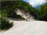
From the parking lot, head onto the steep cart track towards Lovrenc. After a short steep ascent, the cart track brings us to a junction where a footpath branches right to the church of St. Lovrenc. We continue on the lower cart track path, which again starts to ascend more steeply and brings us to the Dom na Lovrencu after 15 minutes of walking from the starting point.
At the hut, continue on the path towards Storžič and after a few steps the path takes us out of the forest onto meadows below the church. We reach the church of St. Lovrenc in a few minutes walking across the meadow.
Continue across the meadow past the church and the path soon takes us into the forest. Further on, the wide path gently descends to an indistinct saddle where a path from a slightly higher starting point joins us. Further ahead towards Storžič we continue on the wide path, which gently ascends. The path soon narrows and then ascends steeply through the forest for quite some time. Higher up, the path takes us out of the forest and beautiful views open up to the southern slopes of Storžič. The steepness does not let up all the way to a bench at the junction.
Left is a marked path towards Javornik and Poljana, right towards Kališče. At the junction, we do not continue neither left nor right, but onto an unmarked path straight ahead. The somewhat less trodden path we will notice to the left of the tree on which there are direction signs. From the junction, the path ascends the grassy slope, which becomes steeper and soon brings us near an indistinct gully. Here we continue somewhat to the left and then ascend to the left of the mentioned gully towards the southwest ridge of Storžič. The slope on this side is also somewhat more wooded. The path is somewhat less trodden, but we can follow it without major difficulties. As we approach the ridge, the path turns right and crosses the grassy slopes. A short steep ascent to the ridge follows. The grassy slopes are quite steep on most of the path and very dangerous for slipping when wet. Even when dry, some caution is needed.
When we reach the ridge, continue right and then ascend mostly grassy and relatively steep ridge. On steeper sections, the path several times moves away from the ridge to the left or right side. We follow the ridge until we join the marked path from planina Javornik. The marked path then turns slightly right and soon paths from Dom pod Storžičem and Kališče join us. To the summit, which we can already see ahead, only a short ascent remains.
Descent possible via planina Javornik or towards Kališče.
Starting point - Dom na Lovrencu 0:15, Dom na Lovrencu - sv. Lovrenc 0:05, sv. Lovrenc - saddle at sv. Lovrencu 0:10, saddle at sv. Lovrencu - wide valley 1:45, Wide valley, Wide valley - junction on Storžič ridge 1:35, junction on Storžič ridge - Storžič 0:15.
Description and photos refer to the condition in 2015 (June).

Photos:
 1
1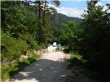 2
2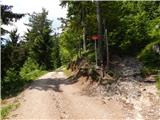 3
3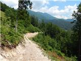 4
4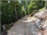 5
5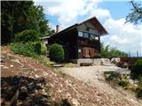 6
6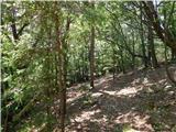 7
7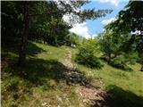 8
8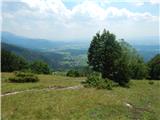 9
9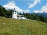 10
10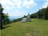 11
11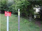 12
12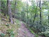 13
13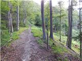 14
14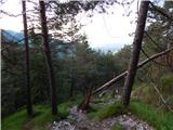 15
15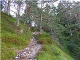 16
16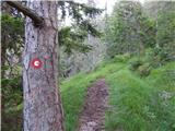 17
17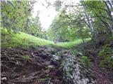 18
18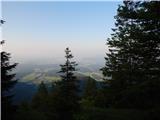 19
19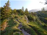 20
20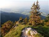 21
21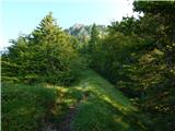 22
22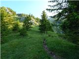 23
23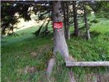 24
24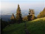 25
25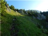 26
26 27
27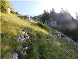 28
28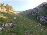 29
29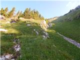 30
30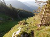 31
31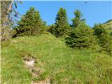 32
32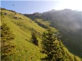 33
33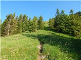 34
34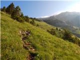 35
35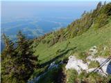 36
36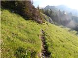 37
37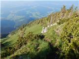 38
38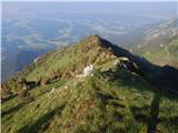 39
39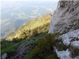 40
40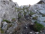 41
41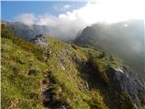 42
42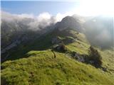 43
43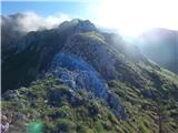 44
44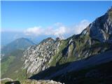 45
45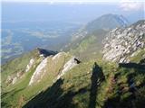 46
46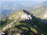 47
47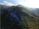 48
48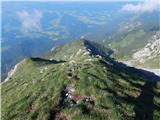 49
49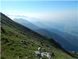 50
50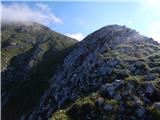 51
51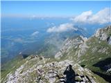 52
52 53
53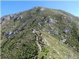 54
54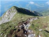 55
55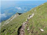 56
56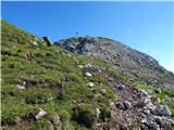 57
57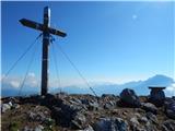 58
58 59
59 60
60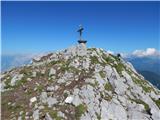 61
61
Discussion about the trip Laško - Storžič (on southwest ridge)
|
| zamudu22. 07. 2016 |
We hiked the tour yesterday (ascent, descent via Kalisce). Very pleasant. For a long time we haven't seen such large, fresh clumps of edelweiss as yesterday in the upper part of the ridge.
Only on the descent I missed the signposts for Laško, everywhere only Baselj  . .
Zvone
|
|
|
|
| Romancha25. 10. 2019 |
24.10. the road to the parking is desperate for normal (relatively low) cars. Better leave it below, not on the gravel road. I left it at the first bend (about 200m from the farm), because I didn't dare reverse through the potholes. Further up it's even worse.
|
|
|
|
| tango12. 11. 2021 14:55:51 |
Trail without special features, fog up to 1200m, then sunny and warm. We returned to Javornik and the first part was a real muddy adventure, so traversing the scree was even more enjoyable. From Karničar hut on Javornik we headed towards Kališče, but only to the bench at the junction (picture 24) then down to the starting point.
Nice autumn hike, next time we'll avoid the descent to Javornik and choose another variant, as there are plenty.
|
|
|
|
| mamaricka11. 07. 2023 20:12:51 |
Today via this path to Storžič. Wonderful panoramic path. Highly recommend. Road to parking really not in best condition, so sensible to park at parking below the farm. Day was hot, but pleasant breeze along the ridge. Returned via Kališče.
|
|
|
|
| Loni12. 07. 2023 09:10:30 |
The road is in such condition because every rain "fixes" it, then tractors and cars do their bit, and in the end you have a pump track variant.
|
|
|
To post a comment you must log in:
If you do not yet have a username, you must first
register.