Starting point: Lenzanger (1550 m)
| Latitude/Longitude: | 47,08142°N 12,98469°E |
| |
Walking time: 5 h 10 min
Difficulty: difficult marked way
Elevation gain: 1704 m
Elevation difference along the route: 1704 m
Map:
Recommended equipment (summer): helmet, ice axe, crampons
Recommended equipment (winter): helmet, ice axe, crampons
Views: 4.770
 | 3 people like this post |
Access to starting point:
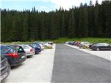
Through the Karawanks Tunnel, we drive to Austria, and then we continue driving on the Tauern highway. Further, we drive through the Katschberg Tunnel and later also the Tauerntunnel. We follow the highway towards Salzburg (also Solnograd) only to the exit for Bischofshofen, from where we continue driving on a four-lane road towards the already mentioned town. From Bischofshofen we follow the signs for Zell am See through the valley by the river Salzach. At the end of Taxenbach we turn towards Rauris. Further, we drive through the Raurisertal valley through Rauris and Wörth. We then follow the ascending road all the way to the large parking lot Lenzanger. In the last part, the road is a toll road (9€ - August 2013).
Route description:
From the parking lot, we continue following the signs »Naturfreundehaus« on the road, which is further closed to traffic. The road, which immediately after the gate becomes a macadam road, first leads us through the forest and brings us to a crossroads. To the right, slightly downhill, the road leads towards the alpine pasture Grießwiesalm, while we continue slightly to the left on the road towards the hut Naturfreundehaus.
The road then soon brings us out of the forest and leads us along the stream Scheidbach with beautiful views towards the summit Hoher Sonnblick. Here we soon come to a junction where we continue right over the bridge on footpath 123 towards the notch Goldzechscharte and the summit Hocharn. Further along the road, the path leads towards the hut Naturfreundehaus.
After crossing the bridge, the path leads us for a short time across slightly swampy terrain, then across meadows towards the southwest. Further on, we walk for some time along the path, which runs alongside bushes and brings us back near the stream. Here the path turns right and begins to ascend more steeply. At the very beginning, a steel cable assists us. The path then mostly ascends in zigzags over grassy terrain occasionally covered with bushes. Higher up, the bushes end and an ascent follows on grassy slopes from which we have a nice view all the time on the Raurisertal valley and nearby summits. We have an especially nice view of the north face of the nearby Hoher Sonnblick. On the grassy slopes, the path turns slightly to the left and then crosses several smaller streams. When we approach steeper slopes over which numerous streams and smaller waterfalls flow in the summer months, the path turns right and ascends somewhat more steeply. Here we ascend rocky terrain towards the northwest; the trail is not very visible, so we must pay even more attention to the markers. Higher up, the path turns somewhat to the left and crosses some snowfields that persist late into summer. The use of an ice axe and crampons is recommended for crossing. Further on, the path turns a bit more to the left and crosses the slopes towards the west in a gentle ascent. This path then brings us to the ridge near the notch Nördliche Goldzechscharte, where there is also a junction.
At the junction, where a view opens towards the west, we continue right; to the left, the path leads to Goldzechkopf and further to the summit Hoher Sonnblick. From the junction, the path mostly ascends along the ridge beside the glacier Hocharnkees. On a shorter section where the ridge becomes somewhat steeper, the path moves away from the ridge to the right (east) side. A renewed ascent to the ridge follows, from which increasingly beautiful views open up. When we reach the forepeak (3203 m), the ridge turns somewhat to the right. We continue along the ridge and, on a slightly steeper slope, soon reach the summit.

Photos:
 1
1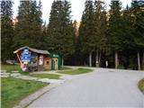 2
2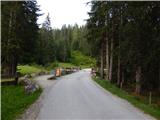 3
3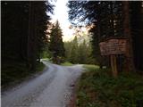 4
4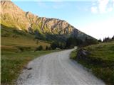 5
5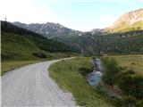 6
6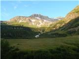 7
7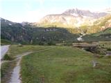 8
8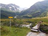 9
9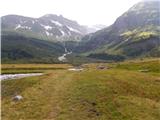 10
10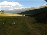 11
11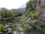 12
12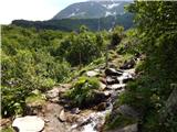 13
13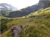 14
14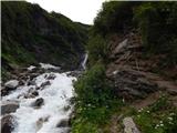 15
15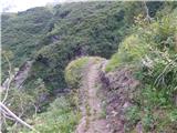 16
16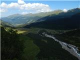 17
17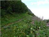 18
18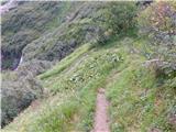 19
19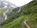 20
20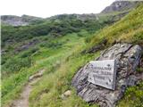 21
21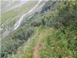 22
22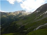 23
23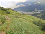 24
24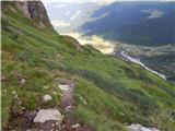 25
25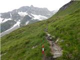 26
26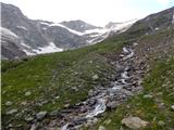 27
27 28
28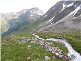 29
29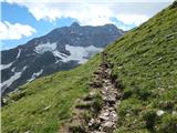 30
30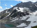 31
31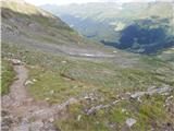 32
32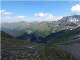 33
33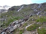 34
34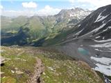 35
35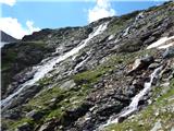 36
36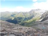 37
37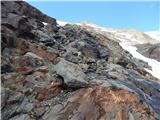 38
38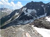 39
39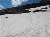 40
40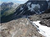 41
41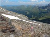 42
42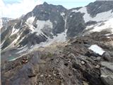 43
43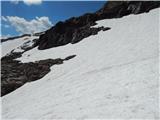 44
44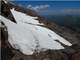 45
45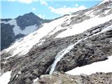 46
46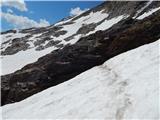 47
47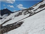 48
48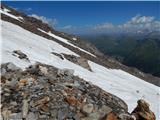 49
49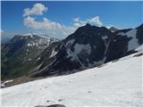 50
50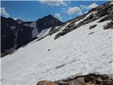 51
51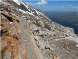 52
52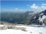 53
53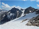 54
54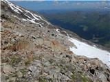 55
55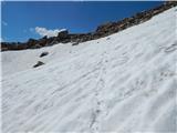 56
56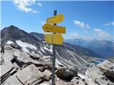 57
57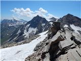 58
58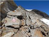 59
59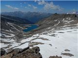 60
60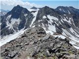 61
61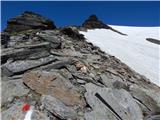 62
62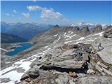 63
63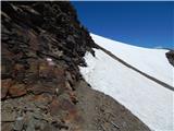 64
64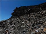 65
65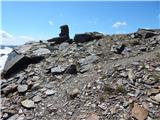 66
66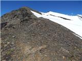 67
67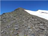 68
68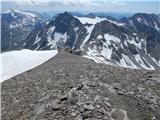 69
69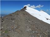 70
70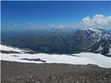 71
71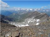 72
72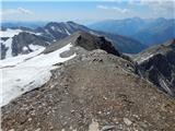 73
73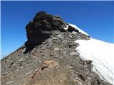 74
74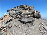 75
75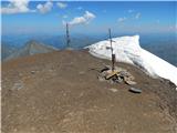 76
76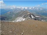 77
77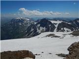 78
78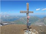 79
79
Discussion about the trip Lenzanger - Hocharn
|
| Robie30. 09. 2018 |
Road to the upper parking - 9EUR / arrived at 21:30 on a weekday and the barrier was raised, on return Friday morning paid at the exit, they allow sleeping in the camper, also WC nearby. Path solidly marked as much as possible due to terrain. Even in September we needed crampons (for a few steps), helmet welcome. Water is abundant in summer and autumn - first 3 hours many glacier streams, so no point carrying supplies for the whole path from the parking...
|
|
|
To post a comment you must log in:
If you do not yet have a username, you must first
register.