Lesično - Sveti Mihael (Pilštanj)
Starting point: Lesično (307 m)
| Latitude/Longitude: | 46,10162°N 15,51958°E |
| |
Walking time: 15 min
Difficulty: easy marked way
Elevation gain: 68 m
Elevation difference along the route: 75 m
Map:
Recommended equipment (summer):
Recommended equipment (winter): ice axe, crampons
Views: 81
 | 1 person like this post |
Access to starting point:
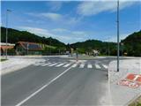
a) We drive to Šentjur, then follow the signs for Podsreda and Planina pri Sevnici. At the end of Šentjur we turn left in the direction of Podsreda, from where we drive along a fairly winding road to the settlement of Lesično, where the described route begins at the roundabout. We park in one of the parking areas in the centre of the settlement.
b) From the Brežice–Podčetrtek road on the outskirts of the settlement Bistrica ob Sotli we turn left (from the direction of Podčetrtek right) towards Podsreda. We bypass the centre of Podsreda on the right side, then drive to the settlement of Lesično, where the described route begins at the roundabout. We park in one of the parking areas in the centre of the settlement.
c) From the direction of Sevnica and Krško we drive to Brestanica, then follow the signs for Podsreda. This is followed by some ascent and then a descent into Podsreda, where at the end of the settlement we turn left towards Šentjur and Kozje. We drive to the settlement of Lesično, where the described route begins at the roundabout. We park in one of the parking areas in the centre of the settlement.
Route description:
From the place where we parked, we first return to the roundabout, then follow the road in the direction of Kozje. Near the bus station, signs for Pilštanj direct us left onto the access road to a nearby house, which we bypass on the left side. After the house, we cross a small stream over a wooden bridge, then the path turns into a forest. With the help of stairs and a railing, it begins to ascend steeply up the slope, which is also somewhat exposed higher up. Higher up, somewhat before the exposed viewpoint with the Slovenian flag, the path turns left, then gradually ascends to a gentler ridge.
Here we pass the location of the former Drenski Castle (Hartenštajn). Since there are no remains or information board at the location today, the area is completely unrecognizable, but with some attention to the surroundings, we can still only observe the outlines of the former defensive ditches. The path continues on the right side bypassing a nearby house, where a path marked with local signs joins from the right. After the junction, we reach the central part of the Pilštanj settlement, where we go slightly right and past the famous Pilštanj pranger (pillory) and the century-old dren. While viewing the rich cultural landmarks of the place, we quickly reach the church of St. Michael.
Description and photos refer to the state in May 2026.

Photos:
 1
1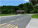 2
2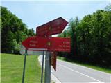 3
3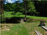 4
4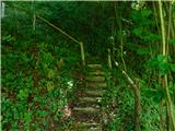 5
5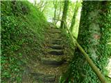 6
6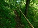 7
7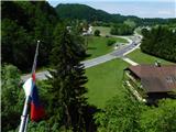 8
8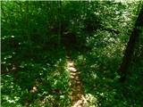 9
9 10
10 11
11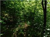 12
12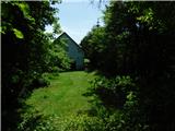 13
13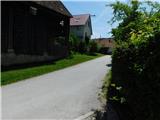 14
14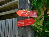 15
15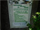 16
16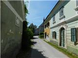 17
17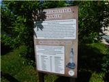 18
18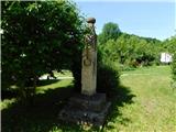 19
19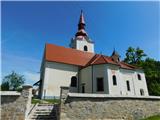 20
20
Discussion about the trip Lesično - Sveti Mihael (Pilštanj)
To post a comment you must log in:
If you do not yet have a username, you must first
register.