Libeliče - Šteharski vrh (Šteharnikov vrh) (via Trotov križ)
Starting point: Libeliče (455 m)
| Latitude/Longitude: | 46,62040°N 14,94800°E |
| |
Route name: via Trotov križ
Walking time: 3 h
Difficulty: easy unmarked way
Elevation gain: 563 m
Elevation difference along the route: 650 m
Map: Koroška 1:50.000
Recommended equipment (summer):
Recommended equipment (winter): ice axe, crampons
Views: 610
 | 1 person like this post |
Access to starting point:
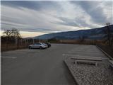
A) From Slovenj Gradec or the Mežiška dolina valley we drive to Dravograd, then still before the bridge over the river Drava we turn left in the direction of the settlements Črneče and Libeliče. Further on, we first cross the river Meža, then we drive through Črneče and later also through Gorče. After Gorče we arrive in Libeliče, where at the chapel we continue right, then we go once again right and park on a larger asphalt parking lot by the fire station Libeliče.
B) We drive to Dravograd, then we continue driving towards Slovenj Gradec. Soon after the bridge over the river Drava, we turn right in the direction of the settlements Črneče and Libeliče. Further on, we first cross the river Meža, then we drive through Črneče and later also through Gorče. After Gorče we arrive in Libeliče, where at the chapel we continue right, then we go once again right and park on a larger asphalt parking lot by the fire station Libeliče.
C) Via the border crossings Ljubelj or Jezerski vrh we drive to Austria, then we follow the signs for Pliberk / Bleiburg and further to the settlement Labot / Lavamünd. Before the settlement Labot, still before we cross the river Drava, the signs for Potoče / Bach and Libeliče / Leifling direct us right onto a somewhat narrower road. Further on, we drive through the settlement Potoče, behind it soon via the border crossing Libeliče we arrive in Slovenia, where we park on the parking lot by the fire station in Libeliče.
Route description:
From the fire station we first ascend to the parish church of St. Martin, which is located on the northwestern part of Libeliče. Before the church, on the part where there is the ossuary from the 11th century, before the wall on the left we notice a trodden path, on which we diagonally ascend into the forest.
During the ascent through the forest we are initially accompanied by the signs of the nearby path Etnološko naravoslovne znamenitosti Libelič, which we follow in the opposite direction, so that the numbers on the signposts decrease. Through the forest we mostly ascend on forest cart tracks, higher up along the pear tree avenue we ascend to the homestead, where there is a viewpoint.
We continue across the yard, from the crossroads behind the homestead we continue on the right road, which leads us past a signpost. A diagonal ascent with nice views follows, reaching from Golica / Koralpe across Košenjak to Pohorje, then the cart track takes us into the forest, where we reach the macadam road. We follow the road to the right, after the left serpentine we leave it and continue slightly right on the cart track, which takes us past the hunting observatory to a larger clearing. On the other side of the clearing we return to the forest, and the path diagonally takes us to the state border with Austria. Along the state border we ascend to the place where the state border turns sharply right, while we ascend on the path that runs across the hay meadow to the next homestead, which we bypass on the left side and at which, at the next signpost, we cross another road. With nice views we ascend to the forest. In the forest the cart track forks, and we choose the left, gentler cart track, which further in a gentle ascent crosses the eastern slopes of Požegov vrh. During the crossing the path leads us past an older cross and across a smaller spring, then we soon reach the macadam road, which we reach at the crossroads to the farm Jorgač.
We follow the road to the right, on it we diagonally ascend to a somewhat larger crossroads at the NOB monument, where we continue straight towards Ravne na Koroškem (right Strojna). The path further leads us past Trotov križ (triangular chapel with saints depicted on frescoes), still before we step out of the forest a road branches off sharply to the right towards the farm Utek (on maps Vutek). We continue straight, at the junction in the middle of the meadow we go slightly right. A short walk with nice views on Peca follows, then at the entrance into the forest the path forks again. This time we choose the slightly left road in the direction of the hunting hut Strojna (slightly right Ravne). Further on the road enters the forest, above the homestead Trot a nice view of the peaks above the Mežiška dolina valley opens up again. The path further leads us along a gentle macadam road that crosses the slopes of Trotov vrh, on the road we soon arrive at the hunting hut Strojna.
Behind the hunting hut we diagonally return to the forest for a while, then the road that crosses the slopes leads us with nice views towards Peca, Uršlja gora, with good visibility the view reaches all the way to Ojstrica and Planjava. Later we arrive at the junction of the road to the hamlet Šteknija, where there is a smaller pond, we continue straight and continue the crossing. A few minutes of light diagonal descent follow, then the road goes onto the ridge, somewhat behind Jakob's sign we arrive at a somewhat larger crossroads.
Sharply left a macadam road branches off, on which we can arrive in Libeliče past the hunting hut Libeliče, left leads the road on which we can arrive at the church of St. Cross, the right road leads towards Ravne na Koroškem, we continue straight on the ascending cart track, on which we begin to ascend more steeply. After approximately 20 minutes of ascent we reach a marked path, on it in a few steps Šteharnikov vrh.
Description and pictures refer to the condition in 2019 (February).

Along the route: Trotov križ (863m), Trotovo razpotje (972m)
Photos:
 1
1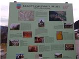 2
2 3
3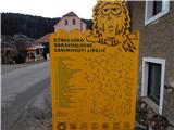 4
4 5
5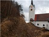 6
6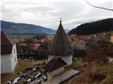 7
7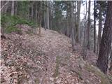 8
8 9
9 10
10 11
11 12
12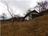 13
13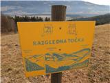 14
14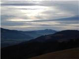 15
15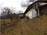 16
16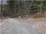 17
17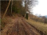 18
18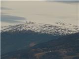 19
19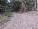 20
20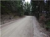 21
21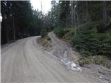 22
22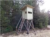 23
23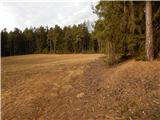 24
24 25
25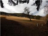 26
26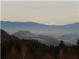 27
27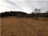 28
28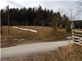 29
29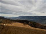 30
30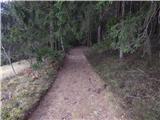 31
31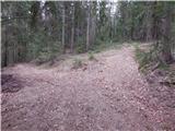 32
32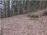 33
33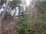 34
34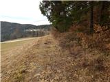 35
35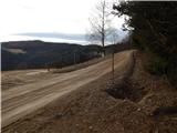 36
36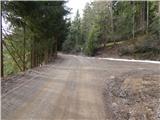 37
37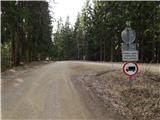 38
38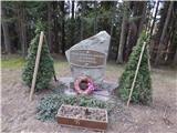 39
39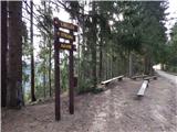 40
40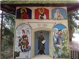 41
41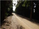 42
42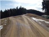 43
43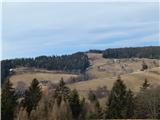 44
44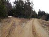 45
45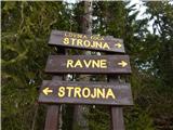 46
46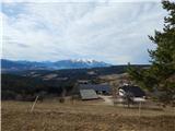 47
47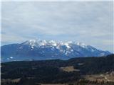 48
48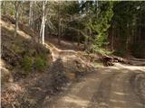 49
49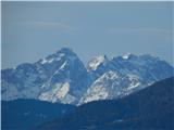 50
50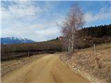 51
51 52
52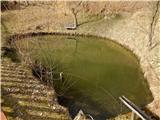 53
53 54
54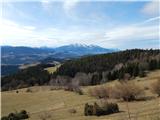 55
55 56
56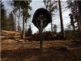 57
57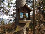 58
58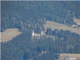 59
59 60
60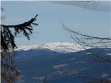 61
61 62
62 63
63 64
64 65
65
Discussion about the trip Libeliče - Šteharski vrh (Šteharnikov vrh) (via Trotov križ)
To post a comment you must log in:
If you do not yet have a username, you must first
register.