Lienzer Dolomitenhütte - Teplitzer Spitze
Starting point: Lienzer Dolomitenhütte (1620 m)
| Latitude/Longitude: | 46,79110°N 12,78420°E |
| |
Walking time: 3 h
Difficulty: very difficult marked way
Elevation gain: 993 m
Elevation difference along the route: 993 m
Map:
Recommended equipment (summer): helmet
Recommended equipment (winter): helmet, ice axe, crampons
Views: 2.723
 | 1 person like this post |
Access to starting point:
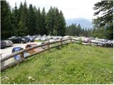
Through the Karawanks Tunnel, we drive to Austria, and then we continue driving towards Spittal and further towards Lienz (a little after Spittal the highway ends). Further, we drive on a relatively nice and wide road through the Drau Valley. A few kilometers before Lienz (near the settlement Unterdorf), we will notice signs for the mountain hut Lienzer Dolomitenhütte, which point us to the left on a local road. The road then crosses the river Drava/Drau over a bridge and brings us to the village Lavant, where we continue right in the direction of the village Tristach. Between the villages Lavant and Tristach we will come to the next crossroad, where we continue left in the direction of "Lienzer Dolomitenhütte". We then follow this road, which starts ascending steeper, to a large parking lot near the mentioned mountain hut. The road is payable (July 2009 7€).
To Lienz we can also come if, instead of through the Drau Valley, we drive through the Gail Valley (Korensko sedlo, Hermagor, mountain pass Ziljsko sedlo/Gailbergsattel); in this case, we arrive in the Drau Valley at the settlement Oberdrauburg.
Route description:
From the parking lot, we continue on the road, on which in 2 minutes we get to the mountain hut Lienzer Dolomitenhütte.
From the mountain hut, we cross the fence and continue the ascent on a panoramic road (a nice view towards the serrated ridge - highest is Spitzkofel 2717 m), which is in the initial part exposed to falling stones. The road then crosses a short lane of forest and brings us to an indistinct saddle Premstall (1625 m), where there is a smaller crossing.
We continue straight past a trough with water (left upwards Weißtein Alm) on the road which after a few minutes of additional walking brings us to a smaller mountain pasture Instein Alm, on which we notice a smaller wooden hut and a little above it a chapel.
We still continue on the road, which quickly brings us to a marked crossing, where we leave it.
We continue the ascent on a wide mountain path which starts ascending a little steeper, through increasingly sparse forest. The path from which very nice views open up, several times crosses the mountain road and higher brings us to a smaller wooden shelter. At the shelter, we again leave the road and continue the ascent through a gently sloping high mountain valley, which is surrounded by high peaks. The gently sloping path which runs along the torrent stream, higher turns to the right and for a short time ascends steeply. We then follow this panoramic path all the way to the mountain hut Karlsbader Hütte (by the hut there is also the lake Laserzsee), which we reach after a few minutes of additional walking.
To the hut we can also come on the mountain road.
From the hut we continue right on a marked path, which first slightly descends, crosses the stream and then brings us to an unmarked crossing. We continue on the left upper path, which is marked with blue circles (the lower path leads towards the saddle Kerschbaumertörl). The path ahead starts ascending steeper and after a few minutes of walking brings us to somewhat flatter terrain, where by the edge stands a cross visible from afar.
At the cross the path gradually passes onto scree and a little higher flattens. Next follows crossing of the slopes towards the left, then the path turns a little to the right and starts ascending steeply on very steep scree. The very steep path higher flattens and brings us to the saddle Odkarscharte, from where a view opens up towards the southwest.
On the saddle we continue right (left Seekofel) on a slightly exposed ridge path, which only a little higher brings us to the next crossing. We continue straight (left downwards Kerschbaumertörl) towards the steep tower, where the blue marks also lead us. After a few meters the easy path ends and changes into quite difficult and exposed climbing, which reaches the second difficulty grade. After approximately 20 m of ascent we step on one of two (third is a little further) steep towers of the peak Teplitzer Spitze.

Photos:
 1
1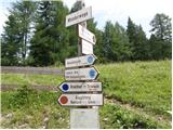 2
2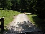 3
3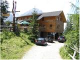 4
4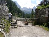 5
5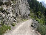 6
6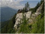 7
7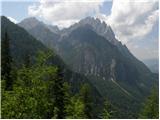 8
8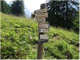 9
9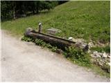 10
10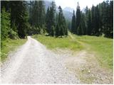 11
11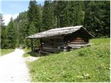 12
12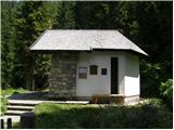 13
13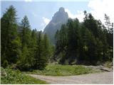 14
14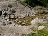 15
15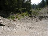 16
16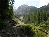 17
17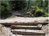 18
18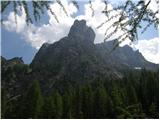 19
19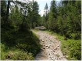 20
20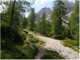 21
21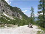 22
22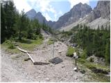 23
23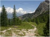 24
24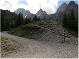 25
25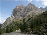 26
26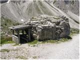 27
27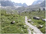 28
28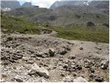 29
29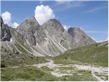 30
30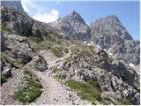 31
31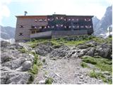 32
32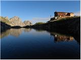 33
33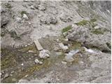 34
34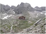 35
35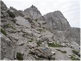 36
36 37
37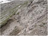 38
38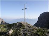 39
39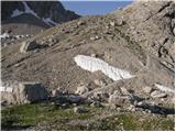 40
40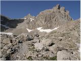 41
41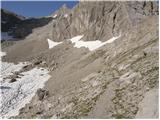 42
42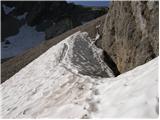 43
43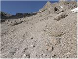 44
44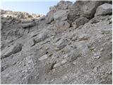 45
45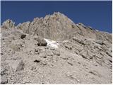 46
46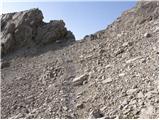 47
47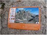 48
48 49
49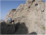 50
50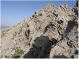 51
51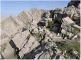 52
52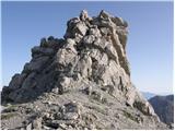 53
53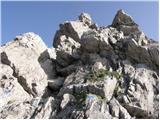 54
54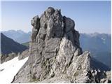 55
55
Discussion about the trip Lienzer Dolomitenhütte - Teplitzer Spitze
To post a comment you must log in:
If you do not yet have a username, you must first
register.