Ljubelj - Loibler Baba/Košutica (via koča na Ljubelju)
Starting point: Ljubelj (1058 m)
| Latitude/Longitude: | 46,43240°N 14,26020°E |
| |
Route name: via koča na Ljubelju
Walking time: 2 h 45 min
Difficulty: difficult marked way
Elevation gain: 910 m
Elevation difference along the route: 1000 m
Map: Karavanke - osrednji del 1:50.000
Recommended equipment (summer):
Recommended equipment (winter): ice axe, crampons
Views: 79.395
 | 4 people like this post |
Access to starting point:
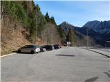
From the highway Ljubljana - Jesenice we take the exit Ljubelj and follow the road ahead to the border crossing. Just a few meters before the border crossing we will notice a parking lot on the right side, where we park.
Route description:
At the end of the parking lot, we notice signposts for the mountain hut Koča na Ljubelju, which after some stairs take us to the old Ljubelj road. This road, which is moderately ascending and in winter converted into a sledding track, we follow all the way to the mountain hut Koča na Ljubelju. We reach it after a little less than an hour of walking, with nice views here and there on Košutica, Veliki vrh and Begunjščica.
From the mountain hut, we continue on the road to the Austrian side, where after five minutes of walking signposts direct us to the right into the forest. The path through the forest slightly ascends and after approximately 30 minutes of walking from the end of the road brings us to the border ridge. The path on the ridge is not steep but the slopes along which we walk are steep, therefore especially in wet conditions great caution is needed. In some places we are also helped by fixed safety gear and a ladder. The forest then becomes thinner and the path brings us to the pastures of Grunt. Grunt is an indistinct peak on the path along which we walk.
Here the path from the concentration camp joins from the right, and we continue straight along the ridge beside the border fence. The path then brings us to a junction, where to the left the path to Dovjakovo sedlo branches off. To us, from the right, the path from the mountain pasture Korošica joins. We continue straight along the increasingly panoramic ridge. The path then becomes steep, the forest becomes thinner and gradually disappears entirely. Further we ascend along the panoramic ridge, which is quite wide so there is no major danger. The path then ascends through dwarf pines and brings us to the Austrian side. Here we ascend through a short but quite steep gully back to the ridge. Here we step onto steep grass-covered slopes on the Slovenian side (in wet, risk of slipping). After this ascent over the grass we reach the summit, somewhat exposed ridge, which we then follow to the peak.
Ljubelj - Koča na Ljubelju 45 minutes, Koča na Ljubelju - Grunt 1:00, Grunt - Košutica 1:00.

Photos:
 1
1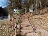 2
2 3
3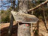 4
4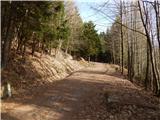 5
5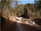 6
6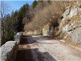 7
7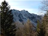 8
8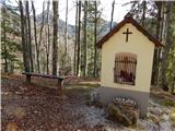 9
9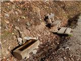 10
10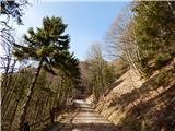 11
11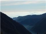 12
12 13
13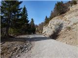 14
14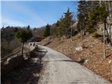 15
15 16
16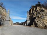 17
17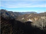 18
18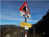 19
19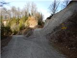 20
20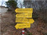 21
21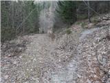 22
22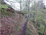 23
23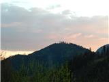 24
24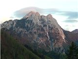 25
25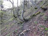 26
26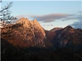 27
27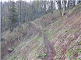 28
28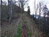 29
29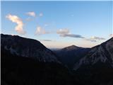 30
30 31
31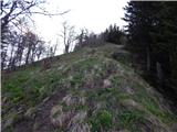 32
32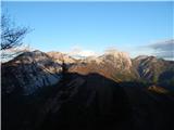 33
33 34
34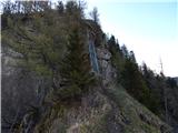 35
35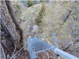 36
36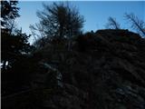 37
37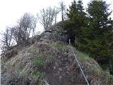 38
38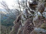 39
39 40
40 41
41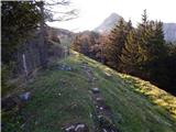 42
42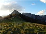 43
43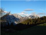 44
44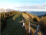 45
45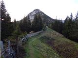 46
46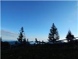 47
47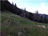 48
48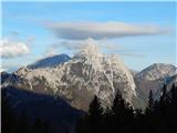 49
49 50
50 51
51 52
52 53
53 54
54 55
55 56
56 57
57 58
58 59
59 60
6061
 62
62 63
63 64
64 65
65 66
66 67
67 68
68 69
69 70
70 71
71 72
72 73
73 74
74
Discussion about the trip Ljubelj - Loibler Baba/Košutica (via koča na Ljubelju)
|
| apovalej13. 03. 2011 |
today at the summit, winter conditions. The path is trodden.
|
|
|
|
| limona228. 05. 2011 |
Has anyone been to Košutica recently? Probably no more snow? Best regards!
|
|
|
|
| @rekar28. 05. 2011 |
Yes, today several cm fell, otherwise in 14 days the livestock heads to the alpine pasture.
|
|
|
|
| gorskarozica5. 05. 2012 |
Nice day, sunny, need to be careful not to disturb the adders. Descent to Planina Korošica.
|
|
|
|
| francimedved9. 04. 2013 |
Has anyone perhaps been to Košutica these days, what are the conditions like? We have a club hike. Thanks
|
|
|
|
| Daaam9. 04. 2013 |
I haven't been up there- But today afternoon I observed from Zelenica.. It still looks all snowy.. But the snow on Zelenica is quite "rotten".. Hope this helps you at least a little...
|
|
|
|
| francimedved9. 04. 2013 |
OK thanks, we'll just wait for the snow to melt a bit.
|
|
|
|
| VanSims10. 06. 2013 |
Warning regarding the footbridge in picture 12 (the only one on the path): Its slats are already quite wobbly and caution is needed, as there is a considerable depth below.
|
|
|
|
| dare2910. 06. 2013 |
Isn't there a metal ladder there now?
|
|
|
|
| VanSims10. 06. 2013 |
Yes, the ladder at the beginning (picture 11) is now metal, the footbridge just before the end of the wire ropes (picture 12) is still wooden and quite wobbly.
|
|
|
|
| dare2911. 06. 2013 |
Pardon, swapped.
|
|
|
|
| B.Smart14. 06. 2013 |
The wooden footbridge is really in very bad condition. Half the log on one side is completely missing, so the planks are hanging down.
But today it was an exceptionally nice trip to Košutica and I was enchanted by the beautiful views. Caution is advised due to snakes, as there are quite a few vipers in the area this year. We encountered one on the way back to the valley. I definitely recommend the trip.
|
|
|
|
| zvone128. 07. 2013 |
Since there hasn't been any comment about the trail to Košutica for a long time. After the macadam on the old Ljubelj road, entering the forest on the Austrian side is really pleasant, followed by walking along the border ridge. The ladder that some mentioned is now new and completely stable, so no fear for the ascent if that deterred anyone. Pleasant trail with nice views, although the sun was "beating down" here too. I recommend a detour to the mountain dairy on Planina Korošica - among other things, you can refresh with sour milk and žganci. But I advise against returning via the path to the concentration camp site. Better return the way you came up or via one of the other possible trails.
|
|
|
|
| Potohodnik15. 08. 2013 |
Yes, I join zvoneta1's opinion. The path to Košutica is nice, not too demanding, i.e. in good condition, except for that log that's no help right after the ladder, there's a rope though. Then to the summit! I suggest descent to Planina Korošica and then a short ascent back to the car. Nice tour

|
|
|
|
| scorpio22. 05. 2014 |
Yesterday up this path. Košutica has not yet completely shaken off the snow, but it does not bother (one awkward snow patch above Korošica can be bypassed with a direct climb to the upper bend of the path). Good luck on the way.
|
|
|
|
| ločanka12. 10. 2014 |
Today on this trail to Košutica. At the beginning the trail quite muddy, also slippery, I hesitated a bit at the narrow passage towards the end of the fixed cable, where you can't hold on anywhere, neither to the cable nor to the rock. Below you just emptiness. From the ridge crossing onwards everything super - trail and views.
|
|
|
|
| Branimir16. 10. 2016 |
Today 16.10. on the way to Košutica from Ljubelj along the old road and past the hut at Ljubelj to the top, I lost keys with a wooden fob in the shape of wooden whiskers. I kindly ask the honest finder to call 041 789 585.
Thanks in advance.
The trail is currently without problems, just slippery in the forest section, so poles are essential equipment.
|
|
|
|
| trdi15. 08. 2018 |
Today I walked this path. The pictures are quite up-to-date, there are no wooden ladders or bridges on the path, as can be deduced from the comments, only this metal ladder, which in reality is not as scary as in the pictures. Above the ladder there are a couple of meters of slightly exposed path, but everything is secured, so this path could safely be marked as partially difficult, but the eastern path from Hajneževo sedlo or the summit ridge is quite exposed. I recommend a circular tour from Vranček past Hajneževo sedlo to Košutica and then to the hut at Ljubelj and back to Vranček by road. From Ljubelj to Vranček it's no more than 15-20 min walk, and there's also a nice path from the first bend to the concentration camp.
|
|
|
|
| Enka5. 07. 2022 12:56:45 |
If I had known that this trail is so beautiful, I would have gone up long ago. In wet conditions it can be slippery before the ladder and around the ladder, but in this dry weather there are no problems. Above the ladder everything is perfectly secured, so the whole section is a nice refreshment of the trail. The first half of the trail is in the shade in the morning, which is pleasant from that point of view too, and quite shady is also the beautiful hunting trail, which I recommend for the return - after the obligatory descent to the Korošica alpine pasture.
|
|
|
|
| orchigu5. 07. 2022 21:25:44 |
Enka (and others), is it clearly marked to Korošica? I know the hunting path is not marked, but I'm interested if it's well trodden? I'm a bit tempted to do this circular variant, but I'm not really the biggest fan of unmarked paths if I don't know them (safety first of course ).
|
|
|
|
| Enka5. 07. 2022 23:12:37 |
From the top you first return the same way, the turn-off to Korošica is marked with a sign (and you see it already on the way up). The turn-off to the hunting path from the path to Korošica is marked on a rock - hunting (border), then the path is well visible and trodden. Once a nicer little path led us right instead of sharply left, but it ended after a few tens of meters, so it was clear where we had to go. No other orientation problems
|
|
|
|
| orchigu7. 07. 2022 21:34:25 |
Great, thanks! I'll head to this trail sooner or later
|
|
|
|
| kamen_spotike31. 10. 2024 21:15:30 |
Today I walked this trail and I agree with the above comment that this trail is partially demanding as besides the described part it is really without special features. Otherwise, besides the nice views, the strudels in the hut are not to be sneezed at. And safe steps
|
|
|
|
| J.P.21. 04. 2025 10:56:35 |
Snow starts approximately at Grunt – sometimes more, sometimes less... Although it's already quite rotten, caution is needed, especially on the last meters below the summit, where the marked path is covered and you have to climb around. The summit itself is more or less bare, but this time we enjoyed only the whiteness of the fog, without views. Definitely a tour for repetition – judging by the comments, next time via the circular path.
|
|
|
|
| felix27. 01. 2026 20:12:11 |
|
|
|
|
| dleskovec29. 01. 2026 12:03:23 |
Nice and interesting, Nina!
|
|
|
|
| plaNinaPirsMajcen29. 01. 2026 15:43:18 |
Thank you very much felix and dleskovec 🤍
Best regards, Nina
|
|
|
|
| Majdag30. 01. 2026 08:38:56 |
Bravo girls, I hiked with you and relived memories. Nice.
|
|
|
To post a comment you must log in:
If you do not yet have a username, you must first
register.