Ljubelj - Prešernova koča na Stolu (upper way)
Starting point: Ljubelj (1058 m)
| Latitude/Longitude: | 46,43240°N 14,26020°E |
| |
Route name: upper way
Walking time: 4 h 45 min
Difficulty: partly demanding marked way
Elevation gain: 1116 m
Elevation difference along the route: 1315 m
Map: Karavanke - osrednji del 1:50.000
Recommended equipment (summer):
Recommended equipment (winter): ice axe, crampons
Views: 11.219
 | 1 person like this post |
Access to starting point:
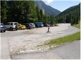
From the Ljubljana–Jesenice highway, take the Ljubelj exit and follow the road ahead to the border crossing. Just a few meters before the border crossing, signs for Zelenica direct us to the left and after some 10 meters of additional driving the road brings us to the parking lot below the ski center Zelenica.
Route description:
From the parking lot, we head onto the marked footpath in the direction of Zelenica, Vrtača and Stol. The path first leads along a moderately steep cart track that ascends through the forest, then turns slightly to the right and brings us out of the forest onto the ski slope track. We continue the ascent on the ski slope, from which beautiful views open up onto the walls and screes of Begunjščica, and on the right side we see the ridge of Ljubeljšica. The path, which continues along a rough road, brings us a little higher to the Koča Vrtača hut, where the Zelenica I chairlift ends and the Zelenica II chairlift begins. Here the transport-rescue road turns sharply to the right, but we continue straight ahead towards Zelenica and proceed along a path that is initially still gentle, then steeper, ascending along the ski slope track. Higher up, we ascend through a sparse belt of dwarf pines, then return to the road. We continue along the rough road, but when the road turns left, we continue right onto a steep footpath that rejoins the road just below the upper station of the single-seater Zelenica II chairlift. From here follows a short descent and the path brings us to the Dom na Zelenici hut.
Just before the hut, a path branches left to Begunjščica and Roblekov dom, but behind the hut we continue left and begin ascending beside the children's drag lift Ciciban. Roughly midway along the drag lift, we reach a small junction, where we continue right across the ski slope (straight to Koča pri izviru Završnice, Srednji vrh and Stol - lower path). On the other side of the Ciciban ski slope, the path enters a narrow belt of forest, beyond which we arrive at the next drag lift. We also just cross this ski slope, then beside a small boulder we find the continuation of the marked path towards Vrtača and Stol. Further on, the path leads along the slopes below the Na Možeh ridge, then descends slightly and brings us to the point where an unmarked path branches right into the Suhega ruševja valley and to Palec (there is a small cairn at the junction). After the junction, the path gradually moves onto the slopes of Vrtača, across which it ascends mostly diagonally. Higher up, an unmarked path from Koča pri izviru Završnice joins from the left, and we continue straight to the nearby marked junction.
At the junction, a path to Vrtača and towards Stol and Svačica via Vatelce or Sklede branches slightly right, but we continue straight along the lower path, which crosses a belt of dwarf pines and raspberry bushes. After a few minutes of further walking, we arrive at the next junction, where we can descend left downhill in a few minutes to the Šija saddle, from which the lower path to Stol leads; right branches a poorer track towards Vrtača (the latter joins the previously mentioned marked path a little higher up), but we again continue straight, this time across occasionally steeper grassy slopes interrupted by a few less steep gullies. The crossing of the grassy slopes soon ends, and the path brings us to a steep gully, through which we begin descending along a path that is locally eroded and slippery in places. When the gully ends, the path moves onto scree, across which it descends diagonally below the cliffs to the cirque V Kožnah. Here the path begins ascending again, and the lower path and the path from Završnica join from the left.
We continue straight and the path further leads past several large boulders. A short, somewhat steeper ascent follows and we arrive at a junction, where a path branches right towards Celovška koča and Svačica, or the path via Vatelce or Sklede joins us. Here too we continue straight, and the path from the small valley between Srednja peč 1920 m (Srednja peč is a lesser-known peak on the left) and the Orlic ridge (Orlice is a harder-to-reach ridge between the Belščica saddle and Stol) gradually moves onto a larger scree field, across which we ascend diagonally to the right, then the path gradually enters a steeper valley between Mali Stol on the left and Stol on the right. Here the path ascends steeply, then gradually levels out and brings us to a marked junction. Here we continue left (right Stol 10 minutes) and after a few minutes of moderate ascent we step onto the summit of Mali Stol, from which only some 10 paces of descent separate us to the Prešernova koča hut.
Ljubelj - Zelenica 1:20, Zelenica - Prešernova koča 3:25.

The trip can be extended to the following destinations: Hochstuhl/Stol
Photos:
 1
1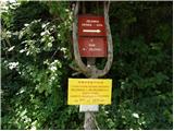 2
2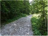 3
3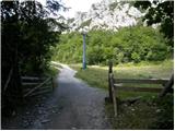 4
4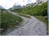 5
5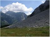 6
6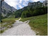 7
7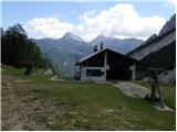 8
8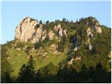 9
9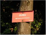 10
10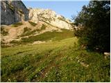 11
11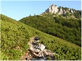 12
12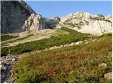 13
13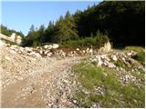 14
14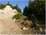 15
15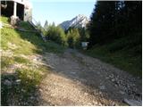 16
16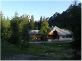 17
17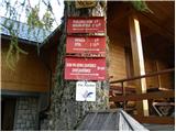 18
18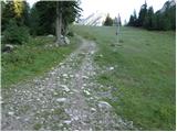 19
19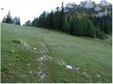 20
20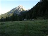 21
21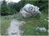 22
22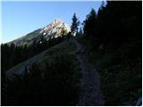 23
23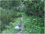 24
24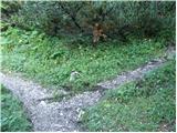 25
25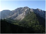 26
26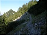 27
27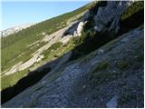 28
28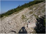 29
29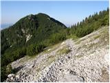 30
30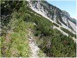 31
31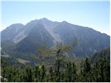 32
32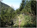 33
33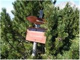 34
34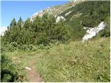 35
35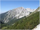 36
36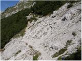 37
37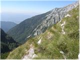 38
38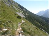 39
39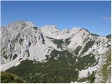 40
40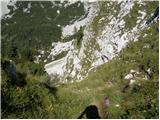 41
41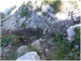 42
42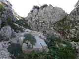 43
43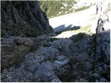 44
44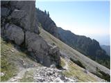 45
45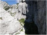 46
46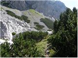 47
47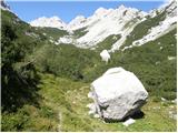 48
48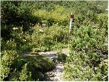 49
49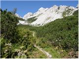 50
50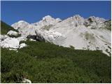 51
51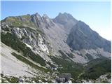 52
52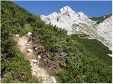 53
53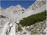 54
54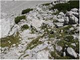 55
55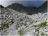 56
56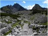 57
57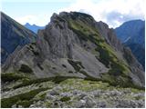 58
58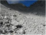 59
59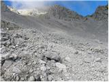 60
60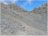 61
61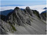 62
62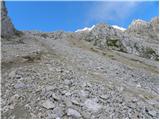 63
63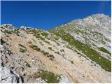 64
64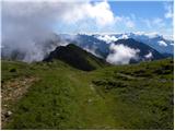 65
65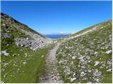 66
66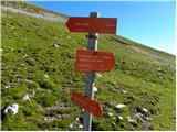 67
67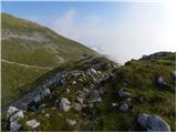 68
68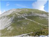 69
69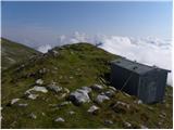 70
70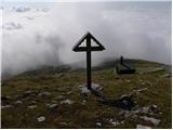 71
71 72
72
Discussion about the trip Ljubelj - Prešernova koča na Stolu (upper way)
|
| zdomec12. 06. 2010 |
The path described here to Stol or to Prešeren hut is NOT the UPPER path! This is the so-called MIDDLE path to Stol. At least a few years ago we had 3 paths to Stol from the hut at Zelenica.
The upper path went like this:
From the hut at Zelenica we went all along the path to Vrtaca up to that typical Southwest ridge where the path to Vrtaca turns right and starts steeply ascending towards the summit. From the ridge we descended a few meters down to the scree and along a poorly visible unmarked trail almost horizontally crossed the entire scree to the saddle near the border crossing, (from where the path descends towards Celovska koča) Then along the marked path that comes from Celovska koča and leads to Stol. We used this if we went from Vrtaca to Stol, (very small loss in elevation)
That unmarked part of the trail is sometimes poorly visible, but if you pay attention, you reach the Austrian marked path, as we have it in sight all the time.
Zdomec
|
|
|
|
| zdomec12. 06. 2010 |
The upper path I described above is nicely described in the older guidebook KARAVANKE, (Stanko Klinar) on page 139 path No. 272.e
Zdomec
|
|
|
|
| heinz13. 06. 2010 |
As far as I know, this one is generally named as the "Stol-Vratača" path (via Vatelca or Skleda). The lower two as "upper" and "lower".
Because if the goal is Stol, starting point either Ljubelj or Tinkova koča, the path via SW ridge of Vratača is not only the longest variant, but actually more suitable if heading to Svačica, Celovška koča or Geissberg.
If we want to count all paths to Stol, we'd need to include the highest one, via Grad.
I'd also add that the descent to Krnica "v Kožnah", which the above description doesn't cover much, due to steepness and scree is more demanding than the other paths. Therefore caution on this section in both directions.
|
|
|
To post a comment you must log in:
If you do not yet have a username, you must first
register.