Ljubelj - Šentanski vrh (Bornova pot)
Starting point: Ljubelj (1058 m)
| Latitude/Longitude: | 46,43060°N 14,26100°E |
| |
Route name: Bornova pot
Walking time: 4 h 35 min
Difficulty: partly demanding unmarked way, partly demanding marked way
Elevation gain: 577 m
Elevation difference along the route: 840 m
Map: Karavanke 1:50.000 - osrednji del
Recommended equipment (summer): helmet, lamp
Recommended equipment (winter): helmet, ice axe, crampons, lamp
Views: 1.360
 | 1 person like this post |
Access to starting point:
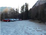
We drive to the border crossing Ljubelj, where before the tunnel we turn left towards Zelenica. Then we drive across a small bridge, after that we descend on the parking lot to the lower southern part of the parking lot, where we park.
Route description:
At the end of the parking lot, we notice signs for mountain pasture Preval, which point us to Bornova pot. At first, we diagonally ascend across a smaller scree, then the path passes into the forest, where with some shorter ascents and descents it crosses steep slopes towards the left. The forest is soon replaced by steep rocky slopes, through which a wide path leads, secured on exposed spots. With nice views of the mountains rising above Podljubelj, we arrive at Bornov tunnel, where for easier and safer progress the use of a headlamp is highly recommended. Somewhere in the middle of the tunnel there is a larger window, from which there is a scenic view of the surroundings, and we carefully continue through the second part of the tunnel. When we leave the tunnel, which after rain also has some larger puddles, a few minutes of exposed crossing follow, then behind the bench "Marijino počivališče" we arrive at a larger scree.
In a gentle descent we also cross the scree, then the path gradually begins to ascend diagonally. At first we still ascend across steep slopes, then the slope first flattens, higher up the trail widens into a cart track. Higher up follows the crossing of a grazing fence, then the path brings us out of the forest, and with a few dozen steps of further walking we ascend to Preval, where there is a marked junction.
From the junction we continue left (right Begunjščica) and walk to the shepherd's hut.
We bypass the hut, from which a beautiful view opens up reaching all the way to Triglav, on the left side, and continue the path in the direction of Dobrča. The marked path towards Dobrča, which we follow, further on bypasses an unnamed peak on the left side, and when the path returns to the ridge, we reach it at the saddle between Čisovec and the unnamed peak.
At the mentioned saddle the marked path towards Dobrča turns right downwards (straight unmarked path to Čisovec) and passes to the western slopes of Čisovec, where the path leads us diagonally across occasionally quite steep slopes. A longer crossing follows on a poorly maintained path, which is usually full of leaves and due to erosion somewhat damaged in several places. Further on we cross a few gullies, then the slope becomes less steep, and from the path we occasionally get some views towards Begunjščica, Stol, Julian Alps, Gorenjska...
A little further we reach the southern ridge of Čisovec, where the path begins to descend (here a few steps off the path we can notice a patch of auriculas, usually in April or May), and occasionally a view also opens up towards Kamniško Savinjske Alpe. Lower down the path descends even more steeply, then it brings us to the saddle Vrh Luž, where an unmarked path past Tominčev slap joins from the left, and from the right the path from Črni potok.
We continue straight ahead, mainly along the ridge, on which we occasionally ascend. Later a path leading across Ledene trate joins from the right, our path further gradually turns slightly right from the ridge and passes onto the increasingly steep slopes of Dobrča. A diagonal ascent across a steep slope follows, where extra caution is needed when wet, then the path flattens and via a grazing fence brings us to a cart track, along which we walk to the edge of Podgorska planina, where there is a marked junction.
We continue left in the direction of the summit Dobrča (straight to Koča na Dobrči 3 minutes), where the path leads past a few huts on Podgorska planina. Behind the huts we continue slightly left and ascend across the panoramic part of the pasture. Higher up the initially poorly traceable path enters the forest, and at junctions we carefully follow the markers. A little higher the path temporarily flattens and leads past two junctions, from both of which we continue straight in the direction of Dobrča. A short somewhat steeper section follows and the path brings us to the summit of Dobrča.
From the summit of Dobrča we continue in the direction of the viewpoint Šentanski vrh, along the path which first descends to a smaller saddle between the two summits, then gently ascends to the panoramic Šentanski vrh a few minutes away.
Ljubelj - Preval 1:30, Preval - Koča na Dobrči 2:30, Koča na Dobrči - Dobrča 30 minutes, Dobrča - Šentanski vrh 5 minutes.
Description and pictures refer to the condition in 2017 (January, April).

Photos:
 1
1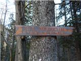 2
2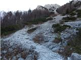 3
3 4
4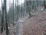 5
5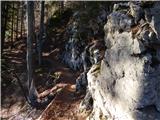 6
6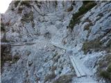 7
7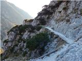 8
8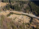 9
9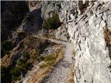 10
10 11
11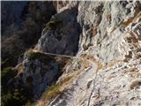 12
12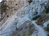 13
13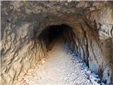 14
14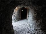 15
15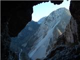 16
16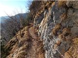 17
17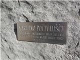 18
18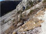 19
19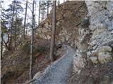 20
20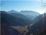 21
21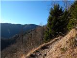 22
22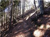 23
23 24
24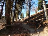 25
25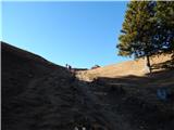 26
26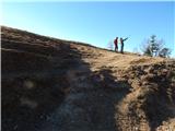 27
27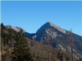 28
28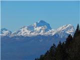 29
29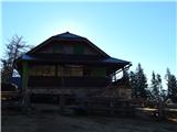 30
30 31
31 32
32 33
33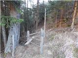 34
34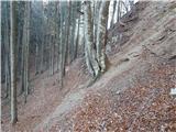 35
35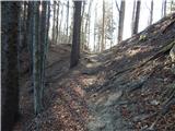 36
36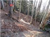 37
37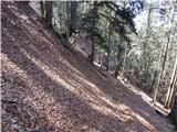 38
38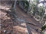 39
39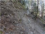 40
40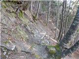 41
41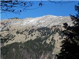 42
42 43
43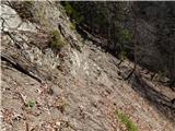 44
44 45
45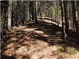 46
46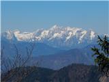 47
47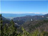 48
48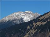 49
49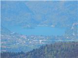 50
50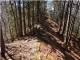 51
51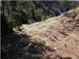 52
52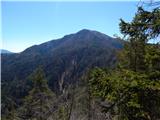 53
53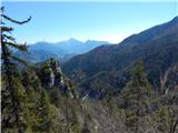 54
54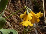 55
55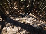 56
56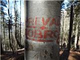 57
57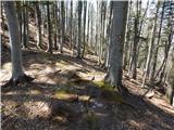 58
58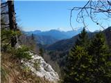 59
59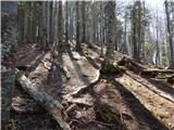 60
60 61
61 62
62 63
63 64
64 65
65 66
66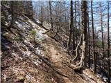 67
67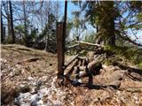 68
68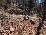 69
69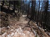 70
70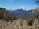 71
71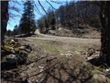 72
72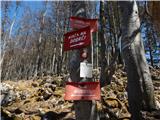 73
73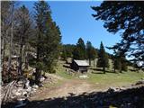 74
74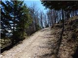 75
75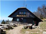 76
76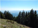 77
77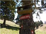 78
78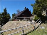 79
79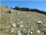 80
80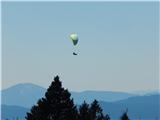 81
81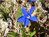 82
82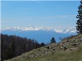 83
83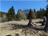 84
84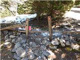 85
85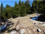 86
86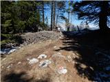 87
87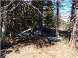 88
88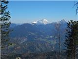 89
89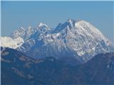 90
90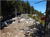 91
91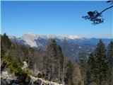 92
92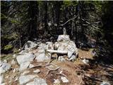 93
93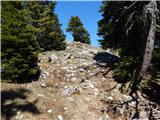 94
94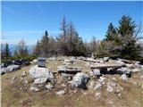 95
95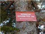 96
96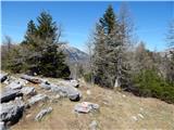 97
97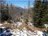 98
98 99
99 100
100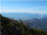 101
101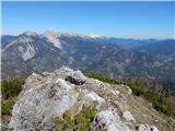 102
102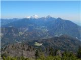 103
103
Discussion about the trip Ljubelj - Šentanski vrh (Bornova pot)
|
| jpresern2. 06. 2017 |
In picture 102 in the back it's not Begunjščica, but the Košuta ridge.
|
|
|
|
| Tadej2. 06. 2017 |
Thanks for the heads-up, I fixed it.
|
|
|
To post a comment you must log in:
If you do not yet have a username, you must first
register.