Ljutomerski ribniki - Jeruzalem (via Gresovščak)
Starting point: Ljutomerski ribniki (185 m)
| Latitude/Longitude: | 46,50660°N 16,20010°E |
| |
Route name: via Gresovščak
Walking time: 1 h 30 min
Difficulty: easy unmarked way
Elevation gain: 153 m
Elevation difference along the route: 185 m
Map:
Recommended equipment (summer):
Recommended equipment (winter):
Views: 1.730
 | 1 person like this post |
Access to starting point:
A) We drive to Ljutomer, then towards Ormož. When Ljutomer ends, first the road to Podgradje branches off to the left, and we turn left at the next crossroad in the direction of the settlement Gresovščak (by the crossroad there are also signs for the Pomurska mountain trail). The path ahead leads us along a somewhat narrower asphalt road, along which we then park at a suitable place.
B) We drive to Ormož, then follow the signs for Ljutomer. We continue driving along the railway tracks, and when we distance ourselves somewhat from them, we soon arrive at a crossroad where the road to the settlement Gresovščak branches off to the right (by the crossroad there are also signs for the Pomurska mountain trail). The path ahead leads us along a somewhat narrower asphalt road, along which we then park at a suitable place.
Route description:
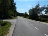
On the road we quickly arrive at the Ljutomerski Ribniki, which the marked path bypasses on the right side. From the road the marked path soon turns right, but we continue on the road to the nearby crossroad, from where we proceed straight in the direction of the settlement Gresovščak (left tourist farm Frank-Ozmec). Immediately after the crossroad we arrive at the settlement Gresovščak, where a narrower asphalt road leads us through the forest. Soon we arrive at the first crossroad, where we continue straight (via the right road we arrive at the castle Železne Dveri), and straight at the second crossroad as well. A little further we arrive at the third crossroad, where we go left (right nearby house, straight upper part of the settlement). An ascent follows and after three hairpins we arrive at two houses and behind them at extensive vineyards on the right side. The path continues between the forest on the left and the vineyard on the right side, then we already arrive at a smaller hamlet, where we continue right onto a macadam road. Behind the nearby house we go left in the direction of Jeruzalem, then we continue on a wide cart track, the path still leads us among vineyards, where we pass some abandoned vineyard where brambles have overgrown. At a few smaller junctions we follow the wider cart track, along it after some time we reach the asphalt road and thus also the markers of the Pomurska mountain trail.
We follow the road to the left, along it in a few minutes of further walking we reach the summit of Jeruzalem.
Description and pictures refer to the condition in 2017 (August).

Photos:
 1
1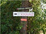 2
2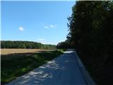 3
3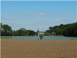 4
4 5
5 6
6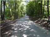 7
7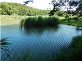 8
8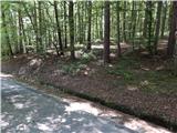 9
9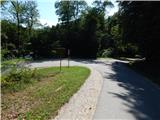 10
10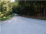 11
11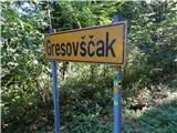 12
12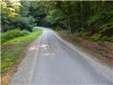 13
13 14
14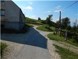 15
15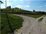 16
16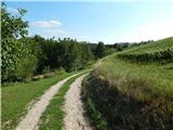 17
17 18
18 19
19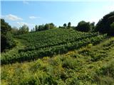 20
20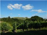 21
21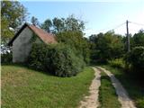 22
22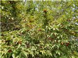 23
23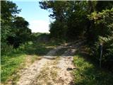 24
24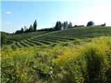 25
25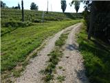 26
26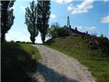 27
27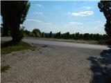 28
28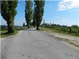 29
29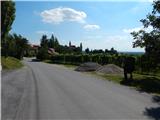 30
30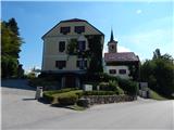 31
31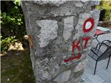 32
32 33
33 34
34
Discussion about the trip Ljutomerski ribniki - Jeruzalem (via Gresovščak)
To post a comment you must log in:
If you do not yet have a username, you must first
register.