Starting point: Lokve (1060 m)
| Latitude/Longitude: | 46,01600°N 13,80500°E |
| |
Walking time: 1 h 30 min
Difficulty: easy marked way
Elevation gain: 239 m
Elevation difference along the route: 350 m
Map: Goriška 1:50.000
Recommended equipment (summer):
Recommended equipment (winter): ice axe, crampons
Views: 35.016
 | 1 person like this post |
Access to starting point:
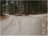
First, we drive to Lokve (from Nova Gorica, Most na Soči or Predmeja), then we continue driving in the direction of the village Lazna. After a short ascent, the road brings us to a crossroads, where a road branches off to the right, which leads towards Poldanovec. We park on the parking lot right next to the crossroads.
Route description:
From the parking lot, we head onto the macadam road in the direction of Poldanovec. The road, which starts ascending, already after a few steps crosses the barrier and only a few steps further brings us to a crossroads.
We continue straight (left Stanov rob) on the marked road, which higher up levels out and turns slightly to the left. The road then starts slightly descending and only a little further brings us to a somewhat larger clearing, from which through the treetops already a view opens up towards our destination. We continue on the road, which turns to the right and after a few minutes of light descent brings us to a well-marked crossroads by which there is a sign with an outline of the path.
We continue on the left road (right path is a little longer), which on the left side bypasses Mojska draga (in the mentioned valley is well visible temperature inversion). The road, which is descending diagonally, after a few additional minutes of walking brings us to a sharp right turn, in the middle of which from the left joins the marked path from the village Lazna.
We continue on the road, from which soon to the left branches off a marked path, which leads to Poldanovec. From the point when we left the road, the mountain path for a short time steeply ascends and brings us to the main ridge of Govc (Govce are steep precipitous slopes, which steeply descend towards the valley Gorenje Trebuše). On the ridge, the path turns to the right and continues with a few short ascents and descents to the foot of Poldanovec, where we also step on a wide but steep cart track.
Further, we ascend diagonally along the already from afar visible cart track, which we follow only to the panoramic ridge. Here the marked path directs us to the left onto the moderately steep summit slopes of the mountain, on which in less than 5 minutes of additional walking we ascend to the very panoramic peak.

Photos:
 1
1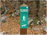 2
2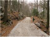 3
3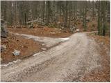 4
4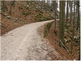 5
5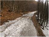 6
6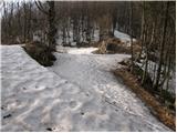 7
7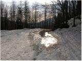 8
8 9
9 10
10 11
11 12
12 13
13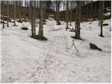 14
14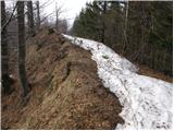 15
15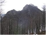 16
16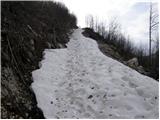 17
17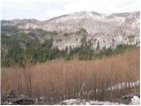 18
18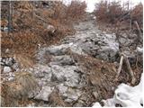 19
19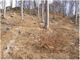 20
20 21
21
Discussion about the trip Lokve - Poldanovec
|
| boma15. 03. 2015 |
This walking time is for start from the parking lot at picture 7. If you start from Lokve, you need to count on 2.30h
|
|
|
|
| Bam30. 06. 2015 |
Does any unmarked path also lead to Poldanovec?
|
|
|
|
| miri30. 06. 2015 |
There is no unmarked path exactly, but try from G.Trebuše.
|
|
|
|
| jurijsobat2net25. 07. 2016 |
Google a bit about the path from Gorenje Trebuše under "Poldanovec (1299 m) - Razglednik Trnovskega gozda" and read Anke Vončina's article and our comment on the path condition on July 20, 2016. Off-trail routes are always there, as many as you want.
|
|
|
|
| Zvonček6. 04. 2017 |
This month we plan to hike Lokve-Stanov rob-Poldanovec-Lokve. We're interested in the path from Stanov rob to Poldanovec. Thanks in advance for any comment.
|
|
|
|
| aditaker20. 05. 2018 |
Hello, I would like to ask if there is a stamp at Poldanovec and at Stanov rob because we need it for our mountaineering booklet? And where are the stamps located?
|
|
|
|
| Zvonček21. 05. 2018 |
There is a stamp at Poldanovec, none at Stanov rob.
|
|
|
|
| 11122. 04. 2025 12:21:18 |
From Poldanovec to Stanov rob (or vice versa) there is an old (unmarked) hunters' trail across the precipitous slope of Veliki Češevik. Hunters once secured it at tricky spots (over gullies) with thin steel cables, which are mostly torn by avalanches; the trail is destroyed there and otherwise, as it is obviously no longer used, it gets buried and disappears. Therefore I advise against it, especially when wet, after rain. In snow it is downright suicidal. To Stanov rob it is safer to go around if you value your life.
|
|
|
To post a comment you must log in:
If you do not yet have a username, you must first
register.