Mače - Javorov vrh (Mačenska pot)
Starting point: Mače (586 m)
| Latitude/Longitude: | 46,31310°N 14,41870°E |
| |
Route name: Mačenska pot
Walking time: 2 h 55 min
Difficulty: easy marked way
Elevation gain: 848 m
Elevation difference along the route: 895 m
Map: Karavanke - osrednji del 1:50.000
Recommended equipment (summer):
Recommended equipment (winter): ice axe, crampons
Views: 3.887
 | 1 person like this post |
Access to starting point:
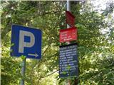
a) From the Ljubljana-Jesenice motorway, take the Kranj-east exit, then continue driving towards Jezersko. When arriving in Preddvor, leave the main road and continue left towards the centre of the mentioned place, from there follow the signs for Mače. When arriving in Mače, at the marked junction continue right (left Bašelj, straight church of St. Nicholas (church not accessible by car)) and drive up the narrow road above the village, where there is a large marked parking lot.
b) From the Jesenice-Ljubljana motorway, take the Kranj-west exit and at the first junction continue left. Then drive through the underpass under the motorway, then arrive at a roundabout, from which continue driving towards Golnik. The road ahead leads through the settlement of Mlaka pri Kranju; at the end of the settlement we continue right towards the settlement of Srakovlje. Driving then continues through Srakovlje, Spodnja Bela, Srednja Bela to Zgornja Bela, where we continue right towards Preddvor. In Preddvor notice signs for Mače, which direct us left past the primary school to the road that climbs to Mače. When arriving in Mače, at the marked junction continue right (left Bašelj, straight church of St. Nicholas (church not accessible by car)) and drive up the narrow road above the village, where there is a large marked parking lot.
Route description:
At the beginning of the large parking lot above Mače, we notice mountaineering direction signs, but we continue right across the entire parking lot in the direction of the Shelter in Hudičev boršt, Javorov vrh or Javorjev vrh, Potoška gora and St. James. From the end of the parking lot, a marked cart track continues, which we follow. The cart track, which has a few minor junctions in the lower part where we follow the marks, first ascends gently to moderately, then somewhat more steeply for a short time. After crossing the torrent, the cart track gradually flattens and brings us to a marked junction, where the mountaineering direction signs direct us left onto a well-trodden and well-maintained mountaineering path. The marked path immediately enters a fairly dense forest, through which it ascends for some time along the torrent gully, then turns somewhat more to the right and brings us in a few zigzags to a less noticeable junction, where the path to Dom na Kališču branches left (the junction is marked with a sign on a tree), we continue straight on the path that gradually brings us into a sparser forest. Higher up, the increasingly sparse forest ends and the path brings us to scenic grassy slopes, from which we get a beautiful view of Gorenjska. Follows another good 10 minutes of ascent on the mentioned grassy slope and we arrive at the spring in Hudičev boršt, next to which there is a marked junction.
Again, we continue right (left Dom na Kališču, Dolga njiva, Srednji vrh...) and after a minute or two of further walking we arrive at the Shelter in Hudičev boršt.
From the shelter, we continue eastwards, where we quickly leave Hudičev boršt and arrive at the place where we step out of the forest. In the initial part where we step out of the forest, a wire cable assists us in the moderate descent, which continues for a few meters of crossing over a relatively steep slope. The path continues along the fairly steep grassy slope of Zaplate, which is extremely avalanche-prone in winter. Crossing the grassy slope, which is especially slippery in wet conditions at a few spots but otherwise technically undemanding, ends after about 15 minutes and the path brings us into the forest. Follows another about 15 minutes of crossing through the forest, then we arrive at a marked junction, where we continue slightly right in the direction of Javorjev vrh (left Cjanovca and Srednji vrh, right Potoška gora, Spodnja Kokra, St. James...).
The path continues along and beside the initially scenic ridge at a few spots and occasionally descends slightly. A little further, the path enters the forest and begins to ascend more steeply along the northwest ridge of Javorov vrh. Just below the summit, the forest ends, and only a few steps of ascent separate us from the scenic summit.
Mače - Hudičev boršt 1:55, Hudičev boršt - Skodovnjek 0:30, Skodovnjek - junction above Skodovnjek 0:10, junction above Skodovnjek - Javorov vrh 0:20.
Description and photos refer to the condition in 2015 (May).

Photos:
 1
1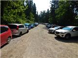 2
2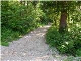 3
3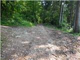 4
4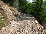 5
5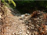 6
6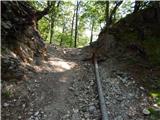 7
7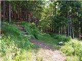 8
8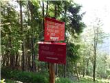 9
9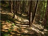 10
10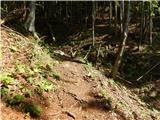 11
11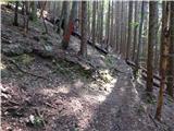 12
12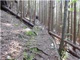 13
13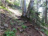 14
14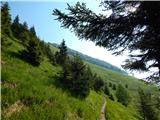 15
15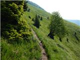 16
16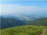 17
17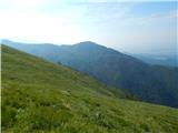 18
18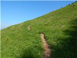 19
19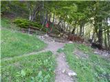 20
20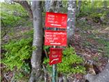 21
21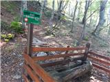 22
22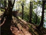 23
23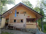 24
24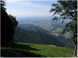 25
25 26
26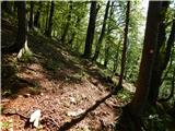 27
27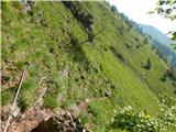 28
28 29
29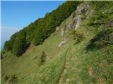 30
30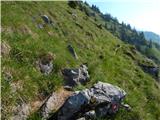 31
31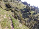 32
32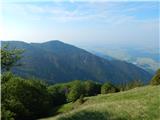 33
33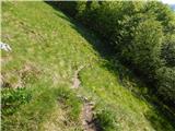 34
34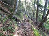 35
35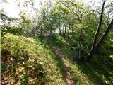 36
36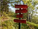 37
37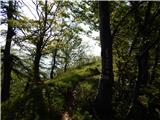 38
38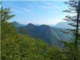 39
39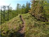 40
40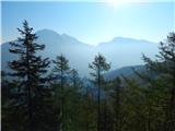 41
41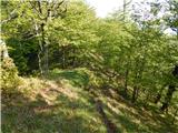 42
42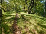 43
43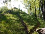 44
44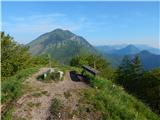 45
45 46
46
Discussion about the trip Mače - Javorov vrh (Mačenska pot)
|
| Enka16. 10. 2021 10:14:54 |
"...and the trail takes us to scenic grassy slopes from which we get a beautiful view of Gorenjska."
From there on, the trail is pure poetry. Wonderful.
|
|
|
To post a comment you must log in:
If you do not yet have a username, you must first
register.