Mače - Mali Grintovec (Mačenska pot and via Dolga njiva)
Starting point: Mače (586 m)
| Latitude/Longitude: | 46,31310°N 14,41870°E |
| |
Route name: Mačenska pot and via Dolga njiva
Walking time: 3 h 40 min
Difficulty: easy marked way
Elevation gain: 1227 m
Elevation difference along the route: 1275 m
Map: Karavanke - osrednji del 1:50.000
Recommended equipment (summer):
Recommended equipment (winter): ice axe, crampons
Views: 4.476
 | 1 person like this post |
Access to starting point:
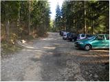
a) From the Ljubljana–Jesenice motorway take the Kranj–east exit, then continue driving towards Jezersko. When arriving in Preddvor leave the main road and continue left towards the centre of the mentioned place, from there follow the signs to Mače. Upon arrival in Mače, at the marked junction continue right (left Bašelj, straight church of St. Nicholas (the church is not accessible by car)) and drive up the narrow road above the village, where there is a large marked parking lot.
b) From the Jesenice–Ljubljana motorway take the Kranj–west exit and at the first junction continue left. Then drive through the underpass beneath the motorway, after which you arrive at a roundabout, from where continue driving towards Golnik. The route ahead leads through the settlement of Mlaka pri Kranju, but at the end of the settlement continue right towards the settlement of Srakovlje. Driving continues through Srakovlje, Spodnja Bela, Srednja Bela to Zgornja Bela, where turn right towards Preddvor. In Preddvor notice the signs for Mače, which direct left past the primary school onto the road that climbs to Mače. Upon arrival in Mače, at the marked junction continue right (left Bašelj, straight church of St. Nicholas (the church is not accessible by car)) and drive up the narrow road above the village, where there is a large marked parking lot.
Route description:
At the start of the large parking lot above Mače we notice alpine direction signs, we continue right across the entire parking lot in the direction of Zavetišče v Hudičevem borštu, Javorov or Javorjev vrh, Potoška gora and sv. Jakob. From the end of the parking lot a marked gravel road continues, which we follow. The gravel road, which has a few minor junctions in the lower part where we follow the markers, initially ascends gently to moderately, then somewhat more steeply for a short time. After crossing the torrent the gravel road gradually levels out and brings us to a marked junction, where alpine direction signs direct us left onto a well-trodden and nicely maintained alpine path. The marked path immediately enters fairly dense forest, through which it ascends for some time along the torrent gully, then turns somewhat more to the right and brings us in a few zigzags to a less noticeable junction, where the path to Dom na Kališču branches left (the junction is marked with a sign on a tree), we continue straight ahead on the path that gradually brings us into sparser forest. Higher up the increasingly sparse forest ends and the path brings us to scenic grassy slopes, from which a beautiful view of Gorenjska opens up. This is followed by just over 10 minutes of ascent along the mentioned grassy slope and we arrive at the spring in Hudičev boršt, next to which there is a marked junction.
Here we continue left in the direction of Kališče and Srednji vrh (right Zavetišče v Hudičevem borštu, 3 minutes) along the path that crosses the grassy slopes of Zaplate to the west. After a few minutes of traversing the path enters the forest, where we soon reach the next marked junction.
This time we continue right in the direction of Cjanovce, Srednji vrh and Mali Grintovec along the path (straight Kališče and Mače), which begins to ascend more steeply through the forest. The fairly steep path higher up brings us into a small valley, where the forest thins out and the path levels off. After a few minutes of walking along the mentioned valley the path turns right, ascends more steeply and after a short ascent brings us to the shepherd's hut on Planina Dolga njiva.
Here is a junction, where we head onto the less trodden path that goes horizontally behind the hut, up along the valley (slightly right Srednji vrh and Cjanovce). The path then begins to ascend gently along the Dolga njiva valley and after just over 20 minutes of walking brings us to the saddle between Mali Grintovec and Srednji vrh, where there is the next junction. We head left following the signs for Mali Grintovec (right Srednji vrh). The path ahead ascends moderately across the slope, which is partially overgrown with dwarf pines. After this short ascent we reach the ridge, where the path from Kališče and Bašeljski vrh joins us.
We continue right along the path, which in a few more minutes of walking brings us to the summit of Mali Grintovec.
Mače - Hudičev boršt 1:50, Hudičev boršt - razpotje pod Dolgo njivo 0:10, razpotje pod Dolgo njivo - Planina Dolga njiva 0:55, Planina Dolga njiva - sedlo nad Dolgo njivo 0:20, sedlo nad Dolgo njivo - Mali Grintovec 0:25.

Photos:
 1
1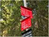 2
2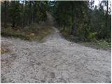 3
3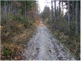 4
4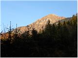 5
5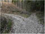 6
6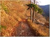 7
7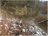 8
8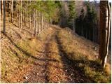 9
9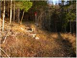 10
10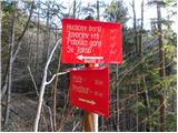 11
11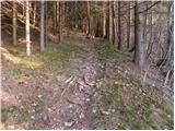 12
12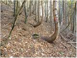 13
13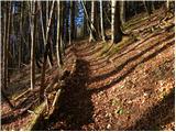 14
14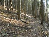 15
15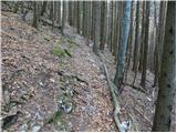 16
16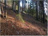 17
17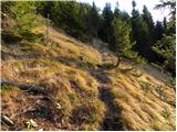 18
18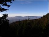 19
19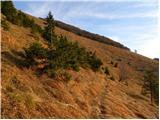 20
20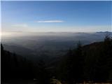 21
21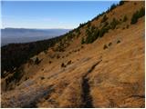 22
22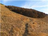 23
23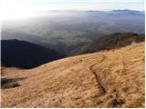 24
24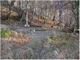 25
25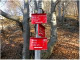 26
26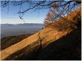 27
27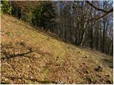 28
28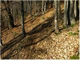 29
29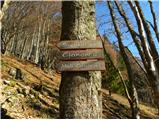 30
30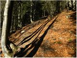 31
31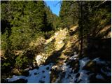 32
32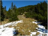 33
33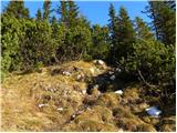 34
34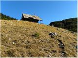 35
35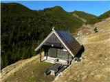 36
36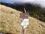 37
37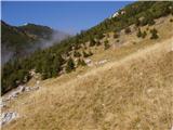 38
38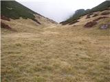 39
39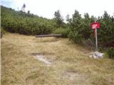 40
40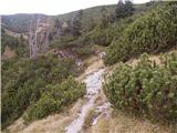 41
41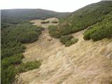 42
42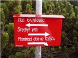 43
43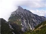 44
44 45
45
Discussion about the trip Mače - Mali Grintovec (Mačenska pot and via Dolga njiva)
|
| ločanka21. 02. 2017 |
Has anyone been here, I mean made a track?
|
|
|
|
| tango13. 02. 2019 |
Today my wife and I set out for Srednji vrh, but since from the junction off the path towards Hudičev boršt no one had gone ahead of us yet, and it was our first time on this trail, we missed Dolgo njivo by about 100m, instead of right through the little woods we continued straight up the gully and then had no choice but to head to Mali Grintovec. Decent wind, among the bushes several times up to the butt in snow, if possible first one leg then the other,... But, super. On the way back we also checked the little hut on Dolgi njivi. Next time we won't miss it
|
|
|
To post a comment you must log in:
If you do not yet have a username, you must first
register.