Malga Ciapela - Cima Ombretta (via Passo Ombretta)
Starting point: Malga Ciapela (1559 m)
| Latitude/Longitude: | 46,42196°N 11,89277°E |
| |
Route name: via Passo Ombretta
Walking time: 4 h 40 min
Difficulty: difficult marked way
Elevation gain: 1452 m
Elevation difference along the route: 1461 m
Map: Tabacco 06 1:25.000
Recommended equipment (summer): helmet, self belay set
Recommended equipment (winter): helmet, self belay set, ice axe, crampons
Views: 1.990
 | 2 people like this post |
Access to starting point:
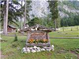
A) First, we drive to Cortina d'Ampezzo (you can get here via the border crossing Rateče or Predel to Trbiž / Tarvisio and then on the highway in the direction of Udine to the exit Tolmezzo. From Tolmezzo we follow the road in the direction of the village Ampezzo and mountain pass Passo della Mauria. The road then descends and brings us to a crossroads, where we continue left (also possible right) in the direction of Cortina d'Ampezzo. At all following crossroads, we follow the signs for Cortina d'Ampezzo and then the signs for alpine pass Passo di Falzarego. Already in the first part of the ascent towards pass Falzarego we will come to a crossroads, where the signs for pass Passo di Giau (2233 m) and Marmolada direct us left. The road after pass Giau starts descending, and we follow it through the settlements in the lower part in the direction of Marmolada or pass Passo di Fedaia. We then follow the road towards pass Passo di Fedaia to the crossroads a little before the bottom station of the cable car. Here we turn left on a narrow asphalt road towards mountain pasture Malga Ciapela. The road then leads us past the camp and tourist farm Malga Ciapela. Just a little after the farm the asphalt road ends. Here we park on one of the parking lots by the road.
B) Access from Primorska: We drive on the highway in the direction of Padova, but only to the highway junction, where we continue in the direction of Veneto and Belluno. Near Belluno the highway ends, and we follow the road ahead in the direction of Belluno, where at the larger crossroads we continue right in the direction of the town Agordo. From the mentioned town onwards we follow frequent signs for Marmolada or pass Passo di Fedaia. We then follow the road towards pass Passo di Fedaia to the crossroads a little before the bottom station of the cable car. Here we turn left on a narrow asphalt road towards mountain pasture Malga Ciapela. The road then leads us past the camp and tourist farm Malga Ciapela. Just a little after the farm the asphalt road ends. Here we park on one of the parking lots by the road.
Route description:
From the parking lot, we head onto a macadam road which is further closed to traffic. First, we cross the bridge and then the road brings us to a marked junction.
Left branches the footpath towards saddle Passo di Forca Rossa, we continue right on the macadam road which ascends more steeply. Soon we reach another junction. This time we turn right into the forest on the footpath towards mountain pasture Malga Ombretta and hut Falier. Further on the road and later on the mule track there is also another somewhat gentler path towards the same pasture.
From the junction, the footpath starts to ascend more steeply and occasionally a nice view opens up from the path to the nearby peaks. The path then turns slightly right and crosses a steep slope in ascent. The path in this section is not demanding as it is secured with a fence, steps also help us. The slope becomes less steep again and from the path a view opens towards a smaller dam along the path. The path continues ascending through the forest and later crosses a mule track. The path becomes somewhat gentler and soon brings us out of the forest to panoramic pasture Malga Ombretta where there is also a smaller hut.
From the hut we continue on the path which runs across pastures towards the west. Further on, the path turns slightly right so that it runs on the right side of the valley. The path then leads us across a short stretch of forest and only a short ascent follows to hut Rifugio Failer, which is located below the slopes of peak Cima Ombretta.
From the hut we continue on path 610 towards saddle Passo Ombretta. From the hut, the path ascends on a mule track mostly through dwarf pines towards the north. When we approach the walls of Marmolada somewhat, the dwarf pines end, and the path turns left. The increasingly scenic path then ascends towards the west and runs on terrain partly covered with grass. The grassy slopes later turn into scree and the path gently ascends towards the west for a while. In the last part of the ascent towards saddle Passo Ombretta the path turns right and starts steeply ascending on scree all the way to the mentioned saddle where there is also a junction.
On the saddle we continue left and only a short ascent follows to the bivouac.
From the bivouac we continue southwards and after a short ascent the path brings us to steel cables. Here the path turns slightly left and with the aid of fixed protections ascends the rocky slope. The secured path is short and quickly brings us to scree. The path then runs across scree towards the south and gradually becomes steeper. Higher up the slope becomes quite steep and also dangerous for slipping. Such a path then brings us to the saddle below peak Cima Ombretta di Mezzo.
The path here turns left and runs along the south side of the ridge towards the east. The path in this section crosses a quite exposed slope which is not secured so some caution is needed during the crossing. Further on the path becomes somewhat easier again and brings us to a smaller saddle below peak Cima Ombretta.
On the saddle where the south path joins us from the right we continue straight and along the very panoramic ridge soon reach the summit.

Photos:
 1
1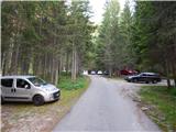 2
2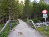 3
3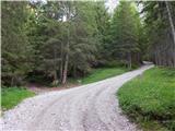 4
4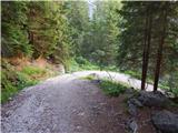 5
5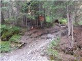 6
6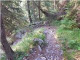 7
7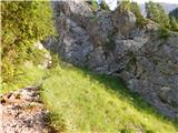 8
8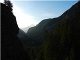 9
9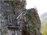 10
10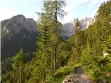 11
11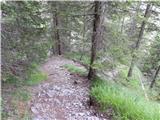 12
12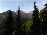 13
13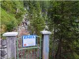 14
14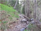 15
15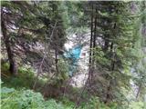 16
16 17
17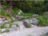 18
18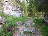 19
19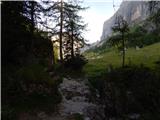 20
20 21
21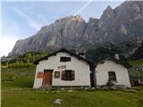 22
22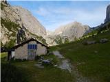 23
23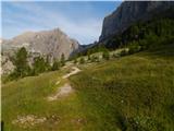 24
24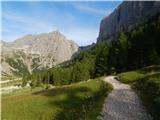 25
25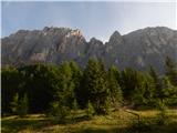 26
26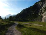 27
27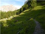 28
28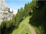 29
29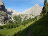 30
30 31
31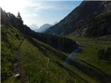 32
32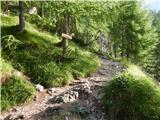 33
33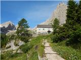 34
34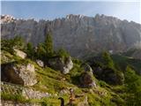 35
35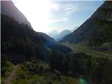 36
36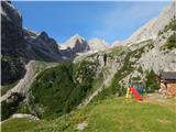 37
37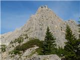 38
38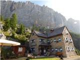 39
39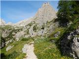 40
40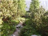 41
41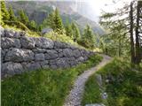 42
42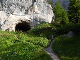 43
43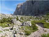 44
44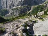 45
45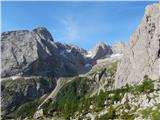 46
46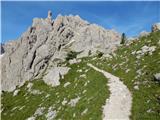 47
47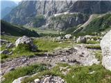 48
48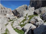 49
49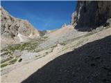 50
50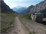 51
51 52
52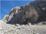 53
53 54
54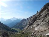 55
55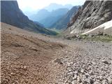 56
56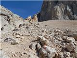 57
57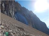 58
58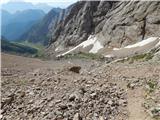 59
59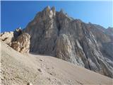 60
60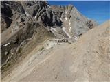 61
61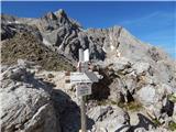 62
62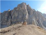 63
63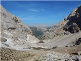 64
64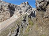 65
65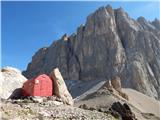 66
66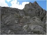 67
67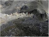 68
68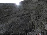 69
69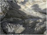 70
70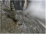 71
71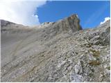 72
72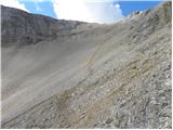 73
73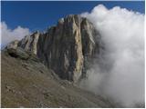 74
74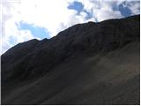 75
75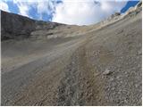 76
76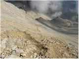 77
77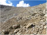 78
78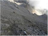 79
79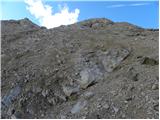 80
80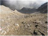 81
81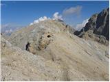 82
82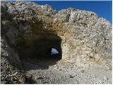 83
83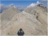 84
84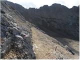 85
85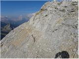 86
86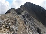 87
87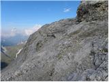 88
88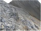 89
89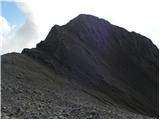 90
90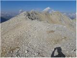 91
91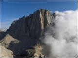 92
92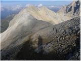 93
93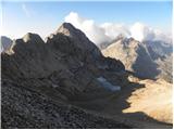 94
94 95
95 96
96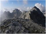 97
97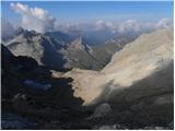 98
98 99
99
Discussion about the trip Malga Ciapela - Cima Ombretta (via Passo Ombretta)
To post a comment you must log in:
If you do not yet have a username, you must first
register.