Malga Ciapela - Punta Penia (Marmolada)
Starting point: Malga Ciapela (1559 m)
| Latitude/Longitude: | 46,42196°N 11,89277°E |
| |
Walking time: 6 h 10 min
Difficulty: very difficult marked way, partly demanding unmarked way
Elevation gain: 1784 m
Elevation difference along the route: 1800 m
Map: Tabacco 06 1:25.000
Recommended equipment (summer): helmet, self belay set
Recommended equipment (winter): helmet, self belay set, ice axe, crampons
Views: 5.146
 | 3 people like this post |
Access to starting point:
A) First, we drive to Cortina d'Ampezzo (you can get here via the border crossing Rateče or Predel to Trbiž / Tarvisio and then on the highway in the direction of Udine to the Tolmezzo exit. From Tolmezzo we follow the road in the direction of the village Ampezzo and mountain pass Passo della Mauria. The road then descends and brings us to a crossroads, where we continue left (possible also right) in the direction of Cortina d'Ampezzo. At all following crossroads, we follow the signs for Cortina d'Ampezzo and then follow the signs for alpine pass Passo di Falzarego. Already in the first part of the ascent towards pass Falzarego we will come to a crossroads, where signs for pass Passo di Giau (2233 m) and Marmolada direct us to the left. The road behind pass Giau starts descending, and we follow it through the settlements in the lower part in the direction of Marmolada or pass Passo di Fedaia. We then follow the road towards pass Passo di Fedaia to the crossroads a little before the bottom station of the cable car. Here we turn left onto a narrow asphalt road towards the mountain pasture Malga Ciapela. The road then leads us past the camp and tourist farm Malga Ciapela. Only a little after the farm the asphalt road ends. Here we park on one of the parking lots by the road.
B) Access from Primorska: We drive on the highway in the direction of Padova, but only to the highway junction, where we continue in the direction of Veneto and Belluno. Near Belluno the highway ends, and we follow the road ahead in the direction of Belluno, where at the larger crossroads we continue right in the direction of the small town Agordo. From the mentioned small town onwards we follow frequent signs for Marmolada or pass Passo di Fedaia. We then follow the road towards pass Passo di Fedaia to the crossroads a little before the bottom station of the cable car. Here we turn left onto a narrow asphalt road towards the mountain pasture Malga Ciapela. The road then leads us past the camp and tourist farm Malga Ciapela. Only a little after the farm the asphalt road ends. Here we park on one of the parking lots by the road.
Route description:
From the parking lot, we head onto the macadam road, which is closed to traffic further on. First, we cross the bridge, then the road brings us to a marked junction.
Left branches the footpath towards the saddle Passo di Forca Rossa, we continue right on the macadam road, which ascends more steeply. Soon we come to another junction. This time we head right into the forest on the footpath towards the mountain pasture Malga Ombretta and hut Falier. Further on the road and later on the mule track leads another somewhat gentler path towards the same mountain pasture.
From the junction, the footpath begins to ascend more steeply, and occasionally a nice view opens up from the path to the nearby peaks. The path then turns slightly to the right and crosses a steep slope in the ascent. The path in this section is not demanding since it is secured with a fence, and stairs assist us too. The slope becomes less steep again, and from the path a view opens towards a smaller dam by the path. The path continues to ascend through the forest and later crosses the mule track. The path becomes somewhat gentler and soon brings us out of the forest to the scenic mountain pasture Malga Ombretta, where there is also a small hut.
From the hut, we continue on the path running across pastures towards the west. Further on, the path turns slightly to the right so that it runs along the right side of the valley. The path then leads us across a short stretch of forest, followed only by a short ascent to hut Rifugio Failer, located below the slopes of peak Cima Obretta.
From the hut, we continue on path 610 towards saddle Passo Ombretta. From the hut, the path ascends on a mule track mostly through dwarf pines towards the north. When we get somewhat closer to the walls of Marmolada, the dwarf pines end, and the path turns to the left. The increasingly scenic path then ascends towards the west and runs on terrain partly covered with grass. The grassy slopes later turn into scree, and the path gently ascends towards the west for some time. In the last part of the ascent towards saddle Passo Ombretta, the path turns to the right and begins to ascend steeply across the scree up to the mentioned saddle, where there is also a junction.
At the saddle, we head right onto an unmarked path. From the saddle, we first ascend towards the wall of Marmolada, then we notice a track crossing steep scree towards the west. We turn left onto the mentioned track, on which we will also notice some old markings. The path is otherwise not maintained, and on some sections the scree is very steep, so considerable caution is needed. After crossing the scree, we join the marked path leading past hut Rifugio Contrin. The more demanding section can also be avoided by descending approximately 100 elevation meters from saddle Passo Ombretta to the west side and then heading right onto the easier unmarked path. We can also descend along the marked path all the way to the marked junction at 2400 meters elevation and then head right there towards notch Forcella Marmolada. In this case, we descend 300 elevation meters.
When after crossing we join the path past hut Rifugio Contrin, we continue right, and an ascent follows on steep scree that brings us under the wall, where the entry to the climbing section of the path is.
In the initial section, the climbing path ascends steeply along the right side of the gully, aided by numerous pegs. A relatively short initial ascent brings us to notch Forcella Marmolada, where the path from lake Lago di Fedaia joins from the left.
At the notch, we continue right and begin ascending the steep slope with the aid of pegs. The path then turns slightly to the right and leads us briefly along the ridge, where a view to the south side opens up again. Further on, the path withdraws somewhat to the left from the ridge and then ascends for quite some time along the steel cable past numerous pegs and pins. Such a path brings us back to a well-secured ridge, along which we then ascend towards the east. In the last part, the path becomes less steep, followed by a short crossing of a gentle snowfield. If the snowfield is frozen, even though it is gentle, the use of an ice axe and crampons is recommended.
A short easy ascent follows to the shelter, where the path over the glacier joins from the left. From here, we have only a few steps of easy walking to the highest peak of the Dolomites.

Photos:
 1
1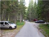 2
2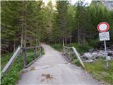 3
3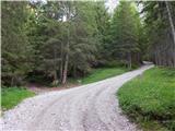 4
4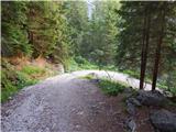 5
5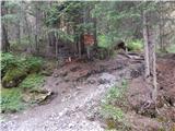 6
6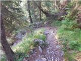 7
7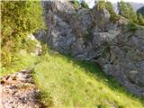 8
8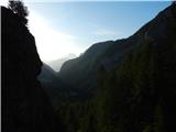 9
9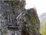 10
10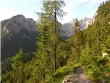 11
11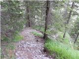 12
12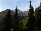 13
13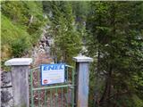 14
14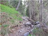 15
15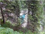 16
16 17
17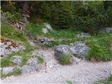 18
18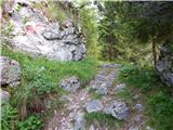 19
19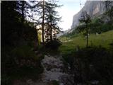 20
20 21
21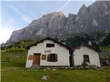 22
22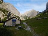 23
23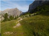 24
24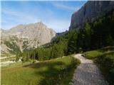 25
25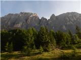 26
26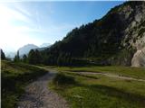 27
27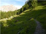 28
28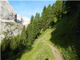 29
29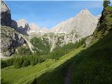 30
30 31
31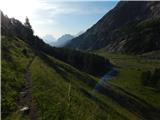 32
32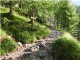 33
33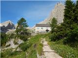 34
34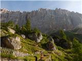 35
35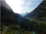 36
36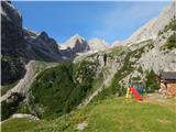 37
37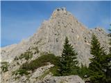 38
38 39
39 40
40 41
41 42
42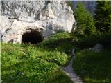 43
43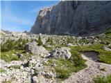 44
44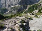 45
45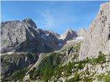 46
46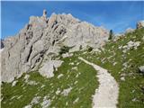 47
47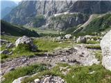 48
48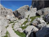 49
49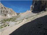 50
50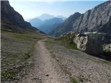 51
51 52
52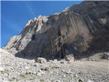 53
53 54
54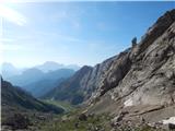 55
55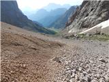 56
56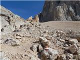 57
57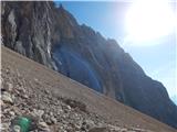 58
58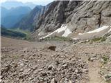 59
59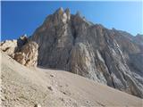 60
60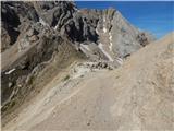 61
61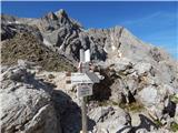 62
62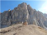 63
63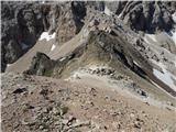 64
64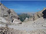 65
65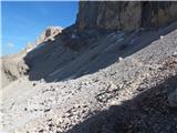 66
66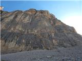 67
67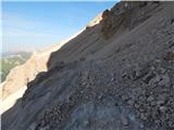 68
68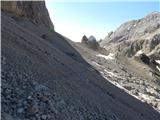 69
69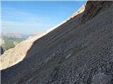 70
70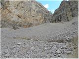 71
71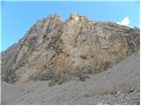 72
72 73
73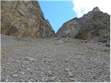 74
74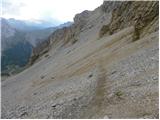 75
75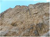 76
76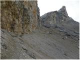 77
77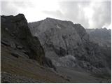 78
78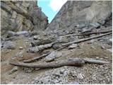 79
79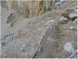 80
80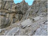 81
81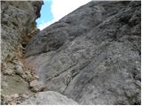 82
82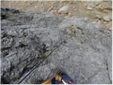 83
83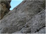 84
84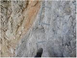 85
85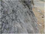 86
86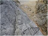 87
87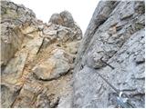 88
88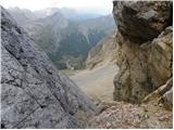 89
89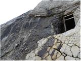 90
90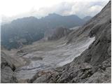 91
91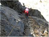 92
92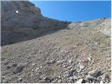 93
93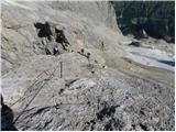 94
94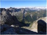 95
95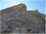 96
96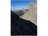 97
97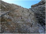 98
98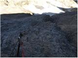 99
99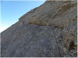 100
100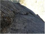 101
101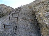 102
102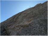 103
103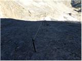 104
104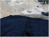 105
105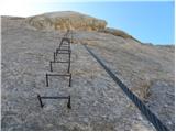 106
106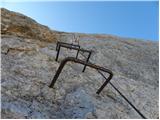 107
107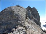 108
108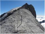 109
109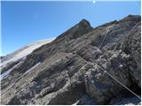 110
110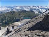 111
111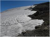 112
112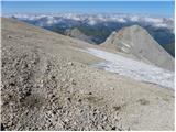 113
113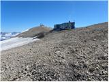 114
114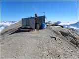 115
115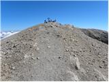 116
116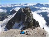 117
117 118
118
Discussion about the trip Malga Ciapela - Punta Penia (Marmolada)
|
| pinkapolonka28. 08. 2017 |
Hello,
On Saturday 26.8.2017 we with daughter and husband did the described route. The above description is very good, but we had some trouble finding the unmarked path from Passo Ombretta onwards. We headed to the right unmarked path, the first option suggested by the author of the above description. The path is well visible from the start, old markings are also visible. But towards the end the path disappears, I think torrents took it away, leaving deep gullies behind. We tried to cross the gullies and continue traversing the scree, but in the final phase we had to descend to the path that the author mentions as the second option. Therefore I would advise everyone to descend 100m already at Passo Ombretta and find the unmarked path to the right. This one is still quite good and you can traverse the scree without problems. We returned via this path.
Best regards Barbara
|
|
|
|
| Majdag16. 07. 2025 09:23:29 |
12.7. Marmolada, Punta Rocca, ascent by cable car from the village Malga Ciapela.
Wonderful mountain, mists weave between the peaks, covering them and revealing them again. To the terrace at Punta Rocca we change cable cars twice. First at 2362m /Banc/, second at 2944m /Serauta/, then we go up to the top terrace 3269m /Punta Rocca/. Great feeling to stand so high and walk on the glacier. There were no best views but the ascent to the mountain and the adventure of the trip is unforgettable.
https://jelenkamenmajdag.blogspot.com/2025/07/marmolada-najvisja-gora-dolomitov.html
|
|
|
To post a comment you must log in:
If you do not yet have a username, you must first
register.